Preonzo (Preonzo)
- former municipality in Switzerland
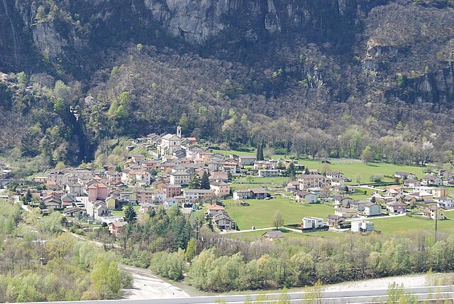
Preonzo is a picturesque village located in the region of Ticino in southern Switzerland, nestled in the valley of the River Brenno. It's a fantastic area for hiking enthusiasts, offering a range of trails that cater to different skill levels. Here are some highlights and tips for hiking in Preonzo:
Hiking Trails
-
Porte d’Angelo Trail: This is a popular trail that takes you through beautiful natural scenery, featuring lush forests and stunning views of the surrounding mountains and valleys.
-
Brenno Valley Trails: The trails along the Brenno River offer a more relaxed hiking experience with opportunities to enjoy nature, birdwatching, and even some swimming spots in the river during warmer months.
-
Monte Ceneri: For a more challenging hike, consider the trail that leads to Monte Ceneri. This trail rewards hikers with panoramic views of the surrounding landscape, including Lake Lugano and beyond.
-
Via delle Valli: This route connects various valleys and showcases the region's biodiversity and picturesque landscapes. It's ideal for those looking to explore more of the natural beauty of Ticino.
Tips for Hiking in Preonzo
-
Prepare Accordingly: Ensure you have appropriate footwear, weather-appropriate clothing, and enough water and snacks for your hike.
-
Check Weather Conditions: The weather in the region can change rapidly, so it's advisable to check the forecast before setting out.
-
Respect Nature: Follow the principles of Leave No Trace by staying on marked paths, taking your waste with you, and respecting wildlife.
-
Local Guidance: Consider joining guided hikes available in the area for a more informative and safe experience. Local guides can enhance your hiking experience with knowledge about the local flora, fauna, and culture.
-
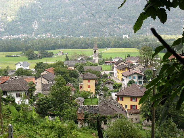
Explore the Village: After hiking, take some time to explore Preonzo itself. The village is charming, featuring local architecture and shops where you can sample regional cuisine.
Overall, hiking in Preonzo provides a wonderful opportunity to experience the natural beauty of the Ticino region while enjoying various trails that cater to different preferences and abilities. Happy hiking!
- Country:

- Postal Code: 6523
- Local Dialing Code: 091
- Licence Plate Code: TI
- Coordinates: 46° 16' 0" N, 9° 0' 0" E


- GPS tracks (wikiloc): [Link]
- AboveSeaLevel: 250 м m
- Area: 16.44 sq km
- Wikipedia en: wiki(en)
- Wikipedia: wiki(de)
- Wikidata storage: Wikidata: Q70070
- Wikipedia Commons Category: [Link]
- Freebase ID: [/m/0gxsrg]
- GeoNames ID: Alt: [8533634]
- VIAF ID: Alt: [238752315]
- OSM relation ID: [1684743]
- GND ID: Alt: [4386718-2]
- HDS ID: [2043]
- Swiss municipality code: [5015]
Shares border with regions:


Lodrino
- municipality in the canton of Ticino, Switzerland
Lodrino, located in the Italian-speaking region of Ticino, Switzerland, offers a variety of hiking opportunities set against a backdrop of stunning natural beauty. Nestled in the foothills of the Alps, the area features picturesque landscapes, charming villages, and diverse ecosystems....
- Country:

- Postal Code: 6527
- Local Dialing Code: 091
- Licence Plate Code: TI
- Coordinates: 46° 17' 18" N, 8° 56' 58" E


- GPS tracks (wikiloc): [Link]
- AboveSeaLevel: 849 м m
- Area: 31.6 sq km


Gnosca
- former municipality in Switzerland
Gnosca, a picturesque village located in the Canton of Ticino in Switzerland, offers a variety of hiking opportunities that take advantage of its beautiful natural surroundings. Here are some key points about hiking in Gnosca:...
- Country:

- Postal Code: 6525
- Local Dialing Code: 091
- Licence Plate Code: TI
- Coordinates: 46° 14' 18" N, 9° 0' 14" E


- GPS tracks (wikiloc): [Link]
- AboveSeaLevel: 801 м m
- Area: 7.5 sq km
- Web site: [Link]
Cresciano
- former municipality in the canton of Ticino, Switzerland
Cresciano, located in the scenic Ticino region of Switzerland, offers a variety of hiking opportunities characterized by beautiful landscapes, charming villages, and rich natural diversity. Here are some highlights and tips for hiking in Cresciano:...
- Country:

- Postal Code: 6705
- Local Dialing Code: 091
- Licence Plate Code: TI
- Coordinates: 46° 18' 12" N, 9° 1' 59" E


- GPS tracks (wikiloc): [Link]
- AboveSeaLevel: 1655 м m
- Area: 17.19 sq km
- Web site: [Link]


Claro
- former municipality in the canton of Ticino, Switzerland
Claro, a picturesque village in the southern part of Switzerland, is nestled in the Ticino region, a gem for hikers and outdoor enthusiasts. The region offers a variety of trails that highlight its stunning landscapes, diverse flora, and charming valleys. Here are some key aspects to consider when hiking in Claro:...
- Country:

- Postal Code: 6702
- Local Dialing Code: 091
- Licence Plate Code: TI
- Coordinates: 46° 15' 58" N, 9° 2' 12" E


- GPS tracks (wikiloc): [Link]
- AboveSeaLevel: 989 м m
- Area: 21.22 sq km
- Web site: [Link]


Moleno
- former municipality in Switzerland
Moleno is a small village located in the picturesque region of the Val di Frapporta, in the province of Pavia, Italy. The area is known for its stunning natural landscapes, lush forests, and beautiful mountains, making it a fantastic destination for hiking enthusiasts....
- Country:

- Postal Code: 6524
- Local Dialing Code: 091
- Licence Plate Code: TI
- Coordinates: 46° 16' 6" N, 8° 59' 51" E


- GPS tracks (wikiloc): [Link]
- AboveSeaLevel: 1156 м m
- Area: 7.49 sq km


Cugnasco-Gerra
- municipality in the canton of Ticino, Switzerland
Cugnasco-Gerra is a charming area located in the Canton of Ticino, Switzerland. This region offers beautiful landscapes, scenic trails, and a variety of hiking opportunities suitable for different skill levels. Here are some highlights for hiking in Cugnasco-Gerra:...
- Country:

- Postal Code: 6516, 6635, 6597
- Local Dialing Code: 091
- Licence Plate Code: TI
- Coordinates: 46° 10' 0" N, 8° 55' 0" E


- GPS tracks (wikiloc): [Link]
- AboveSeaLevel: 225 м m
- Area: 35.8 sq km
- Population: 2877
- Web site: [Link]


Lavertezzo
- municipality in the canton of Ticino, Switzerland
Lavertezzo, located in the Val Verzasca region of Ticino, Switzerland, is a beautiful hiking destination known for its stunning natural landscapes, distinctive granite formations, and clear turquoise waters. Here are some highlights and tips for hiking in the area:...
- Country:

- Postal Code: 6633
- Local Dialing Code: 091
- Licence Plate Code: TI
- Coordinates: 46° 15' 35" N, 8° 50' 28" E


- GPS tracks (wikiloc): [Link]
- AboveSeaLevel: 1087 м m
- Area: 58.1 sq km
- Population: 1329
- Web site: [Link]


Gorduno
- former municipality in Switzerland
Gorduno, located near the region of Ticino in Switzerland, offers a variety of hiking opportunities catering to different skill levels. This area is known for its picturesque landscapes, charming villages, and scenic trails that provide breathtaking views of the surrounding mountains and valleys....
- Country:

- Postal Code: 6518
- Local Dialing Code: 091
- Licence Plate Code: TI
- Coordinates: 46° 13' 31" N, 8° 59' 43" E


- GPS tracks (wikiloc): [Link]
- AboveSeaLevel: 1296 м m
- Area: 9.2 sq km
- Web site: [Link]


Monte Carasso
- former municipality in Switzerland
Monte Carasso, located in the beautiful region of Ticino, Switzerland, offers stunning scenery and a variety of hiking trails suitable for different levels of hikers. The area is known for its lush landscapes, impressive views of the surrounding mountains, and charming Swiss villages....
- Country:

- Postal Code: 6513
- Local Dialing Code: 091
- Licence Plate Code: TI
- Coordinates: 46° 11' 0" N, 9° 0' 0" E


- GPS tracks (wikiloc): [Link]
- AboveSeaLevel: 238 м m
- Area: 9.70 sq km
- Web site: [Link]


Vogorno
- municipality in the canton of Ticino, Switzerland
Vogorno is a beautiful village located in the canton of Ticino, Switzerland, known for its stunning landscapes and natural beauty. It sits near the shores of Lake Verzasca and is surrounded by mountains, making it a fantastic destination for hiking enthusiasts....
- Country:

- Postal Code: 6632
- Local Dialing Code: 091
- Licence Plate Code: TI
- Coordinates: 46° 13' 0" N, 8° 51' 0" E


- GPS tracks (wikiloc): [Link]
- AboveSeaLevel: 461 м m
- Area: 23.9 sq km
- Population: 279

