Presly (Presly)

- commune in Cher, France
- Country:

- Postal Code: 18380
- Coordinates: 47° 23' 17" N, 2° 21' 29" E


- GPS tracks (wikiloc): [Link]
- Area: 74.63 sq km
- Population: 235
- Wikipedia en: wiki(en)
- Wikipedia: wiki(fr)
- Wikidata storage: Wikidata: Q691689
- Wikipedia Commons Category: [Link]
- Freebase ID: [/m/03mfdnx]
- GeoNames ID: Alt: [6428251]
- SIREN number: [211801857]
- BnF ID: [15249531v]
- INSEE municipality code: 18185
Shares border with regions:


La Chapelle-d'Angillon
- commune in Cher, France
- Country:
- Postal Code: 18380
- Coordinates: 47° 21' 48" N, 2° 25' 59" E
- GPS tracks (wikiloc): [Link]
- Area: 10.17 sq km
- Population: 645


Neuvy-sur-Barangeon
- commune in Cher, France
- Country:
- Postal Code: 18330
- Coordinates: 47° 18' 56" N, 2° 15' 14" E
- GPS tracks (wikiloc): [Link]
- Area: 67.34 sq km
- Population: 1243


Méry-ès-Bois
- commune in Cher, France
- Country:
- Postal Code: 18380
- Coordinates: 47° 18' 51" N, 2° 21' 47" E
- GPS tracks (wikiloc): [Link]
- Area: 91.59 sq km
- Population: 579
- Web site: [Link]


Ennordres
- commune in Cher, France
- Country:
- Postal Code: 18380
- Coordinates: 47° 25' 48" N, 2° 23' 0" E
- GPS tracks (wikiloc): [Link]
- Area: 63.79 sq km
- Population: 208


Souesmes
- commune in Loir-et-Cher, France
- Country:
- Postal Code: 41300
- Coordinates: 47° 27' 31" N, 2° 10' 45" E
- GPS tracks (wikiloc): [Link]
- Area: 99.5 sq km
- Population: 1100
- Web site: [Link]
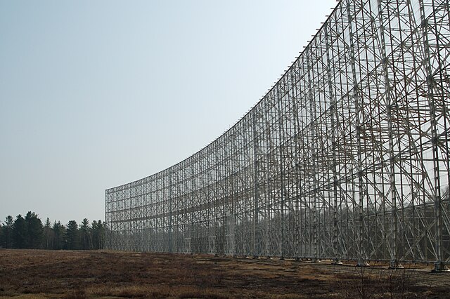
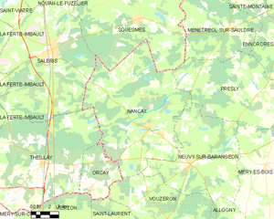
Nançay
- commune in Cher, France
- Country:
- Postal Code: 18330
- Coordinates: 47° 21' 0" N, 2° 11' 40" E
- GPS tracks (wikiloc): [Link]
- Area: 106.33 sq km
- Population: 874
- Web site: [Link]


Ménétréol-sur-Sauldre
- commune in Cher, France
- Country:
- Postal Code: 18700
- Coordinates: 47° 26' 53" N, 2° 18' 29" E
- GPS tracks (wikiloc): [Link]
- Area: 50.08 sq km
- Population: 216