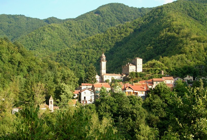
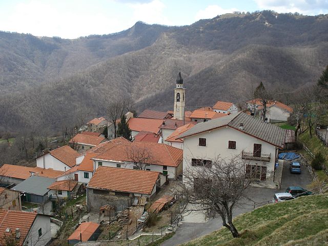
Propata (Propata)
- Italian comune
It seems there might be a slight misspelling in your query, as there isn't a widely recognized hiking destination called "Propata." If you meant "Propata," which is not a common name in hiking literature, I would recommend double-checking the spelling or providing more context.
However, if you were referring to a different hiking destination—perhaps a known region with a similar name or a specific national park—please clarify, and I can provide information on trails, levels of difficulty, scenic views, and any other relevant details.
If you are interested in a general hiking guide or looking for trails in a particular area (e.g., a state, country, or park), let me know, and I'll be happy to assist!
- Country:

- Postal Code: 16027
- Local Dialing Code: 010
- Licence Plate Code: GE
- Coordinates: 44° 33' 53" N, 9° 11' 6" E


- GPS tracks (wikiloc): [Link]
- AboveSeaLevel: 990 м m
- Area: 16.93 sq km
- Population: 136
- Web site: http://www.comune.propata.ge.it/
- Wikipedia en: wiki(en)
- Wikipedia: wiki(it)
- Wikidata storage: Wikidata: Q266366
- Wikipedia Commons Gallery: [Link]
- Wikipedia Commons Category: [Link]
- Freebase ID: [/m/0ghwmt]
- GeoNames ID: Alt: [6536100]
- OSM relation ID: [43297]
- ISTAT ID: 010045
- Italian cadastre code: H073
Shares border with regions:
Carrega Ligure
- municipality in Italy
Carrega Ligure is a beautiful destination for hiking enthusiasts, located in the picturesque region of Liguria, Italy. Nestled in the Apennine Mountains, it offers stunning landscapes characterized by lush forests, rolling hills, and scenic views....
- Country:

- Postal Code: 15060
- Local Dialing Code: 0143
- Licence Plate Code: AL
- Coordinates: 44° 37' 15" N, 9° 10' 33" E


- GPS tracks (wikiloc): [Link]
- AboveSeaLevel: 958 м m
- Area: 55.26 sq km
- Population: 86
- Web site: [Link]


Valbrevenna
- Italian comune
Valbrevenna is a beautiful valley located in the Liguria region of Italy, known for its picturesque landscapes, historical villages, and scenic hiking trails. The area is less commercialized than some other parts of Liguria, making it ideal for those seeking a more tranquil hiking experience....
- Country:

- Postal Code: 16010
- Local Dialing Code: 010
- Licence Plate Code: GE
- Coordinates: 44° 33' 58" N, 9° 3' 48" E


- GPS tracks (wikiloc): [Link]
- AboveSeaLevel: 533 м m
- Area: 34.67 sq km
- Population: 788
- Web site: [Link]


Fascia, Liguria
- Italian comune
Fascia is a charming commune in the Liguria region of Italy, nestled in the hills above the Gulf of Genoa. While it’s not as widely known as other hiking destinations in Liguria, its scenic landscapes and proximity to the Ligurian Apennines make it a great option for those looking to explore the less-traveled paths of the Italian countryside....
- Country:

- Postal Code: 16020
- Local Dialing Code: 010
- Licence Plate Code: GE
- Coordinates: 44° 33' 57" N, 9° 14' 15" E


- GPS tracks (wikiloc): [Link]
- AboveSeaLevel: 900 м m
- Area: 11.25 sq km
- Population: 71
- Web site: [Link]


Rondanina
- Italian comune
Rondanina is a small, picturesque village located in the Liguria region of Italy, nestled within the Apennine Mountains. It offers an idyllic setting for hiking enthusiasts, characterized by its rich natural beauty, charming landscapes, and a variety of trails suitable for all skill levels. Here are a few key points about hiking in Rondanina:...
- Country:

- Postal Code: 16025
- Local Dialing Code: 010
- Licence Plate Code: GE
- Coordinates: 44° 33' 45" N, 9° 13' 4" E


- GPS tracks (wikiloc): [Link]
- AboveSeaLevel: 981 м m
- Area: 12.81 sq km
- Population: 60
- Web site: [Link]


Torriglia
- Italian comune
Torriglia, located in the Liguria region of Italy, is a fantastic destination for hiking enthusiasts. Nestled in the Apennine Mountains, this quaint town offers a variety of landscapes, from lush forests to scenic mountain vistas....
- Country:

- Postal Code: 16029
- Local Dialing Code: 010
- Licence Plate Code: GE
- Coordinates: 44° 31' 7" N, 9° 9' 29" E


- GPS tracks (wikiloc): [Link]
- AboveSeaLevel: 769 м m
- Area: 60.02 sq km
- Population: 2270
- Web site: [Link]

