Propières (Propières)

- commune in Rhône, France
- Country:

- Postal Code: 69790
- Coordinates: 46° 11' 30" N, 4° 26' 14" E


- GPS tracks (wikiloc): [Link]
- Area: 16 sq km
- Population: 454
- Wikipedia en: wiki(en)
- Wikipedia: wiki(fr)
- Wikidata storage: Wikidata: Q1637079
- Wikipedia Commons Category: [Link]
- Freebase ID: [/m/03qljcm]
- GeoNames ID: Alt: [6441733]
- SIREN number: [216901611]
- BnF ID: [152722491]
- INSEE municipality code: 69161
Shares border with regions:

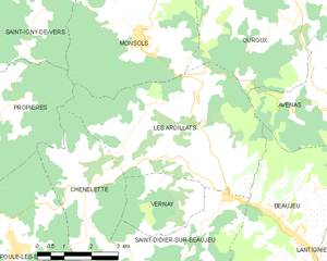
Les Ardillats
- commune in Rhône, France
- Country:
- Postal Code: 69430
- Coordinates: 46° 10' 46" N, 4° 32' 26" E
- GPS tracks (wikiloc): [Link]
- Area: 23.1 sq km
- Population: 633
- Web site: [Link]


Azolette
- commune in Rhône, France
- Country:
- Postal Code: 69790
- Coordinates: 46° 11' 35" N, 4° 25' 7" E
- GPS tracks (wikiloc): [Link]
- Area: 4.18 sq km
- Population: 123

Poule-les-Écharmeaux
- commune in Rhône, France
- Country:
- Postal Code: 69870
- Coordinates: 46° 8' 56" N, 4° 27' 26" E
- GPS tracks (wikiloc): [Link]
- Area: 31.23 sq km
- Population: 1095
- Web site: [Link]


Saint-Clément-de-Vers
- commune in Rhône, France
- Country:
- Postal Code: 69790
- Coordinates: 46° 13' 36" N, 4° 24' 12" E
- GPS tracks (wikiloc): [Link]
- Area: 8.96 sq km
- Population: 227


Monsols
- commune in Rhône, France
- Country:
- Postal Code: 69860
- Coordinates: 46° 13' 10" N, 4° 31' 12" E
- GPS tracks (wikiloc): [Link]
- Area: 19.82 sq km
- Population: 914


Saint-Igny-de-Vers
- commune in Rhône, France
- Country:
- Postal Code: 69790
- Coordinates: 46° 14' 26" N, 4° 26' 10" E
- GPS tracks (wikiloc): [Link]
- Area: 27.35 sq km
- Population: 594


Belleroche
- commune in Loire, France
- Country:
- Postal Code: 42670
- Coordinates: 46° 10' 6" N, 4° 24' 36" E
- GPS tracks (wikiloc): [Link]
- Area: 13.93 sq km
- Population: 309


Saint-Germain-la-Montagne
- commune in Loire, France
- Country:
- Postal Code: 42670
- Coordinates: 46° 12' 9" N, 4° 22' 40" E
- GPS tracks (wikiloc): [Link]
- Area: 12.54 sq km
- Population: 244


Chénelette
- commune in Rhône, France
- Country:
- Postal Code: 69430
- Coordinates: 46° 10' 7" N, 4° 29' 28" E
- GPS tracks (wikiloc): [Link]
- Area: 11.02 sq km
- Population: 331