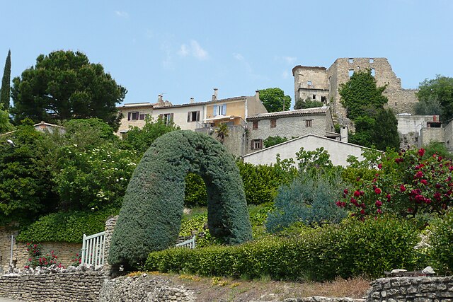
Puyméras (Puyméras)

- commune in Vaucluse, France
 Hiking in Puyméras
Puyméras is a charming village located in the Vaucluse department of the Provence-Alpes-Côte d'Azur region in southeastern France. This picturesque area is surrounded by beautiful landscapes, making it an appealing destination for hiking enthusiasts. Here are some highlights and tips for hiking around Puyméras:
Hiking Trails
-
Local Paths: The region features numerous marked hiking trails that cater to various skill levels. Trails around Puyméras often lead through vineyards, olive groves, and stunning rural scenery, providing a glimpse of the local flora and fauna.
-
Sentier des Lavandes: This trail offers hikers the chance to see blooming lavender fields in the summer months. It's a relatively easy walk that showcases the beauty of Provence's natural landscape.
-
Mont Ventoux: A bit further afield, this legendary mountain is a popular destination for more experienced hikers. The ascent provides breathtaking views of the surrounding area, and there are multiple routes to choose from.
-
Vaucluse Mountains: The nearby Vaucluse Mountains provide a variety of trails. Hikers can enjoy scenic routes that feature dramatic cliffs, forested paths, and panoramic views.
Best Times to Hike
- Spring (March to May): Temperatures are mild, flowers are blooming, and the trails are less crowded.
- Fall (September to November): Similar to spring, the weather is pleasant, and the fall colors add beauty to the landscape.
- Summer (June to August): Be cautious, as temperatures can soar. Early morning hikes are advisable to avoid the heat.
Tips for Hiking in Puyméras
- Water and Snacks: Always carry enough water and some snacks, especially on longer hikes.
- Footwear: Wear sturdy hiking boots for comfort and support, particularly if you plan to tackle rocky trails.
- Maps and Guides: Consider bringing a local hiking map or a guidebook. The trails are generally well-marked, but it’s good to have a backup.
- Respect Nature: Follow Leave No Trace principles to ensure that the beautiful environment remains intact for future visitors.
Local Culture and Attractions
After a day of hiking, take the time to explore Puyméras itself. The village has a quaint atmosphere, with local shops, cafés, and restaurants where you can sample regional cuisine. You can also visit nearby historical sites and enjoy the rich culture of Provence.
Hiking in Puyméras offers a wonderful opportunity to immerse yourself in nature while experiencing the charm of southern France. Enjoy your adventure!
- Country:

- Postal Code: 84110
- Coordinates: 44° 16' 12" N, 5° 7' 41" E


- GPS tracks (wikiloc): [Link]
- Area: 14.59 sq km
- Population: 603
- Wikipedia en: wiki(en)
- Wikipedia: wiki(fr)
- Wikidata storage: Wikidata: Q625857
- Wikipedia Commons Category: [Link]
- Freebase ID: [/m/02vmp6g]
- GeoNames ID: Alt: [2984935]
- SIREN number: [218400943]
- BnF ID: [13187007h]
- Trismegistos Geo ID: [20941]
- INSEE municipality code: 84094
Shares border with regions:


Mérindol-les-Oliviers
- commune in Drôme, France
Hiking in Mérindol-les-Oliviers
Mérindol-les-Oliviers is a charming village located in the Vaucluse department of the Provence-Alpes-Côte d'Azur region in southeastern France. Surrounded by beautiful landscapes and vineyards, the area offers several opportunities for hiking enthusiasts. Here are some highlights about hiking in and around Mérindol-les-Oliviers:...
- Country:
- Postal Code: 26170
- Coordinates: 44° 16' 27" N, 5° 10' 4" E
- GPS tracks (wikiloc): [Link]
- Area: 9.23 sq km
- Population: 222

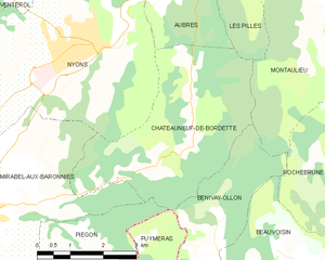
Châteauneuf-de-Bordette
- commune in Drôme, France
Hiking in Châteauneuf-de-Bordette
Châteauneuf-de-Bordette is a small commune located in the Drôme department of southeastern France. The area is known for its picturesque landscapes, rolling hills, and access to the beautiful natural scenery of the Vercors Regional Natural Park, which offers numerous opportunities for hiking and outdoor activities....
- Country:
- Postal Code: 26110
- Coordinates: 44° 20' 8" N, 5° 10' 41" E
- GPS tracks (wikiloc): [Link]
- Area: 15.33 sq km
- Population: 93


Saint-Romain-en-Viennois
- commune in Vaucluse, France
Hiking in Saint-Romain-en-Viennois
Saint-Romain-en-Viennois is a charming village located in the Vaucluse department in the Provence-Alpes-Côte d'Azur region of southeastern France. Its picturesque landscape, set against the backdrop of the Ventoux Mountain and lush vineyards, offers a variety of hiking opportunities that cater to different skill levels....
- Country:
- Postal Code: 84110
- Coordinates: 44° 15' 29" N, 5° 6' 35" E
- GPS tracks (wikiloc): [Link]
- Area: 9 sq km
- Population: 832


Piégon
- commune in Drôme, France
Hiking in Piégon
Piégon, located in the Drôme department of France, is a charming village surrounded by beautiful landscapes and offers a variety of hiking opportunities. Here are some key aspects to keep in mind for hiking in and around Piégon:...
- Country:
- Postal Code: 26110
- Coordinates: 44° 18' 7" N, 5° 7' 35" E
- GPS tracks (wikiloc): [Link]
- Area: 10.21 sq km
- Population: 266

Faucon
- commune in Vaucluse, France
Hiking in Faucon
Faucon, located in the Vaucluse department in the Provence-Alpes-Côte d'Azur region of southeastern France, offers a beautiful setting for hiking enthusiasts. The area is characterized by its scenic vineyards, olive groves, and stunning views of the surrounding landscape, including the iconic Mont Ventoux....
- Country:
- Postal Code: 84110
- Coordinates: 44° 15' 35" N, 5° 8' 47" E
- GPS tracks (wikiloc): [Link]
- Area: 8.65 sq km
- Population: 431


Villedieu
- commune in Vaucluse, France
Hiking in Villedieu
Villedieu, located in the Vaucluse department of the Provence-Alpes-Côte d'Azur region in southeastern France, offers some wonderful hiking opportunities amidst its scenic landscapes. The area is characterized by its rolling hills, vineyards, and proximity to the Ventoux mountain range. Here are some highlights of hiking in and around Villedieu:...
- Country:
- Postal Code: 84110
- Coordinates: 44° 17' 2" N, 5° 2' 5" E
- GPS tracks (wikiloc): [Link]
- Area: 11.38 sq km
- Population: 521

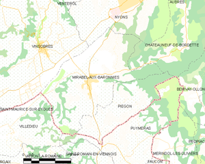
Mirabel-aux-Baronnies
- commune in Drôme, France
Hiking in Mirabel-aux-Baronnies
Mirabel-aux-Baronnies, located in the Vaucluse department of the Provence-Alpes-Côte d'Azur region in southeastern France, offers a wonderful array of hiking opportunities that showcase the natural beauty and diverse landscapes of the area. Here are some things to know about hiking in and around Mirabel-aux-Baronnies:...
- Country:
- Postal Code: 26110
- Coordinates: 44° 18' 39" N, 5° 5' 57" E
- GPS tracks (wikiloc): [Link]
- Area: 22.56 sq km
- Population: 1569


Bénivay-Ollon
- commune in Drôme, France
Hiking in Bénivay-Ollon
Bénivay-Ollon, located in the beautiful French Alps, offers a variety of hiking opportunities for outdoor enthusiasts. The region is characterized by stunning mountain landscapes, lush forests, and a rich array of wildlife. Here are some key points to consider if you're planning a hike in this area:...
- Country:
- Postal Code: 26170
- Coordinates: 44° 17' 52" N, 5° 11' 25" E
- GPS tracks (wikiloc): [Link]
- Area: 9.03 sq km
- Population: 58