Quemper-Guézennec (Quemper-Guézennec)

- commune in Côtes-d'Armor, France
- Country:

- Postal Code: 22260
- Coordinates: 48° 42' 5" N, 3° 6' 20" E


- GPS tracks (wikiloc): [Link]
- Area: 23.08 sq km
- Population: 1132
- Web site: http://www.quemper-guezennec.com
- Wikipedia en: wiki(en)
- Wikipedia: wiki(fr)
- Wikidata storage: Wikidata: Q1021321
- Wikipedia Commons Category: [Link]
- Freebase ID: [/m/03m42fr]
- GeoNames ID: Alt: [6429104]
- SIREN number: [212202568]
- BnF ID: [15251254z]
- INSEE municipality code: 22256
Shares border with regions:

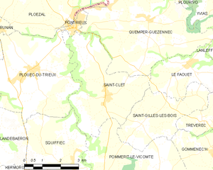
Saint-Clet
- commune in Côtes-d'Armor, France
- Country:
- Postal Code: 22260
- Coordinates: 48° 39' 45" N, 3° 7' 57" E
- GPS tracks (wikiloc): [Link]
- Area: 14.46 sq km
- Population: 878

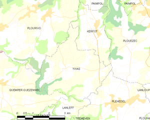
Yvias
- commune in Côtes-d'Armor, France
- Country:
- Postal Code: 22930
- Coordinates: 48° 42' 48" N, 3° 3' 9" E
- GPS tracks (wikiloc): [Link]
- Area: 11.61 sq km
- Population: 759


Le Faouët
- commune in Côtes-d'Armor, France
- Country:
- Postal Code: 22290
- Coordinates: 48° 40' 59" N, 3° 4' 26" E
- GPS tracks (wikiloc): [Link]
- AboveSeaLevel: 70 м m
- Area: 7.55 sq km
- Population: 390
- Web site: [Link]


Pontrieux
- commune in Côtes-d'Armor, France
- Country:
- Postal Code: 22260
- Coordinates: 48° 41' 54" N, 3° 9' 34" E
- GPS tracks (wikiloc): [Link]
- Area: 1.02 sq km
- Population: 1022
- Web site: [Link]


Plourivo
- commune in Côtes-d'Armor, France
- Country:
- Postal Code: 22860
- Coordinates: 48° 44' 38" N, 3° 4' 22" E
- GPS tracks (wikiloc): [Link]
- Area: 28.35 sq km
- Population: 2263


Lanleff
- commune in Côtes-d'Armor, France
- Country:
- Postal Code: 22290
- Coordinates: 48° 41' 34" N, 3° 2' 40" E
- GPS tracks (wikiloc): [Link]
- Area: 2.16 sq km
- Population: 121