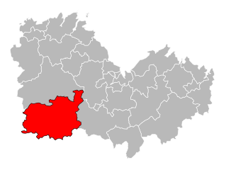
arrondissement of Guingamp (arrondissement de Guingamp)

- arrondissement of France
- Country:

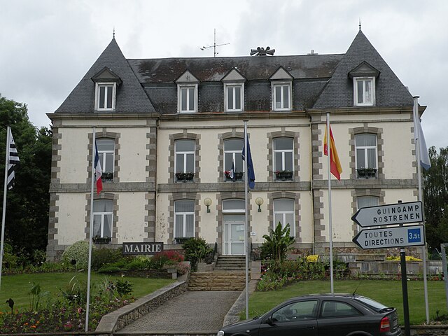
- Capital: Guingamp
- Coordinates: 48° 25' 0" N, 3° 20' 0" E


- GPS tracks (wikiloc): [Link]
- Population: 125719
- Wikipedia en: wiki(en)
- Wikipedia: wiki(fr)
- Wikidata storage: Wikidata: Q701268
- Freebase ID: [/m/095fgq]
- GeoNames ID: Alt: [3014220]
- VIAF ID: Alt: [152421622]
- Library of Congress authority ID: Alt: [n78024087]
- INSEE arrondissement code: [222]
- GNS Unique Feature ID: -1431157
Includes regions:


canton of Maël-Carhaix
- canton of France
- Country:
- Capital: Maël-Carhaix
- Coordinates: 48° 17' 3" N, 3° 25' 24" E
- GPS tracks (wikiloc): [Link]


canton of Callac
- canton of France
- Country:
- Capital: Callac
- Coordinates: 48° 24' 18" N, 3° 25' 36" E
- GPS tracks (wikiloc): [Link]
- Population: 18104


canton of Guingamp
- canton of France
- Country:
- Capital: Guingamp
- Coordinates: 48° 33' 43" N, 3° 9' 0" E
- GPS tracks (wikiloc): [Link]
- Population: 26233

canton of Mûr-de-Bretagne
- canton of France
- Country:
- Capital: Mûr-de-Bretagne
- Coordinates: 48° 12' 0" N, 2° 59' 0" E
- GPS tracks (wikiloc): [Link]
- Population: 19004

canton of Rostrenen
- canton of France
- Country:
- Capital: Rostrenen
- Coordinates: 48° 14' 14" N, 3° 18' 56" E
- GPS tracks (wikiloc): [Link]
- Population: 20770

canton of Saint-Nicolas-du-Pélem
- canton of France
- Country:
- Capital: Saint-Nicolas-du-Pélem
- Coordinates: 48° 19' 0" N, 3° 10' 0" E
- GPS tracks (wikiloc): [Link]


canton of Bourbriac
- canton of France (until March 2015)
- Country:
- Capital: Bourbriac
- Coordinates: 48° 28' 26" N, 3° 11' 14" E
- GPS tracks (wikiloc): [Link]
- Area: 173 sq km
- Population: 4602


canton of Bégard
- canton of France
- Country:
- Capital: Bégard
- Coordinates: 48° 37' 43" N, 3° 17' 59" E
- GPS tracks (wikiloc): [Link]
- Population: 21864


canton of Belle-Isle-en-Terre
- canton of France (until March 2015)
- Country:
- Capital: Belle-Isle-en-Terre
- Coordinates: 48° 32' 44" N, 3° 23' 36" E
- GPS tracks (wikiloc): [Link]