Röhrnbach (Röhrnbach)
- municipality of Germany
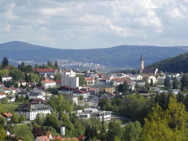
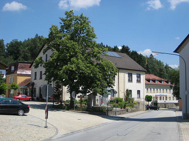
Röhrnbach is a beautiful municipality located in Bavaria, Germany, nestled in the heart of the picturesque landscape of the Bavarian Forest. The area offers a variety of hiking opportunities suitable for different skill levels and preferences.
Hiking Highlights in Röhrnbach:
-
Scenic Trails: The region features an array of well-marked trails that pass through lush forests, rolling hills, and scenic viewpoints. Trails often offer stunning views of the surrounding countryside and the characteristic landscape of the Bavarian Forest.
-
Variety of Routes: There are routes ranging from gentle walks suitable for families and beginners to more challenging hikes for experienced trekkers. You can find both short loops and longer trails that take you deeper into nature.
-
Nature Experiences: Röhrnbach is surrounded by diverse flora and fauna. While hiking, you might spot local wildlife and enjoy the tranquility of the natural environment. The trails can take you through areas rich in biodiversity and unique ecosystems.
-
Cultural Landmarks: Some hiking routes may lead you to historic sites, including chapels and cultural landmarks, giving you an opportunity to learn about the local history and culture.
-
Seasonal Hiking: The best times to hike here are during spring and summer when the weather is pleasant, and the scenery is lush and vibrant. Autumn also offers spectacular foliage for hikes, while winter can provide opportunities for snowshoeing and winter hiking.
-
Nearby Attractions: Röhrnbach is close to various other attractions and towns in the Bavarian Forest region. You could combine your hike with visits to other areas, such as the town of Passau or historical sites in the vicinity.
Preparation Tips:
- Maps and Guides: Make sure to have a good map or a hiking app to navigate the trails effectively.
- Safety: Always carry water, snacks, and a first-aid kit. Wear appropriate footwear and clothing, considering the weather.
- Leave No Trace: Respect nature by following Leave No Trace principles. Dispose of trash properly and remain on marked trails.
Enjoy your hiking adventure in Röhrnbach, and embrace the stunning natural beauty and rich cultural experiences this region has to offer!
- Country:

- Postal Code: 94133
- Local Dialing Code: 08582
- Licence Plate Code: FRG
- Coordinates: 48° 44' 20" N, 13° 31' 23" E


- GPS tracks (wikiloc): [Link]
- AboveSeaLevel: 438 м m
- Area: 40.62 sq km
- Population: 4145
- Web site: http://www.roehrnbach.de
- Wikipedia en: wiki(en)
- Wikipedia: wiki(de)
- Wikidata storage: Wikidata: Q503417
- Wikipedia Commons Category: [Link]
- Freebase ID: [/m/02q36wj]
- GeoNames ID: Alt: [2845559]
- VIAF ID: Alt: [239958862]
- OSM relation ID: [958953]
- GND ID: Alt: [4215101-6]
- archINFORM location ID: [42811]
- Historical Gazetteer (GOV) ID: [ROHAC1JN68SR]
- Bavarikon ID: [ODB_A00001474]
- German municipality key: 09272141
Shares border with regions:


Freyung
- human settlement in Germany
Freyung, located in the Bavarian Forest in Germany, is a beautiful destination for hiking enthusiasts. The region is known for its stunning natural landscapes, rolling hills, dense forests, and picturesque villages. Here are some highlights about hiking in Freyung:...
- Country:

- Postal Code: 94078
- Local Dialing Code: 08558; 08551
- Licence Plate Code: FRG
- Coordinates: 48° 48' 27" N, 13° 32' 51" E


- GPS tracks (wikiloc): [Link]
- AboveSeaLevel: 655 м m
- Area: 48.63 sq km
- Population: 7124
- Web site: [Link]


Büchlberg
- municipality of Germany
Büchlberg is a charming village located in Bavaria, Germany, and is surrounded by beautiful landscapes perfect for hiking enthusiasts. The area provides a variety of trails suitable for different skill levels, offering opportunities to explore picturesque countryside, forests, and hills....
- Country:

- Postal Code: 94124
- Local Dialing Code: 08505
- Licence Plate Code: PA
- Coordinates: 48° 40' 5" N, 13° 30' 39" E


- GPS tracks (wikiloc): [Link]
- AboveSeaLevel: 490 м m
- Area: 28.12 sq km
- Population: 3331
- Web site: [Link]


Perlesreut
- municipality of Germany
Perlesreut is a charming village located in Bavaria, Germany, close to the border with the Czech Republic. It’s situated in a picturesque region that offers a range of hiking opportunities, making it a great destination for both novice and experienced hikers....
- Country:

- Postal Code: 94157
- Local Dialing Code: 08555
- Licence Plate Code: FRG
- Coordinates: 48° 47' 0" N, 13° 27' 0" E


- GPS tracks (wikiloc): [Link]
- AboveSeaLevel: 542 м m
- Area: 29.73 sq km
- Population: 2686
- Web site: [Link]


Hutthurm
- municipality of Germany
Hutthurm, located in Bavaria, Germany, is a small town that serves as an excellent starting point for a variety of outdoor activities, including hiking. The surrounding region is characterized by its beautiful landscapes, rolling hills, forests, and scenic views, making it a delightful place for hikers of all levels....
- Country:

- Postal Code: 94116
- Local Dialing Code: 08505
- Licence Plate Code: PA
- Coordinates: 48° 40' 17" N, 13° 28' 16" E


- GPS tracks (wikiloc): [Link]
- AboveSeaLevel: 465 м m
- Area: 37.2 sq km
- Population: 4935
- Web site: [Link]


Fürsteneck
- municipality of Germany
Fürsteneck, located in Bavaria, Germany, is a great destination for hiking enthusiasts due to its beautiful landscapes and well-marked trails. Nestled among lush forests and rolling hills, it offers various hiking routes suitable for different skill levels. Here are some highlights and tips for hiking in Fürsteneck:...
- Country:

- Postal Code: 94142
- Local Dialing Code: 08555
- Licence Plate Code: FRG
- Coordinates: 48° 43' 0" N, 13° 28' 0" E


- GPS tracks (wikiloc): [Link]
- AboveSeaLevel: 395 м m
- Area: 10.43 sq km
- Population: 813
- Web site: [Link]


Waldkirchen
- municipality of Germany
Waldkirchen, located in the Bavarian region of Germany, is a beautiful destination for hiking enthusiasts. Known for its stunning landscapes, lush forests, and scenic views, the area offers various trails suitable for different skill levels....
- Country:

- Postal Code: 94065
- Local Dialing Code: 08581
- Licence Plate Code: FRG
- Coordinates: 48° 43' 50" N, 13° 36' 4" E


- GPS tracks (wikiloc): [Link]
- AboveSeaLevel: 532 м m
- Area: 80.01 sq km
- Population: 9448
- Web site: [Link]

