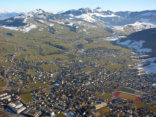
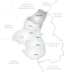
Rüte (Rüte)

- municipality in Switzerland
 Hiking in Rüte
Rüte, a charming area in Switzerland, is nestled in the picturesque Appenzell region. The region is characterized by rolling hills, lush pastures, and stunning mountain views, making it a fantastic destination for hiking enthusiasts. Here are some highlights and tips for hiking in Rüte:
Trails and Routes
-
Rüte to the Ebenalp:
- This popular trail takes you up to the Ebenalp, offering breathtaking panoramic views of the surrounding mountains and valleys. The trail is well-marked and suitable for hikers of various levels.
-
Appenzeller Bogen:
- A scenic circular hike that combines beautiful meadows and forests with stunning cultural views of the Appenzell area. It typically takes around 2-3 hours to complete.
-
Wildkirchli Caves:
- Explore the trail that leads to the charming Wildkirchli Chapel, located in rock caves. This route provides a combination of natural beauty and cultural history.
-
Alpine pasture hikes:
- Rüte features numerous trails through idyllic alpine pastures, where you can see cows grazing and enjoy fresh mountain air—perfect for a more leisurely hike or a family outing.
Hiking Tips
- Seasonal Considerations: Late spring to early autumn is the best time for hiking. Be sure to check local conditions, as some trails may be closed or require special gear in winter.
- Proper Gear: Wear sturdy hiking boots, dress in layers, and always bring a map (or download a hiking app), plenty of water, and some snacks.
- Local Wildlife: Keep an eye out for local wildlife and plants; respect their habitats and maintain a safe distance.
- Guided Hikes: If you're unfamiliar with the area or want a more in-depth experience, consider joining a guided hike to learn more about the local ecology and culture.
Attractions
After your hike, consider exploring the charming village of Rüte itself, where you can enjoy local culinary delights, relax in a cozy café, or visit nearby attractions like the Appenzell Museum for a taste of the region's history and tradition.
Hiking in Rüte allows you to connect with nature while experiencing the stunning landscapes of Switzerland—a truly rewarding adventure for all skill levels!
- Country:

- Postal Code: 9050
- Local Dialing Code: 071
- Licence Plate Code: AI
- Coordinates: 47° 19' 14" N, 9° 25' 48" E


- GPS tracks (wikiloc): [Link]
- AboveSeaLevel: 799 м m
- Area: 40.9 sq km
- Population: 3606
- Web site: http://www.ruete.ch
- Wikipedia en: wiki(en)
- Wikipedia: wiki(de)
- Wikidata storage: Wikidata: Q67188
- Wikipedia Commons Category: [Link]
- Freebase ID: [/m/01vbyc]
- GeoNames ID: Alt: [7286996]
- VIAF ID: Alt: [139835241]
- OSM relation ID: [1683929]
- archINFORM location ID: [45193]
- HDS ID: [1315]
- Swiss municipality code: [3103]
Shares border with regions:


Oberriet
- municipality in Switzerland
Hiking in Oberriet
Oberriet, located in the picturesque region of eastern Switzerland, offers a unique hiking experience characterized by stunning landscapes, charming villages, and a variety of trails suitable for different skill levels. Here are some key points to consider for hiking in Oberriet:...
- Country:
- Postal Code: 9463
- Local Dialing Code: 071
- Licence Plate Code: SG
- Coordinates: 47° 20' 6" N, 9° 33' 49" E
- GPS tracks (wikiloc): [Link]
- AboveSeaLevel: 421 м m
- Area: 34.51 sq km
- Population: 8839
- Web site: [Link]


Eichberg
- municipality in the canton of St. Gallen, Switzerland
Hiking in Eichberg
Eichberg, located near the city of St. Gallen in Switzerland, offers a variety of hiking opportunities in a picturesque alpine setting. The region is known for its stunning landscapes, lush green meadows, and panoramic views of the surrounding mountains....
- Country:
- Postal Code: 9453
- Local Dialing Code: 071
- Licence Plate Code: SG
- Coordinates: 47° 20' 35" N, 9° 31' 51" E
- GPS tracks (wikiloc): [Link]
- AboveSeaLevel: 481 м m
- Area: 5.43 sq km
- Population: 1524
- Web site: [Link]

Appenzell District
- municipality in Switzerland
Hiking in Appenzell District
Appenzell District, located in the eastern part of Switzerland, is renowned for its stunning landscapes, rolling hills, picturesque villages, and rich cultural heritage. It's an excellent destination for hikers of all levels, offering a variety of trails that showcase the region's natural beauty and provide access to breathtaking mountain views....
- Country:
- Postal Code: 9050
- Local Dialing Code: 071
- Licence Plate Code: AI
- Coordinates: 47° 20' 0" N, 9° 25' 0" E
- GPS tracks (wikiloc): [Link]
- AboveSeaLevel: 780 м m
- Area: 16.9 sq km
- Population: 5809
- Web site: [Link]


Gais
- municipality in Switzerland
Hiking in Gais
Gais, a charming village in the Appenzell Innerrhoden region of Switzerland, offers stunning hiking opportunities suitable for various skill levels. The surrounding landscapes are characterized by rolling hills, lush meadows, and spectacular mountain views, making it a paradise for outdoor enthusiasts....
- Country:
- Postal Code: 9056
- Local Dialing Code: 071
- Licence Plate Code: AR
- Coordinates: 47° 21' 38" N, 9° 27' 4" E
- GPS tracks (wikiloc): [Link]
- AboveSeaLevel: 983 м m
- Area: 21.23 sq km
- Population: 3096
- Web site: [Link]


Altstätten
- municipality in Switzerland
Hiking in Altstätten
Altstätten, located in the eastern part of Switzerland, is a charming town nestled near the Appenzell region, offering a variety of hiking opportunities that cater to all levels of hikers. The surrounding landscape is characterized by rolling hills, lush forests, and stunning mountain views, making it a fantastic destination for outdoor enthusiasts....
- Country:
- Postal Code: 9450
- Local Dialing Code: 071
- Licence Plate Code: SG
- Coordinates: 47° 22' 41" N, 9° 32' 56" E
- GPS tracks (wikiloc): [Link]
- AboveSeaLevel: 465 м m
- Area: 39.11 sq km
- Population: 11549
- Web site: [Link]


Schwende District
- municipality in Switzerland
Hiking in Schwende District
Schwende District, located in the Appenzell Innerrhoden region of Switzerland, is a beautiful and scenic area that offers a variety of hiking opportunities. Known for its breathtaking landscapes, picturesque villages, and rich cultural heritage, this district is a great choice for hikers of all skill levels. Here are some highlights to consider when hiking in the Schwende District:...
- Country:
- Postal Code: 9057
- Local Dialing Code: 071
- Licence Plate Code: AI
- Coordinates: 47° 16' 51" N, 9° 23' 35" E
- GPS tracks (wikiloc): [Link]
- AboveSeaLevel: 1611 м m
- Area: 57.5 sq km
- Population: 2202
- Web site: [Link]
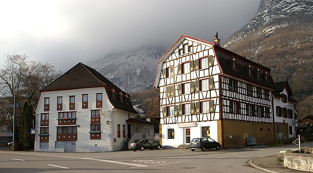
Sennwald
- municipality in Switzerland
Hiking in Sennwald
Sennwald is a picturesque municipality located in the Canton of St. Gallen, Switzerland. It is surrounded by breathtaking landscapes and offers a variety of hiking opportunities that cater to different skill levels. Here’s what you can expect when hiking in Sennwald:...
- Country:
- Postal Code: 9466
- Local Dialing Code: 081
- Licence Plate Code: SG
- Coordinates: 47° 14' 38" N, 9° 28' 37" E
- GPS tracks (wikiloc): [Link]
- AboveSeaLevel: 441 м m
- Area: 41.53 sq km
- Population: 5564
- Web site: [Link]