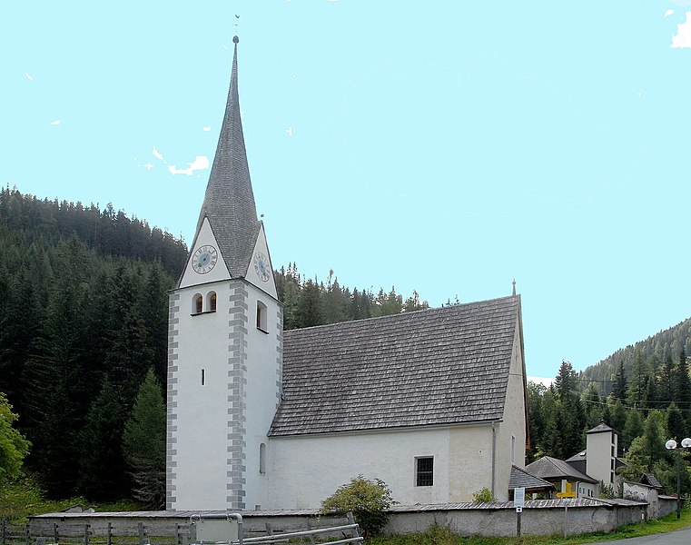
Radenthein (Radenthein)
- municipality in Austria
Radenthein, located in the Carinthia region of Austria, offers a beautiful setting for hiking enthusiasts. Nestled between the picturesque mountains and near the scenic shores of Lake Millstatt, Radenthein provides a variety of hiking trails suitable for all levels of hikers.
Hiking Trails
-
Lake Millstatt Circuit: This is a popular trail that runs around Lake Millstatt, providing stunning views of the water and surrounding mountains. It features gentle terrain, making it suitable for families and casual hikers.
-
Kreuzbergl: For more experienced hikers, the trails leading up to Kreuzbergl offer a moderate challenge with rewarding views from the top. The trail winds through beautiful forests and alpine meadows.
-
Nockberge National Park: Just a short drive from Radenthein, this national park is home to a wide variety of trails. You can explore alpine landscapes, unique flora and fauna, and enjoy the breathtaking views of the Nockberge mountain range.
-
The "Gölden Trail": This is a themed hiking route that combines nature and culture. Along the way, you can discover historical sites and enjoy artistic installations that celebrate the region's heritage.
Tips for Hiking in Radenthein
- Season: The best time for hiking is late spring through early autumn. The summer months are particularly popular due to the favorable weather conditions.
- Gear: Make sure to wear sturdy hiking boots and bring layers, as mountain weather can change rapidly. Always carry enough water and snacks.
- Maps and Guides: While many trails are well-marked, it's a good idea to have a map or a GPS device, especially for the more remote paths.
- Local Resources: Check in with the local tourism office for up-to-date information on trail conditions and guided hiking tours.
Additional Activities
Besides hiking, Radenthein offers opportunities for swimming in Lake Millstatt, cycling, and exploring the local culture and cuisine. Enjoying a meal at a local hut after a day of hiking can be a delightful way to experience the region.
Whether you are a seasoned hiker or just starting out, Radenthein has something for everyone while immersing you in the natural beauty of Austria.
- Country:

- Local Dialing Code: 0 42 46
- Licence Plate Code: SP
- Coordinates: 46° 48' 0" N, 13° 42' 0" E


- GPS tracks (wikiloc): [Link]
- AboveSeaLevel: 746 м m
- Area: 89.3 sq km
- Population: 5831
- Web site: http://www.radenthein.gv.at
- Wikipedia en: wiki(en)
- Wikipedia: wiki(de)
- Wikidata storage: Wikidata: Q700132
- Wikipedia Commons Gallery: [Link]
- Wikipedia Commons Category: [Link]
- Freebase ID: [/m/02qr_tw]
- GeoNames ID: Alt: [2768130]
- VIAF ID: Alt: [131359337]
- GND ID: Alt: [4267608-3]
- archINFORM location ID: [45896]
- Library of Congress authority ID: Alt: [n81079467]
- MusicBrainz area ID: [01010314-c613-4459-a79d-4c9b59f143b1]
- Quora topic ID: [Radenthein]
- TGN ID: [1025976]
- Austrian municipality key: [20630]
Shares border with regions:

Bad Kleinkirchheim
- municipality in Austria
Bad Kleinkirchheim is a beautiful region located in the Carinthia area of Austria, known for its stunning alpine scenery, thermal spas, and a range of outdoor activities, including hiking. Here’s an overview of what you can expect when hiking in Bad Kleinkirchheim:...
- Country:

- Postal Code: 9546
- Local Dialing Code: 04240
- Licence Plate Code: SP
- Coordinates: 46° 48' 49" N, 13° 47' 34" E


- GPS tracks (wikiloc): [Link]
- AboveSeaLevel: 1087 м m
- Area: 74.01 sq km
- Population: 1723
- Web site: [Link]

Ferndorf
- municipality in Austria
Ferndorf, located in Austria, is a beautiful destination for hiking enthusiasts. Nestled in the picturesque landscape of Carinthia, Ferndorf offers a variety of trails that cater to different skill levels, from easy family-friendly walks to more challenging mountain hikes....
- Country:

- Postal Code: 9702
- Local Dialing Code: 0 42 45
- Licence Plate Code: VL
- Coordinates: 46° 44' 10" N, 13° 37' 35" E


- GPS tracks (wikiloc): [Link]
- AboveSeaLevel: 560 м m
- Area: 31.41 sq km
- Population: 2156
- Web site: [Link]

Feld am See
- municipality in Austria
Feld am See, located in the Carinthia region of Austria, is a wonderful destination for hiking enthusiasts. Nestled between the beautiful Lake Feldsee and the surrounding mountains, it offers a variety of trails suitable for different skill levels. Here are some highlights and tips for hiking in this picturesque area:...
- Country:

- Postal Code: 9544
- Local Dialing Code: 0 42 46
- Licence Plate Code: VL
- Coordinates: 46° 46' 32" N, 13° 44' 50" E


- GPS tracks (wikiloc): [Link]
- AboveSeaLevel: 751 м m
- Area: 33.88 sq km
- Population: 1094
- Web site: [Link]

Krems
- municipality in Austria
Krems, a charming village in Carinthia, Austria, is surrounded by stunning natural landscapes and offers a variety of hiking opportunities. The region is known for its picturesque alpine scenery, lush forests, and pristine lakes, making it a fantastic destination for hikers of all levels....
- Country:

- Local Dialing Code: 0 47 35
- Licence Plate Code: SP
- Coordinates: 46° 55' 21" N, 13° 34' 3" E


- GPS tracks (wikiloc): [Link]
- AboveSeaLevel: 807 м m
- Area: 207.11 sq km
- Population: 1679
- Web site: [Link]

Millstatt
- municipality in Austria
Millstatt, located in the beautiful Carinthia region of Austria, is a fantastic destination for hiking enthusiasts. The area is known for its stunning landscapes, including panoramic views of the surrounding mountains and the serene Millstätter See (Lake Millstatt)....
- Country:

- Postal Code: 9872
- Local Dialing Code: 04766
- Licence Plate Code: SP
- Coordinates: 46° 48' 15" N, 13° 34' 50" E


- GPS tracks (wikiloc): [Link]
- AboveSeaLevel: 611 м m
- Area: 57.74 sq km
- Population: 3460
- Web site: [Link]
