Radon (Radon)

- former commune in Orne, France
- Country:

- Postal Code: 61250
- Coordinates: 48° 30' 11" N, 0° 6' 6" E


- GPS tracks (wikiloc): [Link]
- Area: 19.81 sq km
- Population: 1052
- Web site: http://www.commune-de-radon.fr
- Wikipedia en: wiki(en)
- Wikipedia: wiki(fr)
- Wikidata storage: Wikidata: Q248914
- Wikipedia Commons Category: [Link]
- Freebase ID: [/m/08hjlp]
- Freebase ID: [/m/08hjlp]
- GeoNames ID: Alt: [6439210]
- GeoNames ID: Alt: [6439210]
- BnF ID: [15268271f]
- BnF ID: [15268271f]
- MusicBrainz area ID: [e788dd0a-a0fb-494c-bfbe-4aa764467281]
- MusicBrainz area ID: [e788dd0a-a0fb-494c-bfbe-4aa764467281]
- WOEID: [618717]
- WOEID: [618717]
- INSEE municipality code: 61341
- INSEE municipality code: 61341
Shares border with regions:

Le Bouillon
- commune in Orne, France
- Country:
- Postal Code: 61500
- Coordinates: 48° 33' 42" N, 0° 6' 12" E
- GPS tracks (wikiloc): [Link]
- Area: 17.77 sq km
- Population: 173

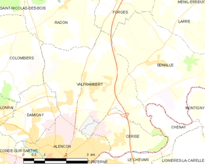
Valframbert
- commune in Orne, France
- Country:
- Postal Code: 61250
- Coordinates: 48° 27' 50" N, 0° 6' 29" E
- GPS tracks (wikiloc): [Link]
- Area: 13.95 sq km
- Population: 1697