
Regensburg (Regensburg)

.svg)
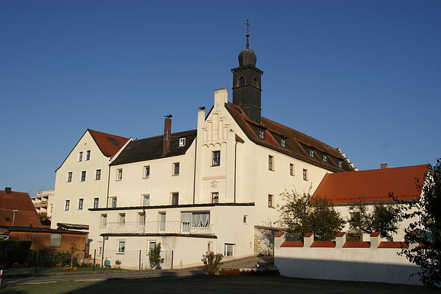
- town in Bavaria, Germany
 Hiking in Regensburg
Regensburg, located in Bavaria, Germany, offers a variety of hiking opportunities, particularly due to its picturesque landscapes along the Danube River and the surrounding countryside. Here are some highlights and tips for hiking in and around Regensburg:
Hiking Trails
-
Danube River Trails: The paths along the Danube offer beautiful views of the river, historic buildings, and lush greenery. You can walk or bike along the riverbanks, which are well-marked and suitable for all levels.
-
Biosphere Reserve Nördlicher Oberpfälzer Wald: Just a short drive from Regensburg, this area provides diverse hiking routes through forests and hills. The reserve is known for its rich biodiversity, making it a great option for nature lovers.
-
Altmühltal Nature Park: A bit further out, this park features stunning limestone cliffs, valleys, and charming villages. You can tackle longer hikes that combine cultural and natural sights, like visiting castles or archaeological sites.
-
Regensburg’s Historical Sites: Explore shorter trails that lead you through Regensburg’s UNESCO World Heritage sites, including the Stone Bridge, St. Peter’s Cathedral, and medieval streets.
Recommended Routes
- Regensburg to Donaustauf: A popular route along the river, approximately 12 km round trip. It offers beautiful views and can be done in about 3-4 hours.
- The Stone Bridge Walk: Starting at the Regensburg Cathedral, this easier walk takes you across the historic bridge and along the river, perfect for families.
Tips for Hiking in Regensburg
- Best Time to Hike: Spring (April to June) and early autumn (September to October) offer mild weather and beautiful scenery.
- Gear Up: Wear sturdy hiking shoes and dress in layers, as weather can change quickly. Bring water and snacks, especially for longer hikes.
- Local Attractions: Consider combining your hike with visits to local attractions, like the Walhalla memorial or the many churches and historical sites in the city.
- Public Transportation: Regensburg’s public transport can help you reach the starting points of many trails.
Safety and Preparedness
- Always check trail maps and conditions, as some paths may become challenging due to weather.
- Inform someone of your hiking plans, especially if venturing into more remote areas.
- Be aware of local wildlife and respect nature by staying on marked trails.
Hiking in and around Regensburg can be a rewarding experience, combining stunning natural beauty with rich cultural history. Happy hiking!
- Country:

- Postal Code: 93057; 93055; 93053; 93051; 93049; 93047
- Local Dialing Code: 941
- Licence Plate Code: R
- Coordinates: 49° 1' 0" N, 12° 5' 0" E


- GPS tracks (wikiloc): [Link]
- AboveSeaLevel: 343 м m
- Area: 80.85 sq km
- Population: 150894
- Web site: https://www.regensburg.de/
- Wikipedia en: wiki(en)
- Wikipedia: wiki(de)
- Wikidata storage: Wikidata: Q2978
- Wikipedia Commons Gallery: [Link]
- Wikipedia Commons Category: [Link]
- Wikipedia Commons Maps Category: [Link]
- Freebase ID: [/m/0d34_]
- GeoNames ID: Alt: [2849483]
- BnF ID: [119335624]
- VIAF ID: Alt: [248075075]
- OSM relation ID: [62411]
- GND ID: Alt: [4048989-9]
- archINFORM location ID: [272]
- Library of Congress authority ID: Alt: [n79129587]
- PACTOLS thesaurus ID: [pcrtakrFzbSBs2]
- MusicBrainz area ID: [c16535bd-85a7-4b2a-899b-d93854cb972c]
- Quora topic ID: [Regensburg]
- Encyclopædia Britannica Online ID: [place/Regensburg]
- Encyclopædia Universalis ID: [ratisbonne]
- EMLO location ID: [6627736a-699f-480a-b6ca-897d288fe960]
- Facebook Places ID: [109952035700751]
- Great Russian Encyclopedia Online ID: [3502444]
- Bavarikon ID: [ODB_A00001699]
- National Library of Israel ID: [000110243]
- NUTS code: [DE232]
- Nomisma ID: [regensburg]
- Klexikon article ID: [Regensburg]
- German municipality key: 09362000
- US National Archives Identifier: 10045420
- German district key: 09362
Includes regions:
Burgweinting-Harting
- human settlement in Germany
Hiking in Burgweinting-Harting
Burgweinting-Harting is a charming area located near Regensburg in Bavaria, Germany. This region offers a variety of hiking opportunities, showcasing the scenic beauty of the Bavarian countryside. Here are some key points to consider when hiking in this area:...
- Country:
- Coordinates: 48° 59' 20" N, 12° 9' 10" E
- GPS tracks (wikiloc): [Link]
Schwabelweis
- human settlement
Hiking in Schwabelweis
Schwabelweis, located in the vicinity of Regensburg in Bavaria, Germany, offers a range of hiking opportunities that showcase the beautiful landscapes of the region, including picturesque countryside, forests, and the Danube River. While it may not be as well-known as some other hiking destinations, it provides a lovely setting for both casual walkers and more experienced hikers....
- Country:
- Coordinates: 49° 2' 0" N, 12° 10' 0" E
- GPS tracks (wikiloc): [Link]
Steinweg-Pfaffenstein
- human settlement
Hiking in Steinweg-Pfaffenstein
Hiking in Steinweg-Pfaffenstein, located in the beautiful region of Thuringia, Germany, offers a rewarding experience for outdoor enthusiasts. This area is known for its stunning landscapes, rich flora and fauna, and well-maintained hiking trails suitable for various skill levels....
- Country:
- Coordinates: 49° 1' 50" N, 12° 5' 38" E
- GPS tracks (wikiloc): [Link]

Sallern-Gallingkofen
- Municipality in Regensburg
Hiking in Sallern-Gallingkofen
Sallern-Gallingkofen is a charming area that offers various outdoor activities, including hiking. Nestled in Bavaria, Germany, it features scenic landscapes, rolling hills, and a mix of rural and forested terrains that make it ideal for outdoor enthusiasts....
- Country:
- Coordinates: 49° 2' 50" N, 12° 6' 5" E
- GPS tracks (wikiloc): [Link]
Kumpfmühl-Ziegetsdorf-Neuprüll
- human settlement
Hiking in Kumpfmühl-Ziegetsdorf-Neuprüll
Kumpfmühl-Ziegetsdorf-Neuprüll is a district located in the city of Regensburg, Germany. While not traditionally renowned for extensive hiking trails, the area offers some local walking opportunities intertwined with beautiful nature and scenic views. Here are a few points to consider if you're interested in hiking or walking in and around this region:...
- Country:
- Coordinates: 49° 0' 0" N, 12° 4' 50" E
- GPS tracks (wikiloc): [Link]
Galgenberg
- human settlement in Germany
Hiking in Galgenberg
Galgenberg, located in Regensburg, Germany, is a popular outdoor destination that offers scenic hiking opportunities. Known for its natural beauty and significant historical context, it is a charming place for both locals and visitors....
- Country:
- Coordinates: 49° 0' 0" N, 12° 6' 10" E
- GPS tracks (wikiloc): [Link]
Konradsiedlung-Wutzlhofen
- human settlement
Hiking in Konradsiedlung-Wutzlhofen
Konradsiedlung-Wutzlhofen is a charming area in Germany that offers several opportunities for hiking enthusiasts. While it might not be as widely recognized as larger national parks or famous trails, the region features beautiful landscapes, local flora and fauna, and a peaceful atmosphere that makes it a perfect spot for a hiking getaway....
- Country:
- Coordinates: 49° 2' 45" N, 12° 7' 25" E
- GPS tracks (wikiloc): [Link]
Großprüfening-Dechbetten-Königswiesen
- human settlement in Germany
Hiking in Großprüfening-Dechbetten-Königswiesen
Großprüfening-Dechbetten-Königswiesen is a region in Bavaria, Germany, located near the city of Regensburg. This area offers various opportunities for hikers of all skill levels, featuring scenic landscapes, diverse flora and fauna, and historical sites....
- Country:
- Coordinates: 49° 0' 38" N, 12° 3' 33" E
- GPS tracks (wikiloc): [Link]
Oberisling-Leoprechting-Graß
- human settlement in Germany
Hiking in Oberisling-Leoprechting-Graß
Oberisling-Leoprechting-Graß, located in Bavaria, Germany, offers a variety of hiking opportunities amid beautiful landscapes, natural beauty, and cultural experiences. Here are some key points to consider when planning your hiking adventures in that area:...
- Country:
- Coordinates: 48° 59' 0" N, 12° 6' 45" E
- GPS tracks (wikiloc): [Link]
Kasernenviertel
- human settlement
Hiking in Kasernenviertel
Kasernenviertel, located in the city of Basel, Switzerland, is not typically recognized as a traditional hiking area. However, it offers a unique blend of urban and natural experiences owing to its position near the Rhine River and its proximity to various parks and green spaces....
- Country:
- Coordinates: 49° 0' 19" N, 12° 7' 9" E
- GPS tracks (wikiloc): [Link]
Ober-/Niederwinzer-Kager
- human settlement in Germany
Hiking in Ober-/Niederwinzer-Kager
Ober-Niederwinzer-Kager appears to be a relatively lesser-known or less prominent hiking destination, which might not have extensive information readily available. However, I can provide general advice on what you might expect and how to prepare for hiking in rural or less developed areas....
- Country:

Ostenviertel
- human settlement in Germany
Hiking in Ostenviertel
Ostenviertel, a district located in the vibrant city of Leipzig, Germany, is not traditionally known for extensive hiking trails like more rural areas. However, there are still opportunities for enjoyable walks and outdoor experiences in and around the district....
- Country:
- Coordinates: 49° 1' 2" N, 12° 7' 30" E
- GPS tracks (wikiloc): [Link]
Reinhausen
- city district of Regensburg, Bavaria, Germany
Hiking in Reinhausen
Reinhausen is a district in the city of Göttingen, Germany, known for its beautiful natural surroundings and hiking opportunities. While not as famous as some other hiking destinations in Germany, it offers a range of trails that cater to different skill levels and interests....
- Country:
- Coordinates: 49° 2' 7" N, 12° 6' 45" E
- GPS tracks (wikiloc): [Link]
Weichs
- human settlement in Germany
Hiking in Weichs
Weichs, located near Regensburg in Bavaria, Germany, is an excellent starting point for various hiking adventures in the beautiful Bavarian countryside. The area boasts a mix of picturesque landscapes, historical landmarks, and well-marked trails....
- Country:
- Coordinates: 49° 1' 29" N, 12° 7' 4" E
- GPS tracks (wikiloc): [Link]
Westenviertel
- human settlement in Germany
Hiking in Westenviertel
Westernviertel, a vibrant district in the city of Essen, Germany, is known more for its urban setting than for traditional hiking trails. However, it provides excellent opportunities for urban hiking and exploring local parks, green spaces, and nearby natural areas....
- Country:
- Coordinates: 49° 1' 0" N, 12° 3' 5" E
- GPS tracks (wikiloc): [Link]
Stadtamhof
- human settlement
Hiking in Stadtamhof
Stadtamhof, located near Regensburg in Bavaria, Germany, offers a unique blend of history and nature, providing an intriguing setting for hiking enthusiasts. The area is known for its picturesque landscapes, with winding trails that often follow the banks of the Danube River and offer stunning views of the surrounding countryside and the historic town of Regensburg....
- Country:
- Coordinates: 49° 1' 28" N, 12° 5' 50" E
- GPS tracks (wikiloc): [Link]
Brandlberg-Keilberg
- human settlement
Hiking in Brandlberg-Keilberg
Brandlberg-Keilberg is a beautiful hiking area situated in Austria, primarily within the stunning landscapes of the Salzkammergut region. It offers a diverse range of hiking trails suitable for various skill levels, and the scenery is truly breathtaking, featuring lush forests, picturesque meadows, and stunning mountain views....
- Country:
- Coordinates: 49° 2' 20" N, 12° 9' 0" E
- GPS tracks (wikiloc): [Link]
Shares border with regions:

Regensburg
- district of Bavaria, Germany
Hiking in Regensburg
Regensburg is located in the state of Bavaria, Germany, and it offers a variety of hiking opportunities that showcase the region's natural beauty and historical significance. Here's what you can expect when hiking in and around the Regensburg district:...
- Country:
- Capital: Regensburg
- Licence Plate Code: R
- Coordinates: 49° 4' 48" N, 12° 10' 12" E
- GPS tracks (wikiloc): [Link]
- AboveSeaLevel: 390 м m
- Area: 1396.00 sq km
- Population: 144278
- Web site: [Link]