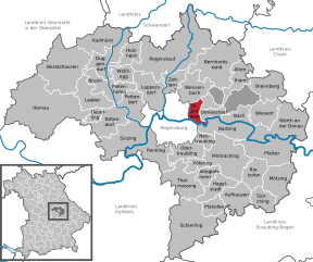
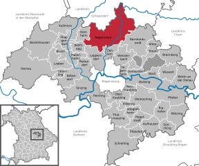
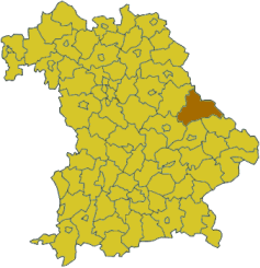
Regensburg (Landkreis Regensburg)
.svg)
- district of Bavaria, Germany
 Hiking in Regensburg
Regensburg is located in the state of Bavaria, Germany, and it offers a variety of hiking opportunities that showcase the region's natural beauty and historical significance. Here's what you can expect when hiking in and around the Regensburg district:
Scenic Trails
-
Danube River Trails: The vicinity of the Danube River provides beautiful scenic routes. There are paths along the riverbanks that are perfect for walking and biking, offering views of the water, lush greenery, and occasionally historical landmarks.
-
Bavarian Forest National Park: Located not too far from Regensburg, this national park presents a range of hiking trails through dense forests and along rivers. It's a great place for those looking for more rugged terrain and wildlife viewing.
-
The Jura Mountains: If you're open to exploring a bit further, you can find trails in the Jura region, which features limestone formations, caves, and panoramic views.
Cultural Hikes
Regensburg is rich in history and culture, so many hikes incorporate significant historical routes. The city itself is a UNESCO World Heritage site, and after hiking, you can explore its medieval architecture, including the famous Stone Bridge and Regensburg Cathedral.
Hiking Tips
- Trail Difficulty: Most trails range from easy to moderate difficulty, making them accessible for individuals at various hiking experiences.
- Seasonal Considerations: Spring and fall are particularly pleasant times to hike, with milder weather and beautiful foliage, but summer can also be enjoyable if you start early to avoid the midday heat.
- Equipment: Good walking shoes are essential, as some trails may be uneven. Always carry water and snacks, and be sure to check the weather before heading out.
Local Hiking Groups
Consider joining local hiking groups or clubs, which can provide guided hikes, social opportunities, and a chance to learn more about the local flora and fauna.
Overall, hiking in Regensburg offers a combination of natural beauty and historical exploration, making it a fantastic destination for outdoor enthusiasts.
- Country:

- Capital: Regensburg
- Licence Plate Code: R
- Coordinates: 49° 4' 48" N, 12° 10' 12" E


- GPS tracks (wikiloc): [Link]
- AboveSeaLevel: 390 м m
- Area: 1396.00 sq km
- Population: 144278
- Web site: http://www.landkreis-regensburg.de
- Wikipedia en: wiki(en)
- Wikipedia: wiki(de)
- Wikidata storage: Wikidata: Q10429
- Wikipedia Commons Category: [Link]
- Freebase ID: [/m/02bntw]
- GeoNames ID: Alt: [3220858]
- VIAF ID: Alt: [234134409]
- OSM relation ID: [62565]
- GND ID: Alt: [4048990-5]
- archINFORM location ID: [2578]
- Library of Congress authority ID: Alt: [n86119728]
- TGN ID: [7077094]
- Historical Gazetteer (GOV) ID: [adm_139375]
- Bavarikon ID: [ODB_A00001829]
- NUTS code: [DE238]
- German district key: 09375
Includes regions:
Kreuther Forst
- unincorporated area in Germany
Hiking in Kreuther Forst
Kreuther Forst is a beautiful forest area located near the Bavarian town of Kreuth in Germany, nestled on the southern shores of the Tegernsee lake and near the foothills of the Alps. This region is known for its picturesque landscapes, dense woodlands, and an abundance of hiking trails that cater to various skill levels....
- Country:
- Coordinates: 49° 3' 0" N, 12° 14' 0" E
- GPS tracks (wikiloc): [Link]


Forstmühler Forst
- unincorporated area in Germany
Hiking in Forstmühler Forst
Forstmühler Forst is a beautiful area located in Germany, known for its picturesque landscapes and tranquil forested paths, making it an excellent destination for hiking enthusiasts. Here are a few points to consider if you’re planning a hike in this region:...
- Country:
- Coordinates: 49° 3' 0" N, 12° 18' 0" E
- GPS tracks (wikiloc): [Link]

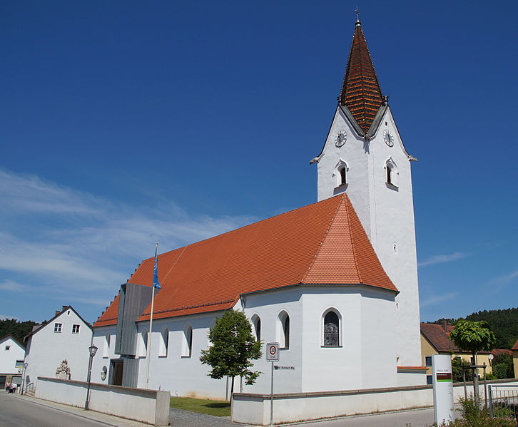
Zeitlarn
- municipality of Germany
Hiking in Zeitlarn
Zeitlarn is a charming municipality located in Bavaria, Germany, not far from the city of Regensburg. While it may not be as famous a hiking destination as some of the larger national parks, it offers a variety of opportunities for hiking enthusiasts to explore the beautiful Bavarian countryside....
- Country:
- Postal Code: 93197
- Local Dialing Code: 0941; 09402
- Licence Plate Code: R
- Coordinates: 49° 4' 43" N, 12° 6' 42" E
- GPS tracks (wikiloc): [Link]
- AboveSeaLevel: 333 м m
- Area: 16.11 sq km
- Population: 4502
- Web site: [Link]


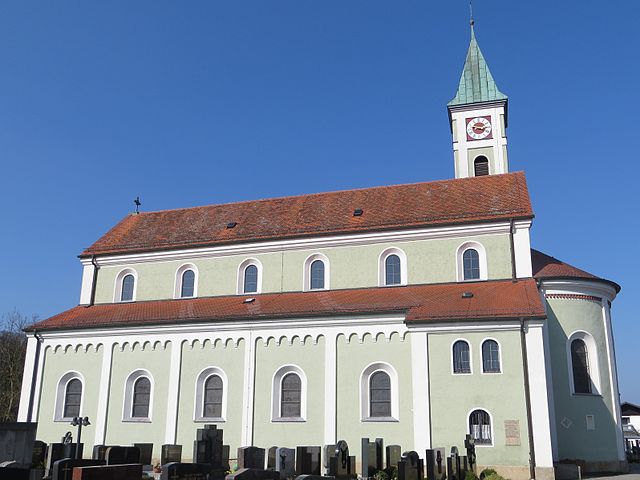
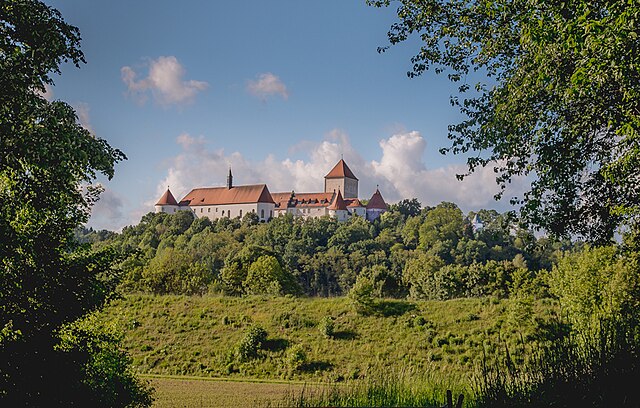
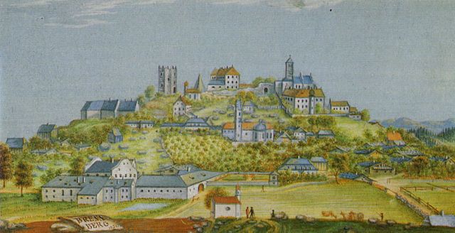
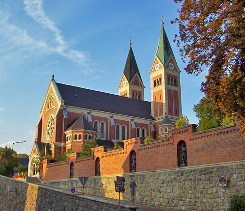
Donaustauf
- municipality of Germany
Hiking in Donaustauf
Donaustauf is a picturesque town located in Bavaria, Germany, near the banks of the Danube River. It's known for its stunning landscapes, charming architecture, and historical significance, making it a fantastic destination for hikers. Here are some highlights and tips for hiking in the Donaustauf area:...
- Country:
- Postal Code: 93093
- Local Dialing Code: 09403
- Licence Plate Code: R
- Coordinates: 49° 1' 44" N, 12° 12' 29" E
- GPS tracks (wikiloc): [Link]
- AboveSeaLevel: 358 м m
- Area: 9.72 sq km
- Population: 3288
- Web site: [Link]


Deuerling
- municipality in Bavaria in Germany
Hiking in Deuerling
Deuerling is a charming village located in Bavaria, Germany, surrounded by beautiful landscapes ideal for hiking enthusiasts. The region features various trails that cater to different skill levels, making it a great destination for both beginners and experienced hikers....
- Country:
- Postal Code: 93180
- Local Dialing Code: 09498
- Licence Plate Code: R
- Coordinates: 49° 2' 10" N, 11° 54' 27" E
- GPS tracks (wikiloc): [Link]
- AboveSeaLevel: 417 м m
- Area: 7.13 sq km
- Population: 1625
- Web site: [Link]


Beratzhausen
- municipality of Germany
Hiking in Beratzhausen
Beratzhausen, located in Bavaria, Germany, offers a scenic environment for hiking enthusiasts. The area is characterized by beautiful landscapes, including lush forests, rolling hills, and proximity to the Naab River. Here are some key points to consider when hiking in Beratzhausen:...
- Country:
- Postal Code: 93176
- Local Dialing Code: 09493
- Licence Plate Code: R
- Coordinates: 49° 5' 43" N, 11° 48' 37" E
- GPS tracks (wikiloc): [Link]
- AboveSeaLevel: 467 м m
- Area: 72.54 sq km
- Population: 5117
- Web site: [Link]


Alteglofsheim
- municipality of Germany
Hiking in Alteglofsheim
Alteglofsheim is a small municipality located in Bavaria, Germany, near Regensburg. While it may not be as well-known as other hiking destinations, the surrounding areas offer a variety of hiking opportunities that can cater to different skill levels....
- Country:
- Postal Code: 93087
- Local Dialing Code: 09453
- Licence Plate Code: R
- Coordinates: 48° 55' 0" N, 12° 12' 0" E
- GPS tracks (wikiloc): [Link]
- AboveSeaLevel: 372 м m
- Area: 13.23 sq km
- Population: 2701
- Web site: [Link]


Altenthann
- municipality of Germany
Hiking in Altenthann
Altenthann is a small municipality located in Bavaria, Germany, known for its natural beauty and picturesque landscapes, making it a great destination for hiking enthusiasts. Here are some key points to consider if you're planning a hiking trip in and around Altenthann:...
- Country:
- Postal Code: 93177
- Local Dialing Code: 09408; 09403
- Licence Plate Code: R
- Coordinates: 49° 5' 34" N, 12° 18' 13" E
- GPS tracks (wikiloc): [Link]
- AboveSeaLevel: 508 м m
- Area: 21.27 sq km
- Population: 1315
- Web site: [Link]

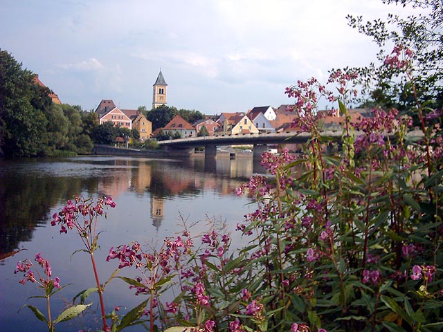
Wörth an der Donau
- municipality of Germany
Hiking in Wörth an der Donau
Wörth an der Donau is a picturesque town located in Bavaria, Germany, known for its stunning natural surroundings and access to the Danube River. Hiking in and around Wörth an der Donau offers scenic routes that cater to various skill levels....
- Country:
- Postal Code: 93086
- Local Dialing Code: 09482
- Licence Plate Code: R
- Coordinates: 49° 0' 3" N, 12° 24' 4" E
- GPS tracks (wikiloc): [Link]
- AboveSeaLevel: 327 м m
- Area: 52.34 sq km
- Population: 4756
- Web site: [Link]


Neutraubling
- town in Germany
Hiking in Neutraubling
Neutraubling, located in Bavaria, Germany, is a smaller town that offers a few opportunities for hiking and enjoying nature. While it may not be a major hiking destination like some of the larger national parks or mountainous regions in Bavaria, the area around Neutraubling offers scenic routes and trails, especially for those who enjoy a more relaxed hiking experience....
- Country:
- Postal Code: 93073
- Local Dialing Code: 09401
- Licence Plate Code: R
- Coordinates: 48° 59' 37" N, 12° 11' 43" E
- GPS tracks (wikiloc): [Link]
- AboveSeaLevel: 330 м m
- Area: 12 sq km
- Population: 8721
- Web site: [Link]


Bach an der Donau
- municipality of Germany
Hiking in Bach an der Donau
Bach an der Donau, also known as Bach on the Danube, is a picturesque village located along the Danube River in Bavaria, Germany. The area offers some beautiful hiking opportunities, characterized by scenic views of the river, lush forests, and charming countryside....
- Country:
- Postal Code: 93090
- Local Dialing Code: 09403
- Licence Plate Code: R
- Coordinates: 49° 1' 15" N, 12° 18' 14" E
- GPS tracks (wikiloc): [Link]
- AboveSeaLevel: 334 м m
- Area: 14.82 sq km
- Population: 1545
- Web site: [Link]


Brunn
- municipality of Germany
Hiking in Brunn
Brunn, located in the Upper Palatinate region of Bavaria, Germany, offers a variety of hiking opportunities that showcase the beautiful landscapes and rich heritage of the area. Here are some key points to consider when hiking in Brunn:...
- Country:
- Postal Code: 93164
- Local Dialing Code: 09498
- Licence Plate Code: R
- Coordinates: 49° 5' 43" N, 11° 53' 50" E
- GPS tracks (wikiloc): [Link]
- AboveSeaLevel: 469 м m
- Area: 12.94 sq km
- Population: 928
- Web site: [Link]


Bernhardswald
- municipality of Germany
Hiking in Bernhardswald
Bernhardswald, located in Bavaria, Germany, offers some beautiful hiking opportunities for outdoor enthusiasts. Here's an overview of what you can expect when hiking in this area:...
- Country:
- Postal Code: 93170
- Local Dialing Code: 09463; 09407
- Licence Plate Code: R
- Coordinates: 49° 5' 26" N, 12° 14' 40" E
- GPS tracks (wikiloc): [Link]
- AboveSeaLevel: 445 м m
- Area: 71.92 sq km
- Population: 4225
- Web site: [Link]


Barbing
- municipality of Germany
Hiking in Barbing
Barbing, a scenic municipality located in Bavaria, Germany, offers a variety of hiking opportunities for outdoor enthusiasts. Situated near the Danube River and surrounded by beautiful landscapes, Barbing provides hikers with trails suitable for all levels of experience. Here are some points to consider when hiking in Barbing:...
- Country:
- Postal Code: 93092
- Local Dialing Code: 09481; 09403; 09401
- Licence Plate Code: R
- Coordinates: 49° 0' 12" N, 12° 11' 57" E
- GPS tracks (wikiloc): [Link]
- AboveSeaLevel: 332 м m
- Area: 30.51 sq km
- Population: 3373
- Web site: [Link]

Brennberg
- municipality of Germany
Hiking in Brennberg
Brennberg, a picturesque area located near Regensburg in Bavaria, Germany, offers a variety of hiking opportunities for enthusiasts of all levels. The landscape is characterized by rolling hills, lush forests, and scenic viewpoints, making it a perfect destination for nature lovers....
- Country:
- Postal Code: 93179
- Local Dialing Code: 09484
- Licence Plate Code: R
- Coordinates: 49° 4' 34" N, 12° 23' 30" E
- GPS tracks (wikiloc): [Link]
- AboveSeaLevel: 611 м m
- Area: 30.77 sq km
- Population: 1555
- Web site: [Link]


Pfakofen
- municipality of Germany
Hiking in Pfakofen
Pfakofen, a small district in Bavaria, Germany, is surrounded by beautiful natural landscapes, making it an excellent destination for hiking enthusiasts. Here are some highlights and tips for hiking in the Pfakofen area:...
- Country:
- Postal Code: 93101
- Local Dialing Code: 09451
- Licence Plate Code: R
- Coordinates: 48° 51' 25" N, 12° 13' 29" E
- GPS tracks (wikiloc): [Link]
- AboveSeaLevel: 363 м m
- Area: 15.29 sq km
- Population: 1084
- Web site: [Link]


Pielenhofen
- municipality of Germany
Hiking in Pielenhofen
Pielenhofen is a charming village located in Bavaria, Germany, nestled along the banks of the Danube River. The area is surrounded by picturesque landscapes, rolling hills, and lush forests, making it a wonderful destination for hiking enthusiasts....
- Country:
- Postal Code: 93188
- Local Dialing Code: 09409
- Licence Plate Code: R
- Coordinates: 49° 4' 22" N, 11° 57' 23" E
- GPS tracks (wikiloc): [Link]
- AboveSeaLevel: 342 м m
- Area: 13.25 sq km
- Population: 1060
- Web site: [Link]


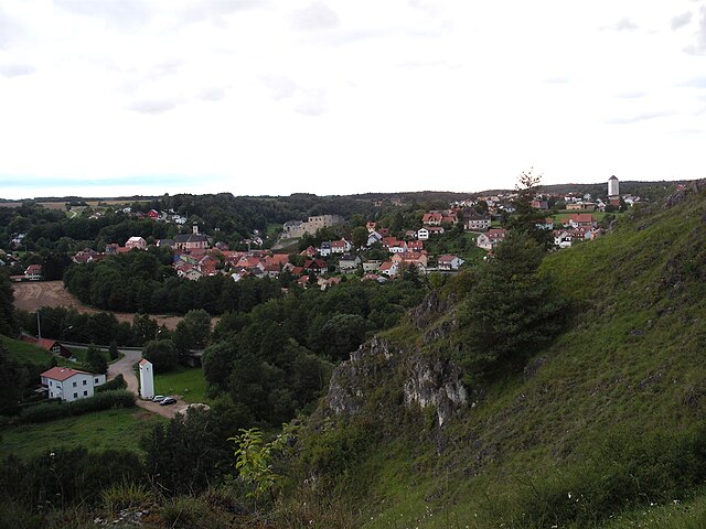
Kallmünz
- municipality of Germany
Hiking in Kallmünz
Kallmünz is a picturesque village located in Bavaria, Germany, along the banks of the Naab River and at the edge of the historic region known as the Upper Palatinate. It’s a fantastic destination for hiking due to its stunning landscapes, rich history, and numerous trails. Here’s what you need to know about hiking in Kallmünz:...
- Country:
- Postal Code: 93183
- Local Dialing Code: 09473
- Licence Plate Code: R
- Coordinates: 49° 9' 40" N, 11° 57' 39" E
- GPS tracks (wikiloc): [Link]
- AboveSeaLevel: 344 м m
- Area: 43.19 sq km
- Population: 2754
- Web site: [Link]


Schierling
- municipality of Germany
Hiking in Schierling
Schierling, located in Bavaria, Germany, is a charming area that offers a variety of hiking opportunities. Nestled in the picturesque countryside near the Regen River, it features a mix of scenic landscapes, rolling hills, and lush forests. Here are some highlights and tips for hiking in Schierling:...
- Country:
- Postal Code: 84069
- Local Dialing Code: 09451
- Licence Plate Code: R
- Coordinates: 48° 50' 5" N, 12° 8' 23" E
- GPS tracks (wikiloc): [Link]
- AboveSeaLevel: 381 м m
- Area: 77.42 sq km
- Population: 6322
- Web site: [Link]

Tegernheim
- municipality of Germany
Hiking in Tegernheim
Tegernheim, located near the Danube River in Bavaria, Germany, offers several opportunities for hiking enthusiasts to explore its scenic landscapes. While Tegernheim itself is a small town, it is well-positioned near larger hiking areas, such as the nearby Danube Trail and the picturesque countryside....
- Country:
- Postal Code: 93105
- Local Dialing Code: 09403
- Licence Plate Code: R
- Coordinates: 49° 1' 0" N, 12° 11' 0" E
- GPS tracks (wikiloc): [Link]
- AboveSeaLevel: 332 м m
- Area: 11.43 sq km
- Population: 3633
- Web site: [Link]


Sünching
- municipality of Germany
Hiking in Sünching
Sünching is a small town located in Bavaria, Germany, and while it may not be as widely known for hiking as some larger destinations, it offers opportunities for outdoor enthusiasts. The surrounding region features beautiful landscapes, including rolling hills, forests, and agricultural areas, making it a lovely place for hiking....
- Country:
- Postal Code: 93104
- Local Dialing Code: 09480
- Licence Plate Code: R
- Coordinates: 48° 52' 43" N, 12° 21' 5" E
- GPS tracks (wikiloc): [Link]
- AboveSeaLevel: 341 м m
- Area: 19.42 sq km
- Population: 1677
- Web site: [Link]


Aufhausen
- municipality of Germany
Hiking in Aufhausen
Aufhausen is a charming area in Bavaria, Germany, known for its scenic landscapes and outdoor recreational opportunities, including hiking. Although the specific hiking trails in Aufhausen may not be as well-known as some of the larger national parks or hiking areas in Germany, there are still plenty of routes and nature experiences to enjoy....
- Country:
- Postal Code: 93089
- Local Dialing Code: 09454
- Licence Plate Code: R
- Coordinates: 48° 52' 0" N, 12° 17' 0" E
- GPS tracks (wikiloc): [Link]
- AboveSeaLevel: 348 м m
- Area: 27.32 sq km
- Population: 1461
- Web site: [Link]


Hemau
- municipality of Germany
Hiking in Hemau
Hemau is a charming town located in Bavaria, Germany, surrounded by scenic landscapes that are perfect for hiking enthusiasts. The region offers a variety of trails suitable for different skill levels, ranging from easy walks to more challenging hikes....
- Country:
- Postal Code: 93155
- Local Dialing Code: 09491
- Licence Plate Code: R
- Coordinates: 49° 3' 7" N, 11° 46' 58" E
- GPS tracks (wikiloc): [Link]
- AboveSeaLevel: 514 м m
- Area: 122.33 sq km
- Population: 6751
- Web site: [Link]


Mintraching
- municipality of Germany
Hiking in Mintraching
Mintraching, a small municipality in Bavaria, Germany, offers picturesque hiking opportunities for outdoor enthusiasts. The region is characterized by its rolling hills, forests, and scenic landscapes, making it a serene spot for hikers of all levels....
- Country:
- Postal Code: 93098
- Local Dialing Code: 09406
- Licence Plate Code: R
- Coordinates: 48° 57' 7" N, 12° 14' 45" E
- GPS tracks (wikiloc): [Link]
- AboveSeaLevel: 335 м m
- Area: 53.87 sq km
- Population: 3537
- Web site: [Link]


Wolfsegg
- municipality of Germany
Hiking in Wolfsegg
Wolfsegg is a beautiful area located in Bavaria, Germany, known for its scenic landscapes, dense forests, and tranquil lakes, making it an ideal location for hiking enthusiasts. Here are some highlights and tips for hiking in Wolfsegg:...
- Country:
- Postal Code: 93195
- Local Dialing Code: 09409
- Licence Plate Code: R
- Coordinates: 49° 6' 27" N, 11° 58' 39" E
- GPS tracks (wikiloc): [Link]
- AboveSeaLevel: 397 м m
- Area: 7.46 sq km
- Population: 1084
- Web site: [Link]


Lappersdorf
- municipality of Germany
Hiking in Lappersdorf
Lappersdorf, located in Bavaria, Germany, offers a variety of hiking opportunities for outdoor enthusiasts. Nestled near the beautiful city of Regensburg and surrounded by lush landscapes, it is an excellent spot for both leisurely walks and more challenging hikes....
- Country:
- Postal Code: 93138
- Local Dialing Code: 0941
- Licence Plate Code: R
- Coordinates: 49° 3' 9" N, 12° 5' 25" E
- GPS tracks (wikiloc): [Link]
- AboveSeaLevel: 341 м m
- Area: 34.51 sq km
- Population: 10908
- Web site: [Link]


Hagelstadt
- municipality of Germany
Hiking in Hagelstadt
Hagelstadt, located in Bavaria, Germany, offers a variety of scenic hiking opportunities for outdoor enthusiasts. The region is characterized by its picturesque landscapes, rolling hills, and lush forests, making it an ideal destination for hikers of all levels....
- Country:
- Postal Code: 93095
- Local Dialing Code: 09454; 09453; 09406
- Licence Plate Code: R
- Coordinates: 48° 53' 45" N, 12° 13' 1" E
- GPS tracks (wikiloc): [Link]
- AboveSeaLevel: 368 м m
- Area: 20.73 sq km
- Population: 1727
- Web site: [Link]


Köfering
- municipality of Germany
Hiking in Köfering
Köfering is a small town located in Bavaria, Germany, and while it may not be as widely known as some of the larger hiking destinations in the region, it offers access to some beautiful natural landscapes and hiking opportunities....
- Country:
- Postal Code: 93096
- Local Dialing Code: 09406
- Licence Plate Code: R
- Coordinates: 48° 56' 0" N, 12° 12' 0" E
- GPS tracks (wikiloc): [Link]
- AboveSeaLevel: 343 м m
- Area: 5.28 sq km
- Population: 1030
- Web site: [Link]


Sinzing
- municipality of Germany
Hiking in Sinzing
Sinzing, located in Bavaria, Germany, offers various beautiful hiking opportunities amidst scenic landscapes. The area is known for its picturesque countryside, forests, and proximity to the Danube River, making it a great destination for outdoor enthusiasts....
- Country:
- Postal Code: 93161
- Local Dialing Code: 0941; 09404
- Licence Plate Code: R
- Coordinates: 48° 59' 28" N, 12° 2' 5" E
- GPS tracks (wikiloc): [Link]
- AboveSeaLevel: 338 м m
- Area: 44.30 sq km
- Population: 5715
- Web site: [Link]

Wenzenbach
- municipality of Germany
Hiking in Wenzenbach
Wenzenbach, located in Bavaria, Germany, offers some lovely hiking options for enthusiasts of all levels. The area is characterized by its beautiful landscapes, rolling hills, and scenic views of the surrounding countryside. Here are some notable aspects of hiking in Wenzenbach:...
- Country:
- Postal Code: 93173
- Local Dialing Code: 09407
- Licence Plate Code: R
- Coordinates: 49° 4' 29" N, 12° 11' 40" E
- GPS tracks (wikiloc): [Link]
- AboveSeaLevel: 359 м m
- Area: 29.85 sq km
- Population: 5535
- Web site: [Link]


Pettendorf
- municipality of Germany
Hiking in Pettendorf
Pettendorf, located in Bavaria, Germany, is a charming destination for hiking enthusiasts. The area is known for its picturesque landscapes, rolling hills, and proximity to the Danube River, making it a great spot for various hiking trails suitable for all skill levels. Here are some highlights:...
- Country:
- Postal Code: 93186
- Local Dialing Code: 09409
- Licence Plate Code: R
- Coordinates: 49° 3' 34" N, 12° 0' 21" E
- GPS tracks (wikiloc): [Link]
- AboveSeaLevel: 455 м m
- Area: 24.59 sq km
- Population: 2577
- Web site: [Link]


Mötzing
- municipality of Germany
Hiking in Mötzing
Mötzing, a small town in Bavaria, Germany, offers a variety of hiking opportunities that showcase the natural beauty and picturesque landscapes of the region. While Mötzing itself might not be widely known as a major hiking destination, its proximity to the surrounding countryside and natural areas makes it an excellent starting point for outdoor activities....
- Country:
- Postal Code: 93099
- Local Dialing Code: 09429
- Licence Plate Code: R
- Coordinates: 48° 53' 39" N, 12° 22' 26" E
- GPS tracks (wikiloc): [Link]
- AboveSeaLevel: 338 м m
- Area: 36.18 sq km
- Population: 1230
- Web site: [Link]

Regenstauf
- municipality of Germany
Hiking in Regenstauf
Regenstauf, located in Bavaria, Germany, offers a variety of hiking opportunities that cater to different skill levels and preferences. Nestled near the banks of the Regen River and surrounded by beautiful landscapes, it’s an excellent destination for nature lovers and outdoor enthusiasts....
- Country:
- Postal Code: 93128
- Local Dialing Code: 09402
- Licence Plate Code: R
- Coordinates: 49° 7' 25" N, 12° 7' 42" E
- GPS tracks (wikiloc): [Link]
- AboveSeaLevel: 336 м m
- Area: 100.00 sq km
- Population: 16067
- Web site: [Link]


Obertraubling
- municipality of Germany
Hiking in Obertraubling
Obertraubling, located in Bavaria, Germany, is a delightful area for hiking enthusiasts. While it's not as widely known as some major hiking destinations in the Bavarian Alps, it offers picturesque landscapes and a serene atmosphere, perfect for outdoor activities....
- Country:
- Postal Code: 93083
- Local Dialing Code: 09401
- Licence Plate Code: R
- Coordinates: 48° 57' 57" N, 12° 10' 1" E
- GPS tracks (wikiloc): [Link]
- AboveSeaLevel: 344 м m
- Area: 24.82 sq km
- Population: 5260
- Web site: [Link]


Thalmassing
- municipality of Germany
Hiking in Thalmassing
Thalmassing, a small municipality in Bavaria, Germany, is known for its picturesque landscapes and nature trails, making it a great destination for hiking enthusiasts. The region is characterized by rolling hills, forests, and meandering rivers, providing a variety of scenery for hikes....
- Country:
- Postal Code: 93107
- Local Dialing Code: 09453
- Licence Plate Code: R
- Coordinates: 48° 54' 53" N, 12° 9' 11" E
- GPS tracks (wikiloc): [Link]
- AboveSeaLevel: 356 м m
- Area: 37.11 sq km
- Population: 3287
- Web site: [Link]


Nittendorf
- municipality of Germany
Hiking in Nittendorf
Nittendorf, located in Bavaria, Germany, offers a great landscape for hiking enthusiasts. The region is characterized by its rolling hills, scenic countryside, and beautiful views, making it an appealing destination for outdoor activities....
- Country:
- Postal Code: 93152
- Local Dialing Code: 09404
- Licence Plate Code: R
- Coordinates: 49° 1' 32" N, 11° 57' 32" E
- GPS tracks (wikiloc): [Link]
- AboveSeaLevel: 336 м m
- Area: 33.45 sq km
- Population: 6550
- Web site: [Link]


Holzheim am Forst
- municipality of Germany
Hiking in Holzheim am Forst
Holzheim am Forst is a quaint village in Bavaria, Germany, surrounded by picturesque landscapes that make it an appealing destination for hiking enthusiasts. The area offers a mix of forested trails, scenic countryside, and beautiful views, making it suitable for all skill levels....
- Country:
- Postal Code: 93183
- Local Dialing Code: 09473
- Licence Plate Code: R
- Coordinates: 49° 8' 53" N, 11° 59' 56" E
- GPS tracks (wikiloc): [Link]
- AboveSeaLevel: 380 м m
- Area: 15.63 sq km
- Population: 846
- Web site: [Link]


Riekofen
- municipality of Germany
Hiking in Riekofen
Riekofen, located in Germany, is a charming area that offers beautiful landscapes and a variety of hiking opportunities. While it may not be as widely known as some national parks, it is an excellent destination for outdoor enthusiasts looking for scenic trails and a peaceful environment....
- Country:
- Postal Code: 93104
- Local Dialing Code: 09480
- Licence Plate Code: R
- Coordinates: 48° 55' 4" N, 12° 21' 1" E
- GPS tracks (wikiloc): [Link]
- AboveSeaLevel: 335 м m
- Area: 24.00 sq km
- Population: 755
- Web site: [Link]


Pfatter
- municipality of Germany
Hiking in Pfatter
Pfatter is a charming small municipality located in Bavaria, Germany, close to the city of Regensburg. While it may not be a widely known hiking destination, the area offers beautiful landscapes, scenic trails, and opportunities to explore the natural beauty of the Bavarian countryside....
- Country:
- Postal Code: 93102
- Local Dialing Code: 09481
- Licence Plate Code: R
- Coordinates: 48° 57' 54" N, 12° 22' 52" E
- GPS tracks (wikiloc): [Link]
- AboveSeaLevel: 326 м m
- Area: 48.14 sq km
- Population: 2511
- Web site: [Link]


Pentling
- municipality of Germany
Hiking in Pentling
Pentling, located in Bavaria, Germany, is a charming area near the city of Regensburg. Nestled in the scenic Danube Valley, it offers a variety of hiking trails suitable for all levels of experience. Here’s an overview of what you can expect when hiking in Pentling:...
- Country:
- Postal Code: 93080
- Local Dialing Code: 0941; 09405
- Licence Plate Code: R
- Coordinates: 48° 59' 1" N, 12° 3' 32" E
- GPS tracks (wikiloc): [Link]
- AboveSeaLevel: 408 м m
- Area: 32.64 sq km
- Population: 4814
- Web site: [Link]

Laaber
- municipality of Germany
Hiking in Laaber
Laaber, located in Bavaria, Germany, offers beautiful hiking opportunities for both beginners and experienced hikers. The region is characterized by its picturesque landscapes, lush forests, rolling hills, and charming villages. Here are some highlights and tips for hiking in Laaber:...
- Country:
- Postal Code: 93164
- Local Dialing Code: 09498
- Licence Plate Code: R
- Coordinates: 49° 3' 55" N, 11° 53' 10" E
- GPS tracks (wikiloc): [Link]
- AboveSeaLevel: 402 м m
- Area: 29.66 sq km
- Population: 4567
- Web site: [Link]


Wiesent
- municipality of Germany
Hiking in Wiesent
Wiesent, located in Bavaria, Germany, is a charming area that offers beautiful landscapes for hiking enthusiasts. The region features a mix of rolling hills, dense forests, and picturesque villages, making it an ideal spot for both casual walkers and experienced hikers....
- Country:
- Postal Code: 93109
- Local Dialing Code: 09482
- Licence Plate Code: R
- Coordinates: 49° 0' 25" N, 12° 22' 40" E
- GPS tracks (wikiloc): [Link]
- AboveSeaLevel: 332 м m
- Area: 26.73 sq km
- Population: 1997
- Web site: [Link]


Duggendorf
- municipality of Germany
Hiking in Duggendorf
Duggendorf, located in the Upper Palatinate region of Bavaria, Germany, is a charming village surrounded by stunning natural landscapes, making it a great destination for hiking enthusiasts. The area offers a mix of beautiful valleys, forests, and hills, providing a variety of trails suitable for different skill levels. Here are some highlights regarding hiking in and around Duggendorf:...
- Country:
- Postal Code: 93182
- Local Dialing Code: 09498; 09473; 09409
- Licence Plate Code: R
- Coordinates: 49° 6' 33" N, 11° 56' 2" E
- GPS tracks (wikiloc): [Link]
- AboveSeaLevel: 338 м m
- Area: 22.03 sq km
- Population: 1320
- Web site: [Link]
Shares border with regions:

Schwandorf
- district of Bavaria, Germany
Hiking in Schwandorf
Schwandorf district, located in Bavaria, Germany, is a great area for hiking enthusiasts looking for scenic routes and beautiful landscapes. The region is characterized by rolling hills, forests, and rivers, providing a mix of terrain that caters to various hiking levels....
- Country:
- Capital: Schwandorf
- Licence Plate Code: SAD; ROD; OVI; NEN; NAB; BUL
- Coordinates: 49° 22' 12" N, 12° 15' 0" E
- GPS tracks (wikiloc): [Link]
- AboveSeaLevel: 465 м m
- Area: 1472.88 sq km
- Population: 131260
- Web site: [Link]
Cham
- district of Bavaria, Germany
Hiking in Cham
Cham District, located in the state of Bavaria, Germany, offers a variety of hiking opportunities amid beautiful landscapes, including forests, meadows, and rolling hills. Here are some highlights and tips for hiking in this area:...
- Country:
- Capital: Cham
- Licence Plate Code: WÜM; ROD; KÖZ; CHA
- Coordinates: 49° 15' 0" N, 12° 40' 12" E
- GPS tracks (wikiloc): [Link]
- AboveSeaLevel: 469 м m
- Area: 1510.00 sq km
- Population: 121401
- Web site: [Link]

Neumarkt
- district of Bavaria, Germany
Hiking in Neumarkt
Neumarkt in der Oberpfalz, a district in Bavaria, Germany, is known for its picturesque landscapes and varied hiking opportunities. Set against a backdrop of rolling hills, lush forests, and charming villages, this area is ideal for both casual walkers and seasoned hikers....
- Country:
- Capital: Neumarkt in der Oberpfalz
- Licence Plate Code: PAR; NM
- Coordinates: 49° 15' 0" N, 11° 30' 0" E
- GPS tracks (wikiloc): [Link]
- AboveSeaLevel: 445 м m
- Area: 1344.00 sq km
- Population: 105346
- Web site: [Link]

Kelheim
- district in Bavaria, Germany
Hiking in Kelheim
Kelheim, located in Bavaria, Germany, is a beautiful area for hiking, characterized by its stunning landscapes, historical sites, and natural attractions. Here are some highlights you might consider when planning a hiking trip in Kelheim:...
- Country:
- Capital: Kelheim
- Licence Plate Code: ROL; RID; PAR; MAI; KEH
- Coordinates: 48° 49' 48" N, 11° 49' 48" E
- GPS tracks (wikiloc): [Link]
- AboveSeaLevel: 369 м m
- Area: 1067.00 sq km
- Population: 90040
- Web site: [Link]

Landshut
- district in Bavaria, Germany
Hiking in Landshut
Landshut district, located in Bavaria, Germany, offers a variety of hiking opportunities that cater to different skill levels and preferences. The landscape is characterized by rolling hills, picturesque villages, and lush forests, providing a beautiful backdrop for outdoor activities....
- Country:
- Capital: Landshut
- Licence Plate Code: LA
- Coordinates: 48° 34' 14" N, 12° 10' 50" E
- GPS tracks (wikiloc): [Link]
- AboveSeaLevel: 383 м m
- Area: 1348 sq km
- Population: 115644
- Web site: [Link]
Straubing-Bogen
- district of Bavaria, Germany
Hiking in Straubing-Bogen
Straubing-Bogen is a beautiful district located in Bavaria, Germany, known for its picturesque landscapes and varied terrain, making it a great destination for hiking enthusiasts. Here are some highlights and tips for hiking in the region:...
- Country:
- Capital: Straubing
- Licence Plate Code: MAL; BOG; SR
- Coordinates: 48° 55' 12" N, 12° 34' 48" E
- GPS tracks (wikiloc): [Link]
- AboveSeaLevel: 337 м m
- Area: 1202.24 sq km
- Population: 81062
- Web site: [Link]

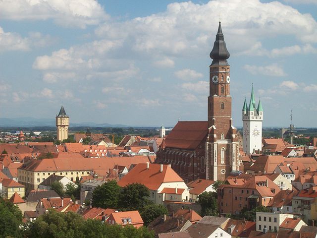
Regensburg
- town in Bavaria, Germany
Hiking in Regensburg
Regensburg, located in Bavaria, Germany, offers a variety of hiking opportunities, particularly due to its picturesque landscapes along the Danube River and the surrounding countryside. Here are some highlights and tips for hiking in and around Regensburg:...
- Country:
- Postal Code: 93057; 93055; 93053; 93051; 93049; 93047
- Local Dialing Code: 941
- Licence Plate Code: R
- Coordinates: 49° 1' 0" N, 12° 5' 0" E
- GPS tracks (wikiloc): [Link]
- AboveSeaLevel: 343 м m
- Area: 80.85 sq km
- Population: 150894
- Web site: [Link]