Ried im Innkreis District (Bezirk Ried im Innkreis)

- district of Austria
 Hiking in Ried im Innkreis District
Ried im Innkreis is a beautiful region located in Upper Austria, known for its picturesque landscapes, lush nature, and various outdoor activities, including hiking. Here are some notable points about hiking in this district:
Scenic Trails
-
Innviertler Moor Nature Reserve: This area features various trails weaving through wetlands and natural reserves. It’s a great spot for birdwatching as well as hiking.
-
Regional Hiking Trails: Numerous marked trails are available that cater to different skill levels, from easy strolls to more challenging hikes. One popular trail is the Innviertler Pilgerweg, which offers a spiritual hiking experience.
-
Zebinger Wald: This forest area is ideal for families and casual hikers, with paths that are easy to navigate and provide a serene environment surrounded by nature.
Unique Features
- Historical Sites: Many hiking routes lead to historical landmarks and quaint villages, giving you an insight into the region's culture and history.
- Flora and Fauna: The diverse ecosystems in this area support various wildlife, making it a great place for nature enthusiasts.
Seasonal Considerations
- Summer Hiking: The mild summer weather is perfect for trekking, with many trails leading to streams and lakes for a refreshing dip.
- Winter Hiking: During the winter months, some paths are still accessible for snowshoeing or winter walks, providing a different yet equally beautiful experience.
Hiking Tips
- Maps and Guides: Make sure to grab a local hiking map or use a reputable hiking app for navigation.
- Equipment: Wear sturdy hiking boots and carry enough water, snacks, and weather-appropriate clothing.
- Check Trail Conditions: Always check trail conditions beforehand, especially after heavy rain or snow.
Local Amenities
After a long hike, you can find various accommodation options, local restaurants, and cafes in Ried im Innkreis where you can refresh and enjoy regional Austrian cuisine.
Overall, Ried im Innkreis offers a range of opportunities for hikers looking to explore beautiful natural settings while also enjoying local culture and history.
- Country:

- Capital: Ried im Innkreis
- Licence Plate Code: RI
- Coordinates: 48° 14' 28" N, 13° 26' 6" E


- GPS tracks (wikiloc): [Link]
- AboveSeaLevel: 408 м m
- Area: 585.01 sq km
- Web site: http://www.bh-ried.gv.at/
- Wikipedia en: wiki(en)
- Wikipedia: wiki(de)
- Wikidata storage: Wikidata: Q264704
- Wikipedia Commons Category: [Link]
- Freebase ID: [/m/0dy_h7]
- GeoNames ID: Alt: [2767470]
- VIAF ID: Alt: [244574182]
- GND ID: Alt: [4104044-2]
- archINFORM location ID: [14676]
- Quora topic ID: [Ried-Im-Innkreis]
Includes regions:

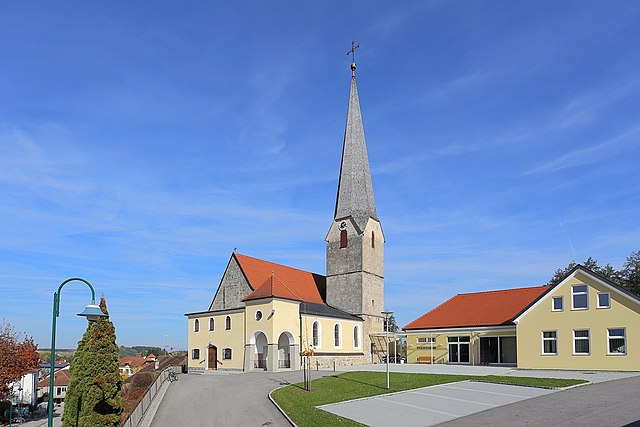
Ried im Innkreis
- municipality in Austria
Hiking in Ried im Innkreis
Ried im Innkreis, located in Austria's Upper Austria region, is a great destination for hiking enthusiasts. The area is characterized by rolling hills, lush forests, and scenic views of the surrounding countryside. Here are some highlights and tips for hiking in and around Ried im Innkreis:...
- Country:
- Postal Code: 4910
- Local Dialing Code: 07752
- Licence Plate Code: RI
- Coordinates: 48° 12' 36" N, 13° 29' 22" E
- GPS tracks (wikiloc): [Link]
- AboveSeaLevel: 433 м m
- Area: 6.77 sq km
- Population: 11903
- Web site: [Link]

Neuhofen im Innkreis
- municipality in Austria
Hiking in Neuhofen im Innkreis
Neuhofen im Innkreis is a charming village located in the Innviertel region of Upper Austria. This area is known for its picturesque landscapes, rolling hills, and scenic trails, making it an excellent destination for hiking enthusiasts. Here are some highlights about hiking in and around Neuhofen im Innkreis:...
- Country:
- Postal Code: 4912
- Local Dialing Code: 07752
- Licence Plate Code: RI
- Coordinates: 48° 11' 0" N, 13° 28' 0" E
- GPS tracks (wikiloc): [Link]
- AboveSeaLevel: 464 м m
- Area: 16 sq km
- Population: 2408
- Web site: [Link]

Andrichsfurt
- municipality in Austria
Hiking in Andrichsfurt
Andrichsfurt, located in Austria, is a charming area that offers a variety of hiking opportunities for outdoor enthusiasts. Nestled near the foothills of the Alps, it features picturesque landscapes, lush forests, and rolling hills, making it an attractive destination for both casual walkers and avid hikers....
- Country:
- Postal Code: 4754
- Local Dialing Code: 07750
- Licence Plate Code: RI
- Coordinates: 48° 15' 54" N, 13° 31' 26" E
- GPS tracks (wikiloc): [Link]
- AboveSeaLevel: 440 м m
- Area: 12.3 sq km
- Population: 770
- Web site: [Link]

Antiesenhofen
- municipality in Austria
Hiking in Antiesenhofen
Antiesenhofen is a small municipality located in the Upper Austria region of Austria. While it may not be as widely recognized as some of the larger hiking destinations in Austria, it offers a tranquil and scenic environment perfect for nature lovers and those looking to escape into the outdoors....
- Country:
- Postal Code: 4980
- Local Dialing Code: 07759
- Licence Plate Code: RI
- Coordinates: 48° 20' 33" N, 13° 23' 52" E
- GPS tracks (wikiloc): [Link]
- AboveSeaLevel: 346 м m
- Area: 8.6 sq km
- Population: 1091
- Web site: [Link]

Mühlheim am Inn
- municipality in Austria
Hiking in Mühlheim am Inn
Mühlheim am Inn is a charming village located in the region of Upper Austria, offering a variety of opportunities for hiking enthusiasts. The landscape features rolling hills, forests, and picturesque views of the Inn River, making it ideal for both casual walkers and seasoned hikers. Here are some highlights and tips for hiking in and around Mühlheim am Inn:...
- Country:
- Postal Code: 4961
- Local Dialing Code: 07723
- Licence Plate Code: RI
- Coordinates: 48° 17' 0" N, 13° 13' 1" E
- GPS tracks (wikiloc): [Link]
- AboveSeaLevel: 343 м m
- Area: 11 sq km
- Population: 661
- Web site: [Link]

Eitzing
- municipality in Austria
Hiking in Eitzing
Eitzing is a small town located in Austria, near the region of Upper Austria, which features picturesque landscapes that can be appealing for hikers. While it may not be a major hiking destination, it offers access to some beautiful trails in the surrounding areas, which can be explored based on your hiking preferences....
- Country:
- Postal Code: 4970
- Licence Plate Code: RI
- Coordinates: 48° 0' 0" N, 13° 0' 0" E
- GPS tracks (wikiloc): [Link]
- AboveSeaLevel: 419 м m
- Area: 8.6 sq km
- Population: 805
- Web site: [Link]

Reichersberg
- municipality in Austria
Hiking in Reichersberg
Reichersberg is a charming village located in the Innviertel region of Austria, known for its beautiful natural landscapes and picturesque scenery. While it may not be as well-known as some other hiking destinations in Austria, it offers a variety of hiking opportunities suitable for various skill levels. Here are some highlights about hiking in and around Reichersberg:...
- Country:
- Postal Code: 4981
- Local Dialing Code: 07758
- Licence Plate Code: RI
- Coordinates: 48° 20' 19" N, 13° 21' 41" E
- GPS tracks (wikiloc): [Link]
- AboveSeaLevel: 347 м m
- Area: 21 sq km
- Population: 1511
- Web site: [Link]


Sankt Martin im Innkreis
- municipality in Upper Austria, Austria
Hiking in Sankt Martin im Innkreis
Sankt Martin im Innkreis is a picturesque village located in Upper Austria, surrounded by beautiful nature and scenic landscapes, making it a great destination for hiking enthusiasts. Here are some highlights and tips for hiking in this region:...
- Country:
- Postal Code: 4973
- Local Dialing Code: 07751
- Licence Plate Code: RI
- Coordinates: 48° 17' 39" N, 13° 26' 25" E
- GPS tracks (wikiloc): [Link]
- AboveSeaLevel: 372 м m
- Area: 9 sq km
- Population: 2055
- Web site: [Link]

Obernberg am Inn
- municipality in Austria
Hiking in Obernberg am Inn
Obernberg am Inn, located in the Innviertel region of Austria, is a beautiful destination for hiking enthusiasts. The area is known for its stunning natural landscapes, including hills, forests, and river valleys, which provide a variety of hiking trails suited for different skill levels, from leisurely walks to more challenging hikes....
- Country:
- Postal Code: 4982
- Local Dialing Code: 07758
- Licence Plate Code: RI
- Coordinates: 48° 19' 16" N, 13° 20' 10" E
- GPS tracks (wikiloc): [Link]
- AboveSeaLevel: 354 м m
- Area: 2 sq km
- Population: 1633
- Web site: [Link]

Geinberg
- municipality in Austria
Hiking in Geinberg
Geinberg, located in the Upper Austria region, is known for its scenic landscapes and serene environment, making it a great destination for hiking enthusiasts. The area is characterized by rolling hills, lush forests, and picturesque countryside, providing a variety of hiking experiences suitable for different skill levels....
- Country:
- Postal Code: 4943
- Local Dialing Code: 07723
- Licence Plate Code: RI
- Coordinates: 48° 15' 52" N, 13° 17' 41" E
- GPS tracks (wikiloc): [Link]
- AboveSeaLevel: 403 м m
- Area: 14 sq km
- Population: 1435
- Web site: [Link]

Taiskirchen im Innkreis
- municipality in Austria
Hiking in Taiskirchen im Innkreis
Taiskirchen im Innkreis is a charming village located in Upper Austria, surrounded by beautiful landscapes that are perfect for hiking enthusiasts. The region offers a variety of hiking trails that cater to different skill levels, making it an excellent destination for both beginners and experienced hikers....
- Country:
- Postal Code: 4753
- Licence Plate Code: RI
- Coordinates: 48° 15' 49" N, 13° 34' 25" E
- GPS tracks (wikiloc): [Link]
- AboveSeaLevel: 475 м m
- Area: 34.53 sq km
- Population: 2407
- Web site: [Link]

Wippenham
- municipality in Austria
Hiking in Wippenham
Wippenham is not widely recognized as a hiking destination, but if you're referring to a specific region or nearby area that has hiking trails, I’d be glad to help you with general hiking tips and suggestions for the type of terrain or landscapes you might expect....
- Country:
- Postal Code: 4942
- Local Dialing Code: 07757
- Licence Plate Code: RI
- Coordinates: 48° 13' 18" N, 13° 22' 56" E
- GPS tracks (wikiloc): [Link]
- AboveSeaLevel: 450 м m
- Area: 8 sq km
- Population: 578
- Web site: [Link]
Senftenbach
- municipality in Austria
Hiking in Senftenbach
Senftenbach, located in the Austrian state of Upper Austria, offers beautiful landscapes and a variety of hiking opportunities for outdoor enthusiasts. Here are some key points to consider for hiking in this region:...
- Country:
- Postal Code: 4973
- Local Dialing Code: 07751
- Licence Plate Code: RI
- Coordinates: 48° 15' 34" N, 13° 25' 8" E
- GPS tracks (wikiloc): [Link]
- AboveSeaLevel: 414 м m
- Area: 10 sq km
- Population: 772
- Web site: [Link]

Weilbach
- municipality in Austria
Hiking in Weilbach
Weilbach, a small village in Austria, offers a charming setting for hikers and outdoor enthusiasts. Nestled in the scenic landscape of the Tyrolean Alps, it provides access to a variety of hiking trails suitable for different skill levels. Here’s an overview of what you can expect:...
- Country:
- Postal Code: 4984
- Local Dialing Code: 07757
- Licence Plate Code: RI
- Coordinates: 48° 16' 39" N, 13° 22' 24" E
- GPS tracks (wikiloc): [Link]
- AboveSeaLevel: 386 м m
- Area: 13 sq km
- Population: 604
- Web site: [Link]

Tumeltsham
- municipality in Austria
Hiking in Tumeltsham
Tumeltsham, located in Austria, is a lovely area for hiking enthusiasts. While it may not be as widely known as some of the larger Austrian cities, its natural beauty and serene landscapes make it a hidden gem for outdoor activities....
- Country:
- Postal Code: 4911
- Licence Plate Code: RI
- Coordinates: 48° 13' 55" N, 13° 29' 52" E
- GPS tracks (wikiloc): [Link]
- AboveSeaLevel: 438 м m
- Area: 9.11 sq km
- Population: 1590
- Web site: [Link]
Waldzell
- municipality in Austria
Hiking in Waldzell
Waldzell is a picturesque area suited for hiking enthusiasts, known for its beautiful landscapes and a variety of trails that cater to different skill levels. While specific details about Waldzell may vary, here are some general aspects you can expect:...
- Country:
- Postal Code: 4924
- Local Dialing Code: 07754
- Licence Plate Code: RI
- Coordinates: 48° 8' 10" N, 13° 25' 45" E
- GPS tracks (wikiloc): [Link]
- AboveSeaLevel: 522 м m
- Area: 40 sq km
- Population: 2177
- Web site: [Link]

Schildorn
- municipality in Austria
Hiking in Schildorn
Schildorn, located in the scenic region of Austria, is a great destination for hiking enthusiasts. The area is known for its beautiful landscapes, featuring a mix of rolling hills, forests, and stunning mountain views. Here are some highlights for hikers considering Schildorn:...
- Country:
- Postal Code: 4920
- Local Dialing Code: 07754
- Licence Plate Code: RI
- Coordinates: 48° 8' 46" N, 13° 27' 57" E
- GPS tracks (wikiloc): [Link]
- AboveSeaLevel: 520 м m
- Area: 13 sq km
- Population: 1227
- Web site: [Link]

Sankt Georgen bei Obernberg am Inn
- municipality in Austria
Hiking in Sankt Georgen bei Obernberg am Inn
Sankt Georgen bei Obernberg am Inn is a charming town located in Upper Austria, near the border with Germany. It's surrounded by a picturesque landscape that offers a range of hiking opportunities for outdoor enthusiasts. Here are some key points you might find helpful about hiking in this region:...
- Country:
- Postal Code: 4983
- Local Dialing Code: 07758
- Licence Plate Code: RI
- Coordinates: 48° 17' 37" N, 13° 20' 2" E
- GPS tracks (wikiloc): [Link]
- AboveSeaLevel: 354 м m
- Area: 18 sq km
- Population: 569
- Web site: [Link]

Pramet
- municipality in Austria
Hiking in Pramet
Pramet, a picturesque region in Austria, offers a variety of hiking opportunities for outdoor enthusiasts. Nestled within the stunning landscapes of the Salzkammergut region, it boasts scenic trails that cater to different skill levels. Here are some key highlights to consider when hiking in Pramet:...
- Country:
- Postal Code: 4925
- Local Dialing Code: 0 77 54
- Licence Plate Code: RI
- Coordinates: 48° 8' 32" N, 13° 29' 12" E
- GPS tracks (wikiloc): [Link]
- AboveSeaLevel: 512 м m
- Area: 13.95 sq km
- Population: 1030
- Web site: [Link]
Kirchdorf am Inn
- municipality in Austria
Hiking in Kirchdorf am Inn
Kirchdorf am Inn, a picturesque village in Austria's Upper Austria region, is a great destination for hiking enthusiasts. The area is characterized by its stunning landscapes, lush forests, and the scenic Inn River, making it an attractive location for outdoor activities....
- Country:
- Postal Code: 4982
- Local Dialing Code: 07758
- Licence Plate Code: RI
- Coordinates: 48° 17' 42" N, 13° 16' 56" E
- GPS tracks (wikiloc): [Link]
- AboveSeaLevel: 335 м m
- Area: 14 sq km
- Population: 636
- Web site: [Link]
Peterskirchen
- municipality in Austria
Hiking in Peterskirchen
Peterskirchen, located in Austria, offers a variety of hiking opportunities for outdoor enthusiasts. Nestled in a scenic region with lush landscapes, it provides both easy and challenging trails suitable for hikers of all skill levels....
- Country:
- Postal Code: 4743
- Local Dialing Code: 07750
- Licence Plate Code: RI
- Coordinates: 48° 14' 18" N, 13° 32' 52" E
- GPS tracks (wikiloc): [Link]
- AboveSeaLevel: 441 м m
- Area: 10 sq km
- Population: 700
- Web site: [Link]

Mettmach
- municipality in Austria
Hiking in Mettmach
Mettmach, located in Upper Austria, offers a range of hiking opportunities for outdoor enthusiasts. The landscape around Mettmach is characterized by rolling hills, lush forests, and scenic farmland, making it a delightful area for both casual strolls and more challenging hikes....
- Country:
- Postal Code: 4931
- Local Dialing Code: 07755
- Licence Plate Code: RI
- Coordinates: 48° 10' 24" N, 13° 20' 34" E
- GPS tracks (wikiloc): [Link]
- AboveSeaLevel: 464 м m
- Area: 30 sq km
- Population: 2355
- Web site: [Link]

Mörschwang
- municipality in Austria
Hiking in Mörschwang
Mörschwang, a small village located in Bavaria, Germany, offers several opportunities for hiking enthusiasts to enjoy the beautiful natural surroundings. Though it may not be as widely known as larger hiking destinations, it has its own charm and can provide a peaceful hiking experience....
- Country:
- Postal Code: 4982
- Local Dialing Code: 07758
- Licence Plate Code: RI
- Coordinates: 48° 18' 14" N, 13° 21' 57" E
- GPS tracks (wikiloc): [Link]
- AboveSeaLevel: 383 м m
- Area: 11 sq km
- Population: 328
- Web site: [Link]
Hohenzell
- municipality in Austria
Hiking in Hohenzell
Hohenzell is a small village located in the state of Bavaria, Germany, known for its picturesque landscapes and access to beautiful natural areas. Hiking in and around Hohenzell offers a variety of trails that cater to different skill levels and preferences....
- Country:
- Postal Code: 4921
- Local Dialing Code: 07752
- Licence Plate Code: RI
- Coordinates: 48° 11' 39" N, 13° 32' 40" E
- GPS tracks (wikiloc): [Link]
- AboveSeaLevel: 478 м m
- Area: 22.53 sq km
- Population: 2246
- Web site: [Link]

Geiersberg
- municipality in Austria
Hiking in Geiersberg
Geiersberg is a beautiful hiking destination located in Bavaria, Germany. It offers a variety of trails that cater to different skill levels, making it suitable for both novice and experienced hikers. The area is characterized by lush forests, rolling hills, and scenic views, providing a picturesque backdrop for outdoor adventures....
- Country:
- Postal Code: 4922
- Local Dialing Code: 07732
- Licence Plate Code: RI
- Coordinates: 48° 12' 16" N, 13° 35' 18" E
- GPS tracks (wikiloc): [Link]
- AboveSeaLevel: 554 м m
- Area: 5.5 sq km
- Population: 519
- Web site: [Link]
Mehrnbach
- municipality in Austria
Hiking in Mehrnbach
Mehrnbach is a small, picturesque village located in Austria, surrounded by beautiful mountainous landscapes and natural scenery. Although it's not as widely known as some major hiking destinations, it offers a serene and charming environment for hiking enthusiasts....
- Country:
- Postal Code: 4941
- Local Dialing Code: 07752
- Licence Plate Code: RI
- Coordinates: 48° 12' 32" N, 13° 26' 11" E
- GPS tracks (wikiloc): [Link]
- AboveSeaLevel: 443 м m
- Area: 22 sq km
- Population: 2363
- Web site: [Link]

Aurolzmünster
- municipality in Austria
Hiking in Aurolzmünster
Aurolzmünster is a serene village located in Bavaria, Germany, surrounded by picturesque landscapes that are perfect for hiking enthusiasts. Here are some key points to consider if you're planning to hike in the area:...
- Country:
- Postal Code: 4971
- Local Dialing Code: 07752
- Licence Plate Code: RI
- Coordinates: 48° 14' 54" N, 13° 27' 24" E
- GPS tracks (wikiloc): [Link]
- AboveSeaLevel: 407 м m
- Area: 16 sq km
- Population: 3000
- Web site: [Link]

Ort im Innkreis
- municipality in Austria
Hiking in Ort im Innkreis
Ort im Innkreis, located in the Innviertel region of Upper Austria, offers several opportunities for hiking enthusiasts. The area is characterized by its picturesque landscapes, rolling hills, and lush greenery, making it a serene destination for nature lovers. Here are some key points about hiking in Ort im Innkreis:...
- Country:
- Postal Code: 4974
- Local Dialing Code: 07751
- Licence Plate Code: RI
- Coordinates: 48° 18' 56" N, 13° 26' 5" E
- GPS tracks (wikiloc): [Link]
- AboveSeaLevel: 360 м m
- Area: 11 sq km
- Population: 1275
- Web site: [Link]

Utzenaich
- municipality in Austria
Hiking in Utzenaich
Utzenaich, located in the beautiful Salzkammergut region of Austria, offers a variety of hiking opportunities for different skill levels. The area is known for its stunning landscapes, including rolling hills, lush forests, and scenic views of the surrounding mountains....
- Country:
- Postal Code: 4972
- Local Dialing Code: 07751
- Licence Plate Code: RI
- Coordinates: 48° 16' 35" N, 13° 27' 40" E
- GPS tracks (wikiloc): [Link]
- AboveSeaLevel: 398 м m
- Area: 20 sq km
- Population: 1536
- Web site: [Link]


Kirchheim im Innkreis
- municipality in the district of Ried im Innkreis in Upper Austria, Austria
Hiking in Kirchheim im Innkreis
Kirchheim im Innkreis, located in Austria, is a charming region that offers several opportunities for hiking enthusiasts. The area is characterized by its beautiful landscapes, including rolling hills, forests, and scenic views of the Inn River. Here are some key points to consider when hiking in this region:...
- Country:
- Postal Code: 4932
- Local Dialing Code: 07755
- Licence Plate Code: RI
- Coordinates: 48° 12' 35" N, 13° 21' 40" E
- GPS tracks (wikiloc): [Link]
- AboveSeaLevel: 429 м m
- Area: 10 sq km
- Population: 716
- Web site: [Link]
Lohnsburg
- municipality in Austria
Hiking in Lohnsburg
Lohnsburg, located in Austria, is a charming area offering a variety of hiking opportunities amidst beautiful landscapes. The region is characterized by rolling hills, forests, and stunning views of the surrounding mountains, making it an attractive destination for both novice and experienced hikers....
- Country:
- Postal Code: 4923
- Local Dialing Code: 07754
- Licence Plate Code: RI
- Coordinates: 48° 8' 42" N, 13° 24' 23" E
- GPS tracks (wikiloc): [Link]
- AboveSeaLevel: 523 м m
- Area: 39.59 sq km
- Population: 2234
- Web site: [Link]

Eberschwang
- municipality in Austria
Hiking in Eberschwang
Eberschwang, a charming municipality in the Upper Austria region, offers some picturesque hiking opportunities. The area features scenic landscapes, lush forests, and rolling hills that make it an attractive destination for outdoor enthusiasts. Here are some highlights of hiking in and around Eberschwang:...
- Country:
- Postal Code: 4906
- Local Dialing Code: 07753
- Licence Plate Code: RI
- Coordinates: 48° 9' 25" N, 13° 33' 37" E
- GPS tracks (wikiloc): [Link]
- AboveSeaLevel: 529 м m
- Area: 40.4 sq km
- Population: 3351
- Web site: [Link]
Gurten, Upper Austria
- municipality in Austria
Hiking in Gurten, Upper Austria
Gurten is actually located in Switzerland, specifically near Bern, and is not in Upper Austria. However, if you are looking for hiking opportunities in Upper Austria, I can certainly provide information on that....
- Country:
- Postal Code: 4942
- Local Dialing Code: 07757
- Licence Plate Code: RI
- Coordinates: 48° 14' 28" N, 13° 20' 41" E
- GPS tracks (wikiloc): [Link]
- AboveSeaLevel: 400 м m
- Area: 16.2 sq km
- Population: 1187
- Web site: [Link]

Pattigham
- municipality in Austria
Hiking in Pattigham
Pattigham is a charming village located in Austria, surrounded by beautiful natural landscapes that offer excellent opportunities for hiking enthusiasts. The region is characterized by picturesque meadows, rolling hills, and stunning views of the nearby mountains, making it an attractive destination for outdoor activities....
- Country:
- Postal Code: 4910
- Local Dialing Code: 07754
- Licence Plate Code: RI
- Coordinates: 48° 9' 19" N, 13° 29' 5" E
- GPS tracks (wikiloc): [Link]
- AboveSeaLevel: 512 м m
- Area: 11.22 sq km
- Population: 928
- Web site: [Link]

Sankt Marienkirchen am Hausruck
- municipality in Austria
Hiking in Sankt Marienkirchen am Hausruck
Sankt Marienkirchen am Hausruck is a charming area located in Austria, known for its beautiful natural landscapes and outdoor activities, including hiking. Here's a guide to hiking in and around this picturesque region:...
- Country:
- Postal Code: 4926
- Local Dialing Code: 07753
- Licence Plate Code: RI
- Coordinates: 48° 10' 55" N, 13° 34' 50" E
- GPS tracks (wikiloc): [Link]
- AboveSeaLevel: 523 м m
- Area: 11 sq km
- Population: 888
- Web site: [Link]

Lambrechten
- municipality in Austria
Hiking in Lambrechten
Lambrechten, a picturesque area located in Austria, is known for its natural beauty and offers excellent hiking opportunities. Surrounded by lush forests, rolling hills, and stunning alpine scenery, Lambrechten provides diverse trails suitable for all skill levels, from beginners to experienced hikers....
- Country:
- Postal Code: 4772
- Local Dialing Code: 07765
- Licence Plate Code: RI
- Coordinates: 48° 19' 5" N, 13° 30' 56" E
- GPS tracks (wikiloc): [Link]
- AboveSeaLevel: 406 м m
- Area: 24 sq km
- Population: 1300
- Web site: [Link]