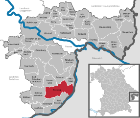
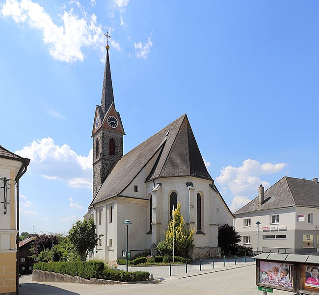
Antiesenhofen (Antiesenhofen)
- municipality in Austria
Antiesenhofen is a small municipality located in the Upper Austria region of Austria. While it may not be as widely recognized as some of the larger hiking destinations in Austria, it offers a tranquil and scenic environment perfect for nature lovers and those looking to escape into the outdoors.
Hiking Opportunities in Antiesenhofen:
-
Scenic Trails: The area around Antiesenhofen features various hiking trails that range in difficulty. Whether you're a beginner or an experienced hiker, you can find suitable routes that meander through picturesque landscapes, including meadows, forests, and along rivers.
-
Local Flora and Fauna: Hiking in this region allows you to experience diverse plant and animal life unique to Austria’s rural areas. It’s a great opportunity for nature enthusiasts to observe wildlife and enjoy the natural beauty.
-
Cultural Sites: Many hiking routes might lead to or near historical and cultural sites. Exploring local villages and their architecture can enhance your hiking experience and provide a sense of the area's history.
-
Proximity to Larger Hiking Areas: Antiesenhofen is situated close to other well-known hiking areas such as the Salzkammergut region or the foothills of the Alps. If you're looking for more challenging hikes or varied landscapes, a short drive can take you to some breathtaking locations.
-
Safety and Preparation: As with any hiking activity, ensure you are well-prepared. Bring plenty of water, snacks, appropriate gear, and a map of the area. Always inform someone of your hiking plans and expected return time.
Tips for Hiking in Antiesenhofen:
- Check Local Guides: Consult local hiking guides or maps which can provide detailed information on the trails.
- Weather Conditions: Always check the weather forecast before heading out, as conditions can change rapidly in mountainous areas.
- Respect Nature: Practice Leave No Trace principles to help preserve the beauty of the area for future hikers.
Exploring the trails around Antiesenhofen can provide a peaceful and fulfilling hiking experience. Enjoy your time in the great outdoors!
- Country:

- Postal Code: 4980
- Local Dialing Code: 07759
- Licence Plate Code: RI
- Coordinates: 48° 20' 33" N, 13° 23' 52" E


- GPS tracks (wikiloc): [Link]
- AboveSeaLevel: 346 м m
- Area: 8.6 sq km
- Population: 1091
- Web site: http://www.antiesenhofen.at/
- Wikipedia en: wiki(en)
- Wikipedia: wiki(de)
- Wikidata storage: Wikidata: Q575138
- Wikipedia Commons Category: [Link]
- Freebase ID: [/m/03gv85s]
- GeoNames ID: Alt: [2782472]
- VIAF ID: Alt: [243210248]
- GND ID: Alt: [4798863-0]
- TGN ID: [7024633]
- Austrian municipality key: [41202]
Shares border with regions:


Pocking
- municipality of Germany
Pocking is a town located in Bavaria, Germany, near the border with Austria. While it may not be as widely recognized for hiking as other regions in Bavaria, it offers access to some lovely trails and scenic landscapes....
- Country:

- Postal Code: 94060
- Local Dialing Code: 08531
- Licence Plate Code: PA
- Coordinates: 48° 23' 59" N, 13° 19' 0" E


- GPS tracks (wikiloc): [Link]
- AboveSeaLevel: 323 м m
- Area: 68.86 sq km
- Population: 11152
- Web site: [Link]


Bad Füssing
- municipality of Germany
Bad Füssing, located in Bavaria, Germany, is predominantly known for its thermal spas, but it also provides excellent opportunities for hiking amidst beautiful natural landscapes. The region is characterized by its gentle hills, lush forests, and the scenic landscape of the Isar valley. Here are some highlights of hiking in Bad Füssing:...
- Country:

- Postal Code: 94072
- Local Dialing Code: 08531
- Licence Plate Code: PA
- Coordinates: 48° 21' 0" N, 13° 18' 0" E


- GPS tracks (wikiloc): [Link]
- AboveSeaLevel: 320 м m
- Area: 55.06 sq km
- Population: 6994
- Web site: [Link]

Reichersberg
- municipality in Austria
Reichersberg is a charming village located in the Innviertel region of Austria, known for its beautiful natural landscapes and picturesque scenery. While it may not be as well-known as some other hiking destinations in Austria, it offers a variety of hiking opportunities suitable for various skill levels. Here are some highlights about hiking in and around Reichersberg:...
- Country:

- Postal Code: 4981
- Local Dialing Code: 07758
- Licence Plate Code: RI
- Coordinates: 48° 20' 19" N, 13° 21' 41" E


- GPS tracks (wikiloc): [Link]
- AboveSeaLevel: 347 м m
- Area: 21 sq km
- Population: 1511
- Web site: [Link]

Ort im Innkreis
- municipality in Austria
Ort im Innkreis, located in the Innviertel region of Upper Austria, offers several opportunities for hiking enthusiasts. The area is characterized by its picturesque landscapes, rolling hills, and lush greenery, making it a serene destination for nature lovers. Here are some key points about hiking in Ort im Innkreis:...
- Country:

- Postal Code: 4974
- Local Dialing Code: 07751
- Licence Plate Code: RI
- Coordinates: 48° 18' 56" N, 13° 26' 5" E


- GPS tracks (wikiloc): [Link]
- AboveSeaLevel: 360 м m
- Area: 11 sq km
- Population: 1275
- Web site: [Link]

Sankt Marienkirchen bei Schärding
- municipality in Austria
 Hiking in Sankt Marienkirchen bei Schärding
Sankt Marienkirchen bei Schärding, located in Austria, offers a beautiful backdrop for hiking enthusiasts. Nestled in the scenic Innviertel region, it features a mix of gentle hills, lush green landscapes, and stunning views of the surrounding countryside, including the nearby River Inn....
- Country:

- Postal Code: 4774
- Local Dialing Code: 07711
- Licence Plate Code: SD
- Coordinates: 48° 23' 0" N, 13° 27' 0" E


- GPS tracks (wikiloc): [Link]
- AboveSeaLevel: 338 м m
- Area: 25 sq km
- Population: 1832
- Web site: [Link]

Eggerding
- municipality in Austria
Eggerding, a small village located in Austria, is surrounded by beautiful landscapes that offer a range of hiking opportunities. The region is characterized by picturesque alpine scenery, rolling hills, and lush forests, making it a great destination for hikers of all skill levels....
- Country:

- Postal Code: 4773
- Local Dialing Code: 07767
- Licence Plate Code: SD
- Coordinates: 48° 21' 0" N, 13° 29' 0" E


- GPS tracks (wikiloc): [Link]
- AboveSeaLevel: 382 м m
- Area: 22 sq km
- Population: 1320
- Web site: [Link]