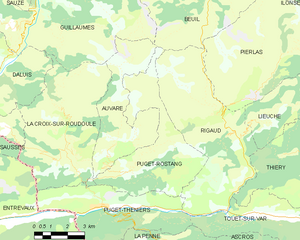
Rigaud (Rigaud)
- commune in Alpes-Maritimes, France
 Hiking in Rigaud
Rigaud, located in the Alpes-Maritimes region of France, offers a lovely setting for hiking enthusiasts. Nestled in the foothills of the French Alps, this area is known for its beautiful landscapes, charming villages, and scenic trails.
Hiking Trails
- The Coastal Trails: While Rigaud might not be directly on the coast, it's close enough to access several coastal trails that provide stunning views of the Mediterranean. The trails often feature a mix of coastal scenery and mountainous terrain.
- Montagne de L’Esterel: Just a short drive away, this mountain range has a variety of well-marked hiking trails. The trails can range from easy walks to more challenging hikes, making it suitable for all skill levels.
- Local Trails: Within and around Rigaud, you can find various marked paths that take you through forests, vineyards, and mountainous landscapes. One popular area is the Parc Naturel Régional des Préalpes d'Azur, which has several trails offering different levels of difficulty.
Best Time for Hiking
- Spring (April to June): The weather is mild, flowers are in bloom, and the trails are less crowded.
- Fall (September to November): Fall offers beautiful foliage and cooler temperatures, making it a pleasant time for hiking.
Safety Tips
- Always check the weather before heading out, as conditions can change rapidly in the mountains.
- Carry enough water and snacks, as well as a map or GPS device.
- Consider hiking with a partner, especially on more remote trails.
Additional Activities
Besides hiking, the region offers opportunities for rock climbing, mountain biking, and exploring local culture through charming villages and historical sites.
Conclusion
Rigaud is a fantastic starting point for various hiking adventures in the Alpes-Maritimes region, catering to both novice and experienced hikers. With its blend of gorgeous nature and exhilarating trails, it provides a memorable outdoor experience.
- Country:

- Postal Code: 06260
- Coordinates: 43° 59' 27" N, 6° 59' 29" E


- GPS tracks (wikiloc): [Link]
- Area: 32.54 sq km
- Population: 207
- Wikipedia en: wiki(en)
- Wikipedia: wiki(fr)
- Wikidata storage: Wikidata: Q114680
- Wikipedia Commons Category: [Link]
- Freebase ID: [/m/03m4zgj]
- Freebase ID: [/m/03m4zgj]
- GeoNames ID: Alt: [6425662]
- GeoNames ID: Alt: [6425662]
- SIREN number: [210601019]
- SIREN number: [210601019]
- WOEID: [619445]
- WOEID: [619445]
- INSEE municipality code: 06101
- INSEE municipality code: 06101
Shares border with regions:


Touët-sur-Var
- commune in Alpes-Maritimes, France
Hiking in Touët-sur-Var
Touët-sur-Var is a charming village located in the Alpes-Maritimes department of France. It is set in a beautiful mountainous region, offering various hiking opportunities for outdoor enthusiasts. Here are some aspects to consider when planning a hike in Touët-sur-Var:...
- Country:
- Postal Code: 06710
- Coordinates: 43° 56' 51" N, 7° 0' 23" E
- GPS tracks (wikiloc): [Link]
- Area: 14.98 sq km
- Population: 681


Beuil
- commune in Alpes-Maritimes, France
Hiking in Beuil
Beuil is a picturesque village located in the Alpes-Maritimes region of southeastern France, known for its stunning alpine scenery and outdoor recreational opportunities. It serves as an excellent base for hiking enthusiasts, offering a variety of trails that cater to different skill levels....
- Country:
- Postal Code: 06470
- Coordinates: 44° 5' 42" N, 6° 59' 15" E
- GPS tracks (wikiloc): [Link]
- Area: 75.65 sq km
- Population: 513
- Web site: [Link]


Lieuche
- commune in Alpes-Maritimes, France
Hiking in Lieuche
Lieuche, a charming village located in the Alpes-Maritimes department in the Provence-Alpes-Côte d'Azur region of France, offers a range of hiking opportunities for both beginners and experienced hikers. The natural beauty of the surrounding landscape, characterized by rolling hills, lush forests, and stunning views of the nearby mountains, makes it a wonderful destination for outdoor enthusiasts....
- Country:
- Postal Code: 06260
- Coordinates: 43° 59' 47" N, 7° 1' 1" E
- GPS tracks (wikiloc): [Link]
- Area: 13.4 sq km
- Population: 44


Thiéry
- commune in Alpes-Maritimes, France
Hiking in Thiéry
Thiéry is a picturesque village located in the Alpes-Maritimes department of the Provence-Alpes-Côte d'Azur region in France. Nestled in the foothills of the French Alps, it offers a range of hiking opportunities with stunning views and diverse landscapes....
- Country:
- Postal Code: 06710
- Coordinates: 43° 58' 42" N, 7° 1' 50" E
- GPS tracks (wikiloc): [Link]
- Area: 22.24 sq km
- Population: 104

Puget-Rostang
- commune in Alpes-Maritimes, France
Hiking in Puget-Rostang
Puget-Rostang is a picturesque area in the French Alps, particularly known for its stunning landscapes, diverse trails, and rich biodiversity. While it may not be as widely known as some other hiking destinations, it offers a variety of hiking experiences suitable for different skill levels....
- Country:
- Postal Code: 06260
- Coordinates: 43° 58' 26" N, 6° 55' 4" E
- GPS tracks (wikiloc): [Link]
- AboveSeaLevel: 771 м m
- Area: 22.46 sq km
- Population: 133

Puget-Théniers
- commune in Alpes-Maritimes, France
Hiking in Puget-Théniers
Puget-Théniers is a charming commune in the Alpes-Maritimes department in the Provence-Alpes-Côte d’Azur region of southeastern France. Nestled in the stunning landscape of the French Alps, it offers a variety of outdoor activities, including hiking, which can be an incredible way to explore the natural beauty of the area....
- Country:
- Postal Code: 06260
- Coordinates: 43° 57' 22" N, 6° 53' 37" E
- GPS tracks (wikiloc): [Link]
- Area: 21.45 sq km
- Population: 1898
- Web site: [Link]

Pierlas
- commune in Alpes-Maritimes, France
Hiking in Pierlas
Pierlas is a charming village located in the Alpes-Maritimes department of France, nestled in the scenic region of Provence-Alpes-Côte d'Azur. It's a great place for hiking enthusiasts looking to explore nature and enjoy breathtaking views of the surrounding mountains and valleys....
- Country:
- Postal Code: 06260
- Coordinates: 44° 1' 54" N, 7° 2' 8" E
- GPS tracks (wikiloc): [Link]
- Area: 31.31 sq km
- Population: 97