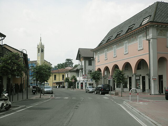
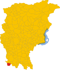
Rivolta d'Adda (Rivolta d'Adda)
.svg)
- Italian comune
 Hiking in Rivolta d'Adda
Rivolta d'Adda is a charming town located in the Lombardy region of Italy, near the Adda River. While it may not be as well-known for hiking as some other destinations in Italy, it offers a variety of outdoor activities and scenic trails that are ideal for those looking to enjoy nature.
Hiking Opportunities
-
Adda River Park (Parco Adda Nord):
- This regional park stretches along the Adda River and is home to rich biodiversity, with numerous trails suitable for different skill levels. The trails provide beautiful views of the river, forests, and historical landmarks.
- You can explore sections of the park on foot, with options for both lengthy hikes and shorter walks.
-
Local Trails:
- Near Rivolta d'Adda, you can find various local trails that lead to picturesque spots, including farmlands and small woodlands. These pathways may not be as well-defined, so it’s ideal to have a map or GPS tool.
- Local nature reserves may also have interconnected trails that allow for easy exploration.
-
Cultural and Historical Routes:
- Some hiking trails may lead you to nearby historical sites, churches, or picturesque villages, giving you a taste of the rich culture and history of Lombardy.
- Look for routes that connect with attractions like the old mills along the Adda River, or charming rural segments that reflect traditional Italian life.
Preparation Tips
- Gear: Wear sturdy hiking shoes, and consider bringing trekking poles for uneven terrains. Also, dress in layers to adapt to changing weather conditions.
- Navigation: Download offline maps or carry a physical map, as cell service may be limited in some areas.
- Hydration and Snacks: Always bring water and some snacks to keep your energy up during your hike.
- Local Guidance: If you're unfamiliar with the area, consider joining a guided hiking tour for a more comprehensive experience and local insights.
Additional Activities
In addition to hiking, the area is suitable for other outdoor activities, such as cycling along the riverbanks or enjoying picnics at scenic spots. Don’t forget to check local events, as the town may host seasonal activities or festivals that can enhance your visit.
Conclusion
While Rivolta d'Adda may not be a major hiking destination, it offers several opportunities to connect with nature and enjoy the beautiful landscapes of the Lombardy region. Whether you're an experienced hiker or just looking for a casual stroll, you'll find plenty to appreciate in this lovely corner of Italy.
- Country:

- Postal Code: 26027
- Local Dialing Code: 0363
- Licence Plate Code: CR
- Coordinates: 45° 28' 0" N, 9° 31' 0" E


- GPS tracks (wikiloc): [Link]
- AboveSeaLevel: 101 м m
- Area: 30.4 sq km
- Population: 8133
- Web site: http://www.comune.rivoltadadda.cr.it/
- Wikipedia en: wiki(en)
- Wikipedia: wiki(it)
- Wikidata storage: Wikidata: Q42617
- Wikipedia Commons Category: [Link]
- Freebase ID: [/m/0gjzr8]
- GeoNames ID: Alt: [6537219]
- BnF ID: [12530912d]
- VIAF ID: Alt: [123613269]
- OSM relation ID: [44975]
- archINFORM location ID: [12569]
- Library of Congress authority ID: Alt: [nr95047454]
- WOEID: [721783]
- UN/LOCODE: [ITRVD]
- ISTAT ID: 019084
- Italian cadastre code: H357
Shares border with regions:


Casirate d'Adda
- Italian comune
Hiking in Casirate d'Adda
Casirate d'Adda is a charming town located in the province of Bergamo in Lombardy, Italy. While it may not be as famous for hiking as some of the larger national parks or mountainous regions in the area, there are still opportunities for outdoor activities and enjoying nature in and around the town....
- Country:
- Postal Code: 24040
- Local Dialing Code: 0363
- Licence Plate Code: BG
- Coordinates: 45° 30' 0" N, 9° 34' 0" E
- GPS tracks (wikiloc): [Link]
- AboveSeaLevel: 114 м m
- Area: 10.17 sq km
- Population: 4120
- Web site: [Link]


Truccazzano
- Italian comune
Hiking in Truccazzano
Truccazzano, a small municipality located in the Lombardy region of Italy, offers a picturesque setting for hiking enthusiasts. While it may not be as widely known as some of the larger national parks or mountainous regions in Italy, it still has its unique charm and opportunities for exploration....
- Country:
- Postal Code: 20060
- Local Dialing Code: 02
- Licence Plate Code: MI
- Coordinates: 45° 29' 0" N, 9° 28' 0" E
- GPS tracks (wikiloc): [Link]
- AboveSeaLevel: 108 м m
- Area: 21.98 sq km
- Population: 5934
- Web site: [Link]


Comazzo
- Italian comune
Hiking in Comazzo
Comazzo is a small town located in the Lombardy region of Italy, and while it may not be widely known for hiking, it is situated near various natural areas and provides access to scenic countryside trails. Here are some insights that could enhance your hiking experience in and around Comazzo:...
- Country:
- Postal Code: 26833
- Local Dialing Code: 02
- Licence Plate Code: LO
- Coordinates: 45° 26' 31" N, 9° 27' 57" E
- GPS tracks (wikiloc): [Link]
- AboveSeaLevel: 98 м m
- Area: 12.8 sq km
- Population: 2301
- Web site: [Link]


Pandino
- Italian comune
Hiking in Pandino
Pandino is a small town located in the Lombardy region of Italy, near the Po Valley. While it may not be as famous for hiking as some of the larger national parks or mountain ranges in Italy, there are still opportunities for outdoor activities and exploring the natural beauty of the surrounding area....
- Country:
- Postal Code: 26025
- Local Dialing Code: 0373
- Licence Plate Code: CR
- Coordinates: 45° 24' 0" N, 9° 33' 0" E
- GPS tracks (wikiloc): [Link]
- AboveSeaLevel: 85 м m
- Area: 22.3 sq km
- Population: 9015
- Web site: [Link]


Cassano d'Adda
- Italian comune
Hiking in Cassano d'Adda
Cassano d'Adda is a charming town located in the Lombardy region of Italy, nestled along the Adda River. It's not only a picturesque area with historical significance but also offers some lovely opportunities for hiking and outdoor activities....
- Country:
- Postal Code: 20062
- Local Dialing Code: 0363
- Licence Plate Code: MI
- Coordinates: 45° 32' 0" N, 9° 31' 0" E
- GPS tracks (wikiloc): [Link]
- AboveSeaLevel: 133 м m
- Area: 18.6 sq km
- Population: 18911
- Web site: [Link]

Spino d’Adda
- Italian comune
Hiking in Spino d’Adda
Spino d'Adda is a picturesque town in Lombardy, Italy, located along the Adda River. It offers a variety of hiking opportunities that allow you to explore the natural beauty of the area and its surrounding landscapes. Here are some highlights and tips for hiking in Spino d'Adda:...
- Country:
- Postal Code: 26016
- Local Dialing Code: 0373
- Licence Plate Code: CR
- Coordinates: 45° 24' 0" N, 9° 30' 0" E
- GPS tracks (wikiloc): [Link]
- AboveSeaLevel: 84 м m
- Area: 20.02 sq km
- Population: 6843
- Web site: [Link]


Merlino
- Italian comune
Hiking in Merlino
Merlino is a small town located in the Lombardy region of Italy. Although it may not be as well-known as some of the larger cities, the surrounding areas offer a variety of scenic landscapes and hiking opportunities that can appeal to nature lovers and outdoor enthusiasts....
- Country:
- Postal Code: 26833
- Local Dialing Code: 02
- Licence Plate Code: LO
- Coordinates: 45° 26' 3" N, 9° 25' 51" E
- GPS tracks (wikiloc): [Link]
- AboveSeaLevel: 101 м m
- Area: 10.73 sq km
- Population: 1746
- Web site: [Link]
Agnadello
- Italian comune
Hiking in Agnadello
Agnadello, a small town in the Lombardy region of northern Italy, is not traditionally known as a hiking destination. However, that doesn't mean you can't enjoy nature and some outdoor activities in and around the area. Here are a few things to consider when hiking near Agnadello:...
- Country:
- Postal Code: 26020
- Local Dialing Code: 0373
- Licence Plate Code: CR
- Coordinates: 45° 27' 0" N, 9° 34' 0" E
- GPS tracks (wikiloc): [Link]
- AboveSeaLevel: 94 м m
- Area: 12.08 sq km
- Population: 3872
- Web site: [Link]

Arzago d'Adda
- Italian comune
Hiking in Arzago d'Adda
Arzago d'Adda is a small town in the Lombardy region of Italy, located along the Adda River. While it may not be one of the most widely recognized hiking destinations, it can offer some lovely outdoor experiences, especially for those looking to explore the scenic countryside and the riverbanks....
- Country:
- Postal Code: 24040
- Local Dialing Code: 0363
- Licence Plate Code: BG
- Coordinates: 45° 28' 55" N, 9° 33' 48" E
- GPS tracks (wikiloc): [Link]
- AboveSeaLevel: 106 м m
- Area: 9.31 sq km
- Population: 2715
- Web site: [Link]