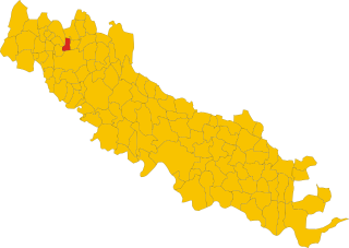
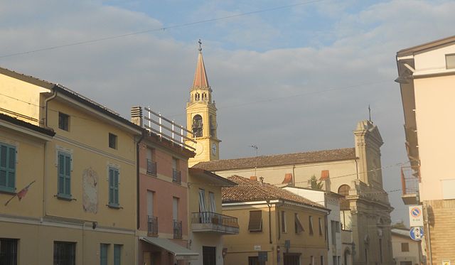
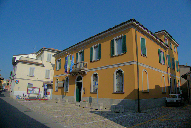
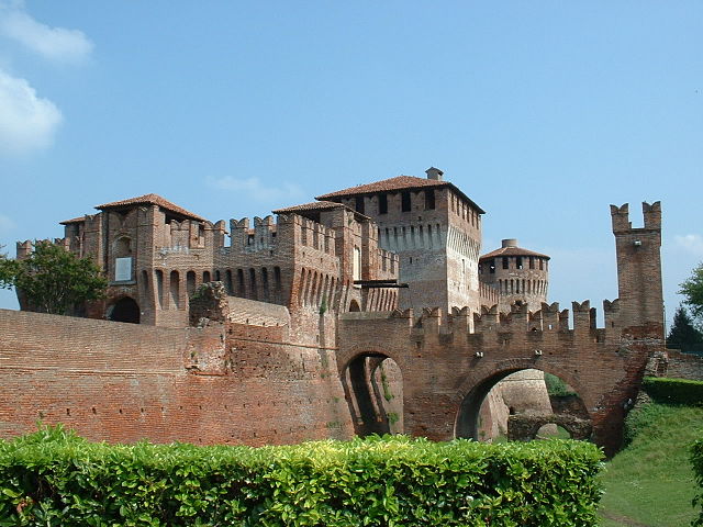
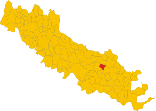
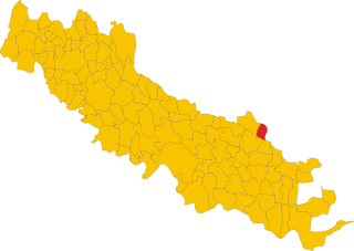
Province of Cremona (provincia di Cremona)

- province of Italy
 Hiking in Province of Cremona
The Province of Cremona, located in the Lombardy region of northern Italy, is not only known for its rich musical heritage and history but also offers various opportunities for outdoor activities, including hiking. While the province itself is relatively flat and agricultural, there are hiking options nearby, particularly in the surrounding areas and countryside.
Key Areas for Hiking in and around Cremona:
-
Po River Park (Parco del Po):
- This park stretches along the Po River, Italy's longest river, and features trails that run through lush wetlands and biodiversity hotspots. You can enjoy flat walks along the riverbanks, with opportunities for birdwatching and enjoying the natural landscape.
-
Oglio River Park (Parco dell'Oglio Nord):
- This is another excellent location for hiking, with trails following the Oglio River. The park is rich in flora and fauna, making it a lovely spot for those who enjoy both nature and quiet walks along river trails.
-
Cremona to neighboring provinces:
- From Cremona, you can easily access the nearby hills and mountainous regions, like the Orobian Alps and the Apennines. Towns like Bergamo and Piacenza offer hiking trails ranging from easy walks to more challenging hikes, suitable for various skill levels.
-
Cremona itself:
- While the city is not primarily known for hiking, exploring the historical streets and parks can be a pleasant walking experience. The city center and surrounding countryside also provide scenic views and opportunities to experience local culture and cuisine on foot.
Recommendations:
- Best Time to Hike: Spring (April to June) and autumn (September to October) are ideal for hiking in this region, as temperatures are mild and the landscapes are particularly vibrant.
- Trail Difficulty: Most trails in the area are easy to moderate, making them suitable for families and casual hikers. However, always check trail conditions and maps before heading out.
- Gear: Wear comfortable hiking shoes, and consider bringing water, snacks, and a map or GPS device. As it can be quite flat, trekking poles may not be necessary, but they can help with longer walks.
Local Culture:
Make time to enjoy local food and wine after your hikes. Cremona is renowned for its polenta, salami, and the famous Grana Padano cheese. You can also explore local artisanal products, especially violin-making, as Cremona is the birthplace of famous violin makers like Stradivari.
Conclusion:
Hiking in the Province of Cremona offers a unique blend of nature and culture. Whether you prefer leisurely walks along rivers or challenging hikes in nearby hills, this area provides a beautiful backdrop for outdoor enthusiasts. Just ensure to check local weather conditions and park regulations before setting out on your adventures!
- Country:

- Capital: Cremona
- Postal Code: 26010–26049; 26100
- Local Dialing Code: 0376; 0375; 0374; 0373; 0372; 0363
- Licence Plate Code: CR
- Coordinates: 45° 8' 0" N, 10° 2' 0" E


- GPS tracks (wikiloc): [Link]
- Area: 1770.57 sq km
- Web site: http://www.provincia.cremona.it
- Wikipedia en: wiki(en)
- Wikipedia: wiki(it)
- Wikidata storage: Wikidata: Q16163
- Wikipedia Commons Gallery: [Link]
- Wikipedia Commons Category: [Link]
- Freebase ID: [/m/040lln]
- GeoNames ID: Alt: [3177837]
- VIAF ID: Alt: [150100449]
- GND ID: Alt: [4085356-1]
- archINFORM location ID: [2374]
- Library of Congress authority ID: Alt: [n80150136]
- MusicBrainz area ID: [406a3421-f236-4c7a-8612-5ea8fbd21a5a]
- TGN ID: [7005869]
- SUDOC authorities ID: [186056028]
- Gran Enciclopèdia Catalana ID: [0020557]
- NUTS code: [ITC4A]
- ISTAT ID: 019
- ISO 3166-2 code: IT-CR
Includes regions:


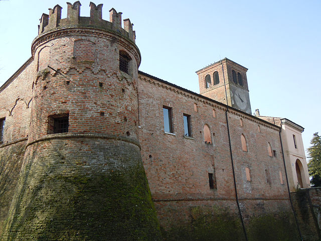
Bordolano
- Italian comune
Hiking in Bordolano
Bordolano is a less-known region, and it may not have well-documented hiking trails compared to some more popular hiking destinations. However, I can provide general advice on how to find hiking opportunities in regions like Bordolano, Italy, or any similar areas....
- Country:
- Postal Code: 26020
- Local Dialing Code: 0372
- Licence Plate Code: CR
- Coordinates: 45° 17' 0" N, 9° 59' 0" E
- GPS tracks (wikiloc): [Link]
- AboveSeaLevel: 64 м m
- Area: 8.14 sq km
- Population: 617
- Web site: [Link]


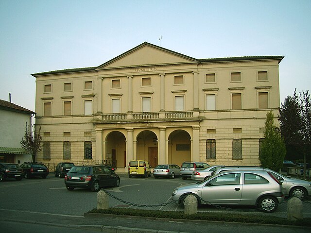
Palazzo Pignano
- Italian comune
Hiking in Palazzo Pignano
Palazzo Pignano is a charming town located in the Lombardy region of northern Italy. While it may not be as well-known for extensive hiking trails as some of the larger national parks or mountainous areas, there are still opportunities for outdoor enthusiasts to explore its beautiful surroundings....
- Country:
- Postal Code: 26020
- Local Dialing Code: 0373
- Licence Plate Code: CR
- Coordinates: 45° 23' 0" N, 9° 34' 0" E
- GPS tracks (wikiloc): [Link]
- AboveSeaLevel: 82 м m
- Area: 8.82 sq km
- Population: 3806
- Web site: [Link]


Sospiro
- Italian comune
Hiking in Sospiro
Sospiro is a small municipality located in the province of Cremona, northern Italy. While it might not be a well-known hiking destination compared to more mountainous regions, the surrounding areas offer some opportunities for scenic walks and hikes....
- Country:
- Postal Code: 26048
- Local Dialing Code: 0372
- Licence Plate Code: CR
- Coordinates: 45° 6' 0" N, 10° 9' 0" E
- GPS tracks (wikiloc): [Link]
- AboveSeaLevel: 36 м m
- Area: 18.96 sq km
- Population: 3103
- Web site: [Link]


Casalmaggiore
- Italian comune
Hiking in Casalmaggiore
Casalmaggiore is a charming town located in the province of Cremona in Lombardy, Italy. While it's not primarily known as a hiking destination, there are several outdoor activities and scenic areas in and around the town that can be enjoyable for hiking enthusiasts. Here are some insights into hiking and exploring the region:...
- Country:
- Postal Code: 26041
- Local Dialing Code: 0375
- Licence Plate Code: CR
- Coordinates: 44° 59' 23" N, 10° 25' 14" E
- GPS tracks (wikiloc): [Link]
- AboveSeaLevel: 26 м m
- Area: 64.53 sq km
- Population: 15376
- Web site: [Link]
Corte de’ Cortesi con Cignone
- Italian comune
Hiking in Corte de’ Cortesi con Cignone
Corte de' Cortesi con Cignone is a small town in the Lombardy region of Italy. While it may not be a well-known hiking destination, the surrounding area offers some beautiful landscapes for outdoor enthusiasts....
- Country:
- Postal Code: 26020
- Local Dialing Code: 0372
- Licence Plate Code: CR
- Coordinates: 45° 16' 0" N, 10° 0' 0" E
- GPS tracks (wikiloc): [Link]
- AboveSeaLevel: 60 м m
- Area: 12.85 sq km
- Population: 1087
- Web site: [Link]
Azzanello
- Italian comune
Hiking in Azzanello
Azzanello is a small town in the Lombardy region of Italy, situated near the banks of the Oglio River. While it may not be a widely recognized hiking destination, it offers opportunities for hiking and outdoor activities thanks to its picturesque natural surroundings and proximity to the river....
- Country:
- Postal Code: 26010
- Local Dialing Code: 0374
- Licence Plate Code: CR
- Coordinates: 45° 18' 47" N, 9° 55' 11" E
- GPS tracks (wikiloc): [Link]
- AboveSeaLevel: 68 м m
- Area: 11.12 sq km
- Population: 635
- Web site: [Link]

Dovera
- Italian comune
Hiking in Dovera
Dovera, a small town in Italy's Lombardy region, offers a unique opportunity for hikers, particularly those interested in exploring the natural beauty of the surrounding areas. While Dovera itself is not a major hiking destination, it's conveniently situated near several natural parks and hiking trails. Here are some points to consider if you're looking to hike in and around Dovera:...
- Country:
- Postal Code: 26010
- Local Dialing Code: 0373
- Licence Plate Code: CR
- Coordinates: 45° 22' 0" N, 9° 32' 0" E
- GPS tracks (wikiloc): [Link]
- AboveSeaLevel: 73 м m
- Area: 20.65 sq km
- Population: 3853
- Web site: [Link]
Persico Dosimo
- Italian comune
Hiking in Persico Dosimo
Persico Dosimo is a quaint locality in the municipality of Cremona, Italy, known for its picturesque landscapes and serene environment. While not a mainstream hiking destination, it can serve as a starting point for exploring the surrounding countryside and rural paths that showcase the natural beauty of the region....
- Country:
- Postal Code: 26043
- Local Dialing Code: 0372
- Licence Plate Code: CR
- Coordinates: 45° 11' 0" N, 10° 6' 0" E
- GPS tracks (wikiloc): [Link]
- AboveSeaLevel: 48 м m
- Area: 20.61 sq km
- Population: 3387
- Web site: [Link]
Malagnino
- Italian comune
Hiking in Malagnino
Malagnino is a small town located in the province of Cremona, Lombardy, Italy. While it may not be as well-known as some other hiking destinations in Italy, it does offer opportunities for outdoor exploration and enjoying the natural surroundings....
- Country:
- Postal Code: 26030
- Local Dialing Code: 0372
- Licence Plate Code: CR
- Coordinates: 45° 8' 0" N, 10° 7' 0" E
- GPS tracks (wikiloc): [Link]
- AboveSeaLevel: 43 м m
- Area: 10.82 sq km
- Population: 1728
- Web site: [Link]
Ricengo
- Italian comune
Hiking in Ricengo
Ricengo, a small town in the Lombardy region of Italy, is not widely recognized as a hiking destination. However, its proximity to larger natural attractions in the region offers opportunities for those looking to enjoy hiking in beautiful Italian landscapes....
- Country:
- Postal Code: 26010
- Local Dialing Code: 0373
- Licence Plate Code: CR
- Coordinates: 45° 24' 0" N, 9° 44' 0" E
- GPS tracks (wikiloc): [Link]
- AboveSeaLevel: 86 м m
- Area: 12.54 sq km
- Population: 1757
- Web site: [Link]


Torre de’ Picenardi
- Italian comune
Hiking in Torre de’ Picenardi
Torre de' Picenardi is a small town in the province of Cremona, located in the Lombardy region of Italy. While it may not be as widely known for hiking as some of the more mountainous areas of Italy, there are still opportunities for outdoor activities and exploring the surrounding countryside....
- Country:
- Postal Code: 26038
- Local Dialing Code: 0375
- Licence Plate Code: CR
- Coordinates: 45° 9' 0" N, 10° 17' 0" E
- GPS tracks (wikiloc): [Link]
- AboveSeaLevel: 37 м m
- Area: 17.12 sq km
- Population: 1697
- Web site: [Link]
Pozzaglio ed Uniti
- Italian comune
Hiking in Pozzaglio ed Uniti
Pozzaglio ed Uniti is a charming village located in the Lombardy region of Italy, near the city of Cremona. While it may not be widely recognized as a major hiking destination, the area surrounding Pozzaglio ed Uniti offers opportunities for scenic walks and hikes, particularly through the beautiful countryside of the Po Valley....
- Country:
- Postal Code: 26010
- Local Dialing Code: 0372
- Licence Plate Code: CR
- Coordinates: 45° 12' 0" N, 10° 3' 0" E
- GPS tracks (wikiloc): [Link]
- AboveSeaLevel: 50 м m
- Area: 20.4 sq km
- Population: 1473
- Web site: [Link]
Pieve d'Olmi
- Italian comune
Hiking in Pieve d'Olmi
Pieve d'Olmi is a small village located in the province of Cremona, Lombardy, Italy. While it may not be as well-known as some of the more prominent hiking destinations in Italy, the surrounding countryside offers some beautiful opportunities for hiking and experiencing the natural beauty of the region....
- Country:
- Postal Code: 26040
- Local Dialing Code: 0372
- Licence Plate Code: CR
- Coordinates: 45° 5' 0" N, 10° 7' 0" E
- GPS tracks (wikiloc): [Link]
- AboveSeaLevel: 36 м m
- Area: 19.44 sq km
- Population: 1291
- Web site: [Link]
Robecco d'Oglio
- Italian comune
Hiking in Robecco d'Oglio
Robecco d'Oglio is a picturesque village located in the Lombardy region of Italy, nestled along the Oglio River. This area is rich in natural beauty and offers several opportunities for hiking and outdoor activities. Here are some key points about hiking in and around Robecco d'Oglio:...
- Country:
- Postal Code: 26010
- Local Dialing Code: 0372
- Licence Plate Code: CR
- Coordinates: 45° 16' 0" N, 10° 5' 0" E
- GPS tracks (wikiloc): [Link]
- AboveSeaLevel: 48 м m
- Area: 17.96 sq km
- Population: 2343
- Web site: [Link]


Monte Cremasco
- Italian comune
Hiking in Monte Cremasco
Monte Cremasco is a lesser-known destination for hiking, located in the Lombardy region of Italy. While it may not be as famous as some of the larger mountain ranges in the country, it offers beautiful landscapes and a mix of rural and natural scenery that can be quite appealing for outdoor enthusiasts....
- Country:
- Postal Code: 26010
- Local Dialing Code: 0373
- Licence Plate Code: CR
- Coordinates: 45° 23' 0" N, 9° 34' 0" E
- GPS tracks (wikiloc): [Link]
- AboveSeaLevel: 84 м m
- Area: 2.34 sq km
- Population: 2332
- Web site: [Link]


Ticengo
- Italian comune
Hiking in Ticengo
Ticengo is a quaint town located in the Lombardy region of Italy, and while it may not be as widely known as some larger destinations, it offers beautiful landscapes nearby that are ideal for hiking enthusiasts. Here are some tips and insights regarding hiking in and around Ticengo:...
- Country:
- Postal Code: 26010
- Local Dialing Code: 0374
- Licence Plate Code: CR
- Coordinates: 45° 22' 0" N, 9° 50' 0" E
- GPS tracks (wikiloc): [Link]
- AboveSeaLevel: 76 м m
- Area: 7.98 sq km
- Population: 443
- Web site: [Link]
Sesto ed Uniti
- Italian comune
Hiking in Sesto ed Uniti
Sesto ed Uniti, located in the province of Cremona in Lombardy, Italy, isn’t primarily known as a hiking destination compared to the more mountainous regions of the country. However, it offers charming rural landscapes and various trails that can be explored by nature enthusiasts looking for a peaceful experience....
- Country:
- Postal Code: 26028
- Local Dialing Code: 0372
- Licence Plate Code: CR
- Coordinates: 45° 11' 0" N, 9° 55' 0" E
- GPS tracks (wikiloc): [Link]
- AboveSeaLevel: 52 м m
- Area: 26.49 sq km
- Population: 3213
- Web site: [Link]

Calvatone
- Italian comune
Hiking in Calvatone
Calvatone is a small town located in the Lombardy region of Italy. While it may not be as widely recognized for hiking as some other areas in Italy, it does offer opportunities for outdoor activities and exploration of the surrounding countryside....
- Country:
- Postal Code: 26030
- Local Dialing Code: 0375
- Licence Plate Code: CR
- Coordinates: 45° 8' 0" N, 10° 27' 0" E
- GPS tracks (wikiloc): [Link]
- AboveSeaLevel: 29 м m
- Area: 13.7 sq km
- Population: 1217
- Web site: [Link]
Acquanegra Cremonese
- Italian comune
Hiking in Acquanegra Cremonese
Acquanegra Cremonese is a charming village located in the Lombardy region of northern Italy. It's surrounded by the beautiful landscapes of the Po Valley, making it a great spot for hiking enthusiasts. While the area might not have extensive hiking trails like larger national parks, there are still several opportunities to enjoy the outdoors....
- Country:
- Postal Code: 26020
- Local Dialing Code: 0372
- Licence Plate Code: CR
- Coordinates: 45° 10' 0" N, 9° 53' 0" E
- GPS tracks (wikiloc): [Link]
- AboveSeaLevel: 45 м m
- Area: 9.22 sq km
- Population: 1181
- Web site: [Link]


Olmeneta
- Italian comune
Hiking in Olmeneta
Olmeneta, located in Italy, is a beautiful destination for hiking enthusiasts. Nestled in the scenic landscapes of the Apennine Mountains, Olmeneta offers a variety of trails suitable for different skill levels, from beginners to more experienced hikers....
- Country:
- Postal Code: 26010
- Local Dialing Code: 0372
- Licence Plate Code: CR
- Coordinates: 45° 14' 0" N, 10° 1' 0" E
- GPS tracks (wikiloc): [Link]
- AboveSeaLevel: 55 м m
- Area: 9.15 sq km
- Population: 946
- Web site: [Link]


Capergnanica
- comune of Italy
Hiking in Capergnanica
Capergnanica, located in the province of Cremona in northern Italy, offers a wonderful setting for hiking enthusiasts looking to explore the Italian countryside. While it may not be as famous as some of the larger parks or mountainous regions in Italy, there are still opportunities for enjoying nature in this area....
- Country:
- Postal Code: 26010
- Local Dialing Code: 0373
- Licence Plate Code: CR
- Coordinates: 45° 20' 0" N, 9° 39' 0" E
- GPS tracks (wikiloc): [Link]
- AboveSeaLevel: 77 м m
- Area: 6.84 sq km
- Population: 2150
- Web site: [Link]


Moscazzano
- Italian comune
Hiking in Moscazzano
Moscazzano is a small municipality located in the province of Cremona in Lombardy, Italy. While it's not known for extensive hiking trails compared to some mountainous regions of Italy, there are still opportunities for nature walks and exploring the beautiful countryside around the area....
- Country:
- Postal Code: 26010
- Local Dialing Code: 0373
- Licence Plate Code: CR
- Coordinates: 45° 17' 0" N, 9° 41' 0" E
- GPS tracks (wikiloc): [Link]
- AboveSeaLevel: 67 м m
- Area: 8.15 sq km
- Population: 800
- Web site: [Link]


Cella Dati
- Italian comune
Hiking in Cella Dati
Cella Dati is a small town in Italy, located in the Lombardy region. While it may not be as renowned for hiking as some of Italy's more famous mountainous areas, such as the Dolomites or the Apennines, there are still opportunities for outdoor activities and hiking in the surrounding areas....
- Country:
- Postal Code: 26040
- Local Dialing Code: 0372
- Licence Plate Code: CR
- Coordinates: 45° 6' 0" N, 10° 13' 0" E
- GPS tracks (wikiloc): [Link]
- AboveSeaLevel: 34 м m
- Area: 18.92 sq km
- Population: 511
- Web site: [Link]
Ripalta Guerina
- Italian comune
Hiking in Ripalta Guerina
Ripalta Guerina, located in the Lombardy region of Italy, is a picturesque area that offers beautiful landscapes and a variety of hiking opportunities. While it may not be as well-known as some other hiking destinations in the region, it features charming scenery, pleasant trails, and a blend of natural beauty and cultural heritage....
- Country:
- Postal Code: 26010
- Local Dialing Code: 0373
- Licence Plate Code: CR
- Coordinates: 45° 18' 0" N, 9° 42' 0" E
- GPS tracks (wikiloc): [Link]
- AboveSeaLevel: 67 м m
- Area: 2.97 sq km
- Population: 529
- Web site: [Link]

Pieve San Giacomo
- Italian comune
Hiking in Pieve San Giacomo
Pieve San Giacomo is a small hamlet located in the province of Brescia, Italy. It's nestled in the beautiful landscape of the Lombardy region, making it an excellent destination for hiking enthusiasts. Here’s what you can expect when hiking in and around Pieve San Giacomo:...
- Country:
- Postal Code: 26035
- Local Dialing Code: 0372
- Licence Plate Code: CR
- Coordinates: 45° 8' 0" N, 10° 11' 0" E
- GPS tracks (wikiloc): [Link]
- AboveSeaLevel: 39 м m
- Area: 14.85 sq km
- Population: 1586
- Web site: [Link]


Motta Baluffi
- Italian comune
Hiking in Motta Baluffi
Motta Baluffi is a small village located in the province of Cremona, in the Lombardy region of Italy. While it may not be a well-known hiking destination compared to the larger mountain ranges in Italy, it offers a unique experience for hikers interested in exploring the serene natural beauty and rural landscapes of the Po Valley....
- Country:
- Postal Code: 26045
- Local Dialing Code: 0375
- Licence Plate Code: CR
- Coordinates: 45° 3' 0" N, 10° 16' 0" E
- GPS tracks (wikiloc): [Link]
- AboveSeaLevel: 31 м m
- Area: 16.47 sq km
- Population: 899
- Web site: [Link]


Martignana di Po
- Italian comune
Hiking in Martignana di Po
Martignana di Po is a small municipality located in the province of Cremona in Italy. While it may not be widely recognized as a hiking destination, the surrounding countryside offers opportunities for outdoor activities such as walking and hiking. Here are some aspects to consider when hiking in and around Martignana di Po:...
- Country:
- Postal Code: 26040
- Local Dialing Code: 0375
- Licence Plate Code: CR
- Coordinates: 45° 0' 0" N, 10° 22' 0" E
- GPS tracks (wikiloc): [Link]
- AboveSeaLevel: 26 м m
- Area: 14.92 sq km
- Population: 2017
- Web site: [Link]


Quintano
- Italian comune
Hiking in Quintano
Quintano, the small town located in the Lombardy region of Italy, offers some scenic hiking opportunities that typically take advantage of its proximity to various natural landscapes. Although Quintano itself may not be a well-known hiking destination, you can explore the surrounding areas, particularly the nearby hills and the countryside....
- Country:
- Postal Code: 26017
- Local Dialing Code: 0373
- Licence Plate Code: CR
- Coordinates: 45° 25' 0" N, 9° 37' 0" E
- GPS tracks (wikiloc): [Link]
- AboveSeaLevel: 91 м m
- Area: 2.86 sq km
- Population: 949
- Web site: [Link]


Rivarolo del Re ed Uniti
- Italian comune
Hiking in Rivarolo del Re ed Uniti
Rivarolo del Re ed Uniti is a small municipality located in the Lombardy region of Italy, near the Po River. While it might not be as well-known for hiking as some of Italy’s more mountainous areas, there are still opportunities for outdoor activities, including hiking, especially for those who appreciate flat terrain and picturesque landscapes....
- Country:
- Postal Code: 26036
- Local Dialing Code: 0375
- Licence Plate Code: CR
- Coordinates: 45° 1' 52" N, 10° 28' 21" E
- GPS tracks (wikiloc): [Link]
- AboveSeaLevel: 22 м m
- Area: 27.33 sq km
- Population: 1967
- Web site: [Link]


San Daniele Po
- Italian comune
Hiking in San Daniele Po
San Daniele Po is a charming commune located in the province of Cremona in northern Italy. While it’s not primarily known for extensive hiking trails like some of Italy's more mountainous regions, there are still opportunities for pleasant walks and outdoor activities in the surrounding countryside and natural areas....
- Country:
- Postal Code: 26046
- Local Dialing Code: 0372
- Licence Plate Code: CR
- Coordinates: 45° 4' 0" N, 10° 11' 0" E
- GPS tracks (wikiloc): [Link]
- AboveSeaLevel: 33 м m
- Area: 22.69 sq km
- Population: 1374
- Web site: [Link]


Cappella de’ Picenardi
- Italian comune
Hiking in Cappella de’ Picenardi
Cappella de' Picenardi is a small town located in the Lombardy region of Italy. While it may not be as well-known as major hiking destinations, the surrounding countryside offers peaceful trails and scenic views, perfect for those looking to escape into nature....
- Country:
- Postal Code: 26030
- Local Dialing Code: 0372
- Licence Plate Code: CR
- Coordinates: 45° 9' 34" N, 10° 13' 52" E
- GPS tracks (wikiloc): [Link]
- AboveSeaLevel: 42 м m
- Area: 14.2 sq km
- Population: 432
- Web site: [Link]


Casaletto Ceredano
- Italian comune
Hiking in Casaletto Ceredano
Casaletto Ceredano, located in the Lombardy region of Italy, is a small town that offers a tranquil setting for outdoor activities, including hiking. While it may not be as widely known as major hiking destinations, it is surrounded by a picturesque landscape that can provide enjoyable experiences for hikers who appreciate nature and quiet trails....
- Country:
- Postal Code: 26010
- Local Dialing Code: 0373
- Licence Plate Code: CR
- Coordinates: 45° 19' 0" N, 9° 37' 0" E
- GPS tracks (wikiloc): [Link]
- AboveSeaLevel: 65 м m
- Area: 6.52 sq km
- Population: 1172
- Web site: [Link]


Cingia de' Botti
- Italian comune
Hiking in Cingia de' Botti
Cingia de' Botti is a small town located in the province of Cremona, in the Lombardy region of Italy. While it may not be as widely recognized as some other hiking destinations in Italy, it offers beautiful natural landscapes and a peaceful atmosphere, ideal for those looking to explore the outdoors....
- Country:
- Postal Code: 26042
- Local Dialing Code: 0375
- Licence Plate Code: CR
- Coordinates: 45° 5' 0" N, 10° 17' 0" E
- GPS tracks (wikiloc): [Link]
- AboveSeaLevel: 31 м m
- Area: 14.36 sq km
- Population: 1254
- Web site: [Link]
Castelvisconti
- Italian comune
Hiking in Castelvisconti
Castelvisconti is a small town located in the Lombardy region of Italy, known for its picturesque landscapes and charming countryside. While it may not be a widely recognized hiking destination, it can serve as a great base for exploring the surrounding areas, which feature numerous trails and scenic routes ideal for hiking....
- Country:
- Postal Code: 26010
- Local Dialing Code: 0374
- Licence Plate Code: CR
- Coordinates: 45° 18' 0" N, 9° 56' 0" E
- GPS tracks (wikiloc): [Link]
- AboveSeaLevel: 66 м m
- Area: 9.76 sq km
- Population: 301
- Web site: [Link]

Castelleone
- Italian comune
Hiking in Castelleone
Castelleone is a charming town located in the Lombardy region of Italy, and while it may not be the most well-known hiking destination, it offers access to some lovely spots worth exploring....
- Country:
- Postal Code: 26012
- Local Dialing Code: 0374
- Licence Plate Code: CR
- Coordinates: 45° 17' 45" N, 9° 45' 39" E
- GPS tracks (wikiloc): [Link]
- AboveSeaLevel: 66 м m
- Area: 45.08 sq km
- Population: 9374
- Web site: [Link]


Solarolo Rainerio
- Italian comune
Hiking in Solarolo Rainerio
Solarolo Rainerio, located in the Lombardy region of northern Italy, may not be widely known for extensive hiking trails, but it is surrounded by beautiful landscapes that offer opportunities for outdoor activities, including hiking. The area features a mix of flat terrain and gentle hills, set in the picturesque backdrop of the Po Valley....
- Country:
- Postal Code: 26030
- Local Dialing Code: 0375
- Licence Plate Code: CR
- Coordinates: 45° 5' 0" N, 10° 21' 0" E
- GPS tracks (wikiloc): [Link]
- AboveSeaLevel: 28 м m
- Area: 11.43 sq km
- Population: 934
- Web site: [Link]


Derovere
- Italian comune
Hiking in Derovere
It seems there might be a typo or misunderstanding, as I couldn't find information regarding a hiking destination called "Derovere." If you meant a specific location, please check the spelling, or provide more context, such as the country or region it's in....
- Country:
- Postal Code: 26040
- Local Dialing Code: 0372
- Licence Plate Code: CR
- Coordinates: 45° 6' 39" N, 10° 14' 56" E
- GPS tracks (wikiloc): [Link]
- AboveSeaLevel: 36 м m
- Area: 9.99 sq km
- Population: 296
- Web site: [Link]


Casaletto Vaprio
- Italian municipality
Hiking in Casaletto Vaprio
Casaletto Vaprio, located in the Lombardy region of Italy, is not typically known as a major hiking destination compared to other areas in the region like the nearby Adda River Park or the Alps. However, the surrounding countryside offers some pleasant walking and hiking opportunities....
- Country:
- Postal Code: 26010
- Local Dialing Code: 0373
- Licence Plate Code: CR
- Coordinates: 45° 24' 0" N, 9° 38' 0" E
- GPS tracks (wikiloc): [Link]
- AboveSeaLevel: 87 м m
- Area: 5.4 sq km
- Population: 1773
- Web site: [Link]


Torricella del Pizzo
- Italian comune
Hiking in Torricella del Pizzo
Torricella del Pizzo is a small village located in the Lombardy region of Italy, not far from the shores of Lake Iseo. While it may not be as widely recognized as some other hiking destinations in Italy, the surrounding area offers delightful opportunities for outdoor activities, including hiking and trekking....
- Country:
- Postal Code: 26040
- Local Dialing Code: 0375
- Licence Plate Code: CR
- Coordinates: 45° 1' 0" N, 10° 18' 0" E
- GPS tracks (wikiloc): [Link]
- AboveSeaLevel: 29 м m
- Area: 23.23 sq km
- Population: 594
- Web site: [Link]
Romanengo
- Italian comune
Hiking in Romanengo
Romanengo is a charming village located in the province of Cremona, Northern Italy. While the area is not widely known for extensive hiking trails compared to more mountainous regions of Italy, it does offer some opportunities for enjoyable walks and hikes in the surrounding countryside....
- Country:
- Postal Code: 26014
- Local Dialing Code: 0373
- Licence Plate Code: CR
- Coordinates: 45° 23' 0" N, 9° 47' 0" E
- GPS tracks (wikiloc): [Link]
- AboveSeaLevel: 81 м m
- Area: 15.05 sq km
- Population: 3071
- Web site: [Link]


Montodine
- Italian comune
Hiking in Montodine
Montodine is a small municipality in the province of Cremona, Lombardy, Italy. While it may not be one of the most famous hiking destinations, it offers a quiet, rural landscape that can be quite pleasant for leisurely walks and nature exploration....
- Country:
- Postal Code: 26010
- Local Dialing Code: 0373
- Licence Plate Code: CR
- Coordinates: 45° 17' 0" N, 9° 43' 0" E
- GPS tracks (wikiloc): [Link]
- AboveSeaLevel: 61 м m
- Area: 11.39 sq km
- Population: 2517
- Web site: [Link]


Annicco
- Italian comune
Hiking in Annicco
Annicco is a small town located in the Lombardy region of Italy. While it may not be as widely known for hiking as some other areas in Italy, it can serve as a gateway for exploring nearby regions that offer beautiful hiking opportunities....
- Country:
- Postal Code: 26021
- Local Dialing Code: 0374
- Licence Plate Code: CR
- Coordinates: 45° 15' 0" N, 9° 53' 0" E
- GPS tracks (wikiloc): [Link]
- AboveSeaLevel: 60 м m
- Area: 19.2 sq km
- Population: 2053
- Web site: [Link]


Pandino
- Italian comune
Hiking in Pandino
Pandino is a small town located in the Lombardy region of Italy, near the Po Valley. While it may not be as famous for hiking as some of the larger national parks or mountain ranges in Italy, there are still opportunities for outdoor activities and exploring the natural beauty of the surrounding area....
- Country:
- Postal Code: 26025
- Local Dialing Code: 0373
- Licence Plate Code: CR
- Coordinates: 45° 24' 0" N, 9° 33' 0" E
- GPS tracks (wikiloc): [Link]
- AboveSeaLevel: 85 м m
- Area: 22.3 sq km
- Population: 9015
- Web site: [Link]


Ripalta Cremasca
- Italian comune
Hiking in Ripalta Cremasca
Ripalta Cremasca is a charming town located in the Lombardy region of Italy, surrounded by beautiful landscapes that are perfect for hiking enthusiasts. While the town itself might not be a major hiking destination, its surrounding areas offer several opportunities for enjoying nature and exploring the outdoors....
- Country:
- Postal Code: 26010
- Local Dialing Code: 0373
- Licence Plate Code: CR
- Coordinates: 45° 20' 0" N, 9° 42' 0" E
- GPS tracks (wikiloc): [Link]
- AboveSeaLevel: 78 м m
- Area: 11.78 sq km
- Population: 3406
- Web site: [Link]


Offanengo
- Italian comune
Hiking in Offanengo
Offanengo is a small town located in the Lombardy region of Italy, near the larger city of Crema. While it may not be widely known for extensive hiking trails, the surrounding areas offer opportunities for outdoor activities, including hiking and nature walks....
- Country:
- Postal Code: 26010
- Local Dialing Code: 0373
- Licence Plate Code: CR
- Coordinates: 45° 23' 0" N, 9° 44' 0" E
- GPS tracks (wikiloc): [Link]
- AboveSeaLevel: 80 м m
- Area: 12.58 sq km
- Population: 6014
- Web site: [Link]


Rivolta d'Adda
- Italian comune
Hiking in Rivolta d'Adda
Rivolta d'Adda is a charming town located in the Lombardy region of Italy, near the Adda River. While it may not be as well-known for hiking as some other destinations in Italy, it offers a variety of outdoor activities and scenic trails that are ideal for those looking to enjoy nature....
- Country:
- Postal Code: 26027
- Local Dialing Code: 0363
- Licence Plate Code: CR
- Coordinates: 45° 28' 0" N, 9° 31' 0" E
- GPS tracks (wikiloc): [Link]
- AboveSeaLevel: 101 м m
- Area: 30.4 sq km
- Population: 8133
- Web site: [Link]


Pizzighettone
- Italian comune
Hiking in Pizzighettone
Pizzighettone, located in the Lombardy region of Italy, offers a unique blend of history and nature for hiking enthusiasts. While it may not be as famous for hiking trails as some of the mountainous regions in Italy, it does have its own charm, particularly with its scenic surroundings and historical features....
- Country:
- Postal Code: 26026
- Local Dialing Code: 0372
- Licence Plate Code: CR
- Coordinates: 45° 11' 0" N, 9° 47' 0" E
- GPS tracks (wikiloc): [Link]
- AboveSeaLevel: 46 м m
- Area: 32.06 sq km
- Population: 6501
- Web site: [Link]


Cumignano sul Naviglio
- Italian comune
Hiking in Cumignano sul Naviglio
Cumignano sul Naviglio is a small town located in the Lombardy region of Italy, near the Naviglio River. While it may not be as famous for hiking as some other Italian destinations, it offers a peaceful environment with charming landscapes that can still provide a pleasant experience for nature lovers and hikers....
- Country:
- Postal Code: 26020
- Local Dialing Code: 0374
- Licence Plate Code: CR
- Coordinates: 45° 21' 0" N, 9° 50' 0" E
- GPS tracks (wikiloc): [Link]
- AboveSeaLevel: 73 м m
- Area: 6.77 sq km
- Population: 448
- Web site: [Link]

Formigara
- Italian comune
Hiking in Formigara
Formigara is a lesser-known yet beautiful hiking destination in Italy, nestled within the picturesque Pavia province of Lombardy. It is part of the larger Lombardy region, known for its stunning landscapes, historical sites, and diverse flora and fauna. While Formigara itself may not be a prominent hiking area like some of the more famous national parks or mountains in Italy, it offers a serene environment for nature lovers and hikers....
- Country:
- Postal Code: 26020
- Local Dialing Code: 0374
- Licence Plate Code: CR
- Coordinates: 45° 14' 0" N, 9° 46' 0" E
- GPS tracks (wikiloc): [Link]
- AboveSeaLevel: 56 м m
- Area: 12.64 sq km
- Population: 1031
- Web site: [Link]


Gabbioneta-Binanuova
- Italian comune
Hiking in Gabbioneta-Binanuova
Gabbioneta-Binanuova is a small municipality in the province of Cremona in Lombardy, Italy. While it may not be as well-known as some major hiking destinations, the surrounding area offers some natural beauty and opportunities for outdoor activities, including hiking....
- Country:
- Postal Code: 26030
- Local Dialing Code: 0372
- Licence Plate Code: CR
- Coordinates: 45° 13' 0" N, 10° 13' 0" E
- GPS tracks (wikiloc): [Link]
- AboveSeaLevel: 38 м m
- Area: 15.71 sq km
- Population: 860
- Web site: [Link]
Grontardo
- Italian comune
Hiking in Grontardo
Grontardo is a small town located in the province of Cremona, Lombardy, Italy. While it may not be as widely recognized as popular hiking destinations in the Alps or Dolomites, it offers beautiful landscapes and opportunities for outdoor activities in the surrounding countryside....
- Country:
- Postal Code: 26044
- Local Dialing Code: 0372
- Licence Plate Code: CR
- Coordinates: 45° 12' 0" N, 10° 9' 0" E
- GPS tracks (wikiloc): [Link]
- AboveSeaLevel: 46 м m
- Area: 12.26 sq km
- Population: 1467
- Web site: [Link]
Pessina Cremonese
- Italian comune
Hiking in Pessina Cremonese
Pessina Cremonese is a small municipality located in the province of Cremona in the Lombardy region of Italy. While it's not a popular hiking destination like some of the more mountainous areas in Italy, it still offers opportunities for those looking to enjoy scenic outdoor activities in a serene rural environment....
- Country:
- Postal Code: 26030
- Local Dialing Code: 0372
- Licence Plate Code: CR
- Coordinates: 45° 11' 0" N, 10° 15' 0" E
- GPS tracks (wikiloc): [Link]
- AboveSeaLevel: 42 м m
- Area: 22.02 sq km
- Population: 626
- Web site: [Link]


Pescarolo ed Uniti
- Italian comune
Hiking in Pescarolo ed Uniti
Pescarolo ed Uniti is a small town located in the Lombardy region of Italy, near the Po River. While the area isn't typically recognized as a major hiking destination compared to larger national parks or mountainous regions, it does offer some opportunities for outdoor exploration, especially for those who enjoy calm walks in picturesque environments....
- Country:
- Postal Code: 26033
- Local Dialing Code: 0372
- Licence Plate Code: CR
- Coordinates: 45° 11' 38" N, 10° 11' 11" E
- GPS tracks (wikiloc): [Link]
- AboveSeaLevel: 45 м m
- Area: 16.54 sq km
- Population: 1544
- Web site: [Link]
Cappella Cantone
- Italian comune
Hiking in Cappella Cantone
Cappella Cantone is a charming town located in the province of Cremona in Italy. While it may not be as widely known for hiking as some of Italy's more famous regions, it is surrounded by beautiful landscapes and offers opportunities for outdoor activities....
- Country:
- Postal Code: 26020
- Local Dialing Code: 0374
- Licence Plate Code: CR
- Coordinates: 45° 15' 0" N, 9° 50' 0" E
- GPS tracks (wikiloc): [Link]
- AboveSeaLevel: 60 м m
- Area: 13.15 sq km
- Population: 576
- Web site: [Link]


Tornata
- Italian comune
Hiking in Tornata
It seems that there may be some confusion with the name "Tornata," as it does not correspond to a widely recognized hiking location or region. However, I can provide information on popular hiking areas, as well as tips and advice for hiking in general....
- Country:
- Postal Code: 26030
- Local Dialing Code: 0375
- Licence Plate Code: CR
- Coordinates: 45° 6' 0" N, 10° 26' 0" E
- GPS tracks (wikiloc): [Link]
- AboveSeaLevel: 29 м m
- Area: 10.17 sq km
- Population: 461
- Web site: [Link]


Torlino Vimercati
- Italian comune
Hiking in Torlino Vimercati
Torlino Vimercati, located in the Lombardy region of Italy, offers a picturesque setting for hiking enthusiasts. The surrounding landscapes are characterized by rolling hills, lush greenery, and scenic views, making it an inviting spot for outdoor activities....
- Country:
- Postal Code: 26017
- Local Dialing Code: 0373
- Licence Plate Code: CR
- Coordinates: 45° 25' 0" N, 9° 36' 0" E
- GPS tracks (wikiloc): [Link]
- AboveSeaLevel: 88 м m
- Area: 5.77 sq km
- Population: 475
- Web site: [Link]


Ripalta Arpina
- Italian comune
Hiking in Ripalta Arpina
Ripalta Arpina is a beautiful area located in northern Italy, known for its stunning landscapes and hiking opportunities. Nestled in the Alps, it offers a range of trails suitable for different skill levels, from beginner hikes to more challenging treks....
- Country:
- Postal Code: 26010
- Local Dialing Code: 0373
- Licence Plate Code: CR
- Coordinates: 45° 18' 0" N, 9° 44' 0" E
- GPS tracks (wikiloc): [Link]
- AboveSeaLevel: 72 м m
- Area: 6.96 sq km
- Population: 993
- Web site: [Link]


Pieranica
- Italian comune
Hiking in Pieranica
Pieranica is a charming location typically associated with beautiful landscapes and trails that are perfect for hiking enthusiasts. While it may not be as widely known as some national parks or major hiking destinations, it still offers opportunities for nature lovers to explore....
- Country:
- Postal Code: 26017
- Local Dialing Code: 0373
- Licence Plate Code: CR
- Coordinates: 45° 25' 0" N, 9° 37' 0" E
- GPS tracks (wikiloc): [Link]
- AboveSeaLevel: 91 м m
- Area: 2.73 sq km
- Population: 1168
- Web site: [Link]

Spino d’Adda
- Italian comune
Hiking in Spino d’Adda
Spino d'Adda is a picturesque town in Lombardy, Italy, located along the Adda River. It offers a variety of hiking opportunities that allow you to explore the natural beauty of the area and its surrounding landscapes. Here are some highlights and tips for hiking in Spino d'Adda:...
- Country:
- Postal Code: 26016
- Local Dialing Code: 0373
- Licence Plate Code: CR
- Coordinates: 45° 24' 0" N, 9° 30' 0" E
- GPS tracks (wikiloc): [Link]
- AboveSeaLevel: 84 м m
- Area: 20.02 sq km
- Population: 6843
- Web site: [Link]
Salvirola
- Italian comune
Hiking in Salvirola
Salvirola, though a small town in the Lombardy region of northern Italy, offers a picturesque backdrop for hiking enthusiasts. Surrounded by the beautiful landscapes of the Po Valley, it provides access to various trails that highlight the natural beauty and cultural sights of the area....
- Country:
- Postal Code: 26010
- Local Dialing Code: 0373
- Licence Plate Code: CR
- Coordinates: 45° 21' 0" N, 9° 47' 0" E
- GPS tracks (wikiloc): [Link]
- AboveSeaLevel: 74 м m
- Area: 7.36 sq km
- Population: 1163
- Web site: [Link]
Crotta d'Adda
- Italian comune
Hiking in Crotta d'Adda
Crotta d'Adda is a picturesque village located in the Lombardy region of Italy, near the Adda River. While it's not widely known as a hiking destination, it offers some beautiful trails and scenic views for outdoor enthusiasts. Here are some aspects to consider when hiking in and around Crotta d'Adda:...
- Country:
- Postal Code: 26020
- Local Dialing Code: 0372
- Licence Plate Code: CR
- Coordinates: 45° 10' 0" N, 9° 51' 0" E
- GPS tracks (wikiloc): [Link]
- AboveSeaLevel: 52 м m
- Area: 12.94 sq km
- Population: 641
- Web site: [Link]


Gombito
- Italian comune
Hiking in Gombito
Gombito is a lesser-known hiking destination that offers stunning landscapes and a variety of trails suitable for different skill levels. While specific trail details can vary, here’s an overview of what you might expect when hiking in the Gombito area:...
- Country:
- Postal Code: 26020
- Local Dialing Code: 0374
- Licence Plate Code: CR
- Coordinates: 45° 16' 0" N, 9° 44' 0" E
- GPS tracks (wikiloc): [Link]
- AboveSeaLevel: 65 м m
- Area: 9.13 sq km
- Population: 631
- Web site: [Link]
San Martino del Lago
- Italian comune
Hiking in San Martino del Lago
San Martino del Lago is a charming village located in the province of Lodi, Lombardy, Italy. While it may not be as widely known as some of the larger hiking destinations in Italy, it offers picturesque trails and the opportunity to explore the beautiful surrounding countryside....
- Country:
- Postal Code: 26040
- Local Dialing Code: 0375
- Licence Plate Code: CR
- Coordinates: 45° 4' 0" N, 10° 19' 0" E
- GPS tracks (wikiloc): [Link]
- AboveSeaLevel: 31 м m
- Area: 10.38 sq km
- Population: 438
- Web site: [Link]

Campagnola Cremasca
- Italian comune
Hiking in Campagnola Cremasca
Campagnola Cremasca is a small town located in the Lombardy region of Italy, known for its picturesque landscapes and rural charm. While the area may not be as famous for hiking as some mountainous regions of Italy, there are still opportunities for enjoyable walks and hikes in the surrounding countryside....
- Country:
- Postal Code: 26013
- Local Dialing Code: 0373
- Licence Plate Code: CR
- Coordinates: 45° 24' 0" N, 9° 40' 0" E
- GPS tracks (wikiloc): [Link]
- AboveSeaLevel: 81 м m
- Area: 4.64 sq km
- Population: 686
- Web site: [Link]


Crema
- Italian comune
Hiking in Crema
Crema, located in the Lombardy region of northern Italy, is not as widely known for hiking as some of the nearby areas in the Italian Alps or the Apennines. However, it does offer some lovely landscapes and walking trails for those who enjoy a more serene and gentle hiking experience....
- Country:
- Postal Code: 26013
- Local Dialing Code: 0373
- Licence Plate Code: CR
- Coordinates: 45° 22' 0" N, 9° 41' 0" E
- GPS tracks (wikiloc): [Link]
- AboveSeaLevel: 79 м m
- Area: 34 sq km
- Population: 34452
- Web site: [Link]
Stagno Lombardo
- Italian comune
Hiking in Stagno Lombardo
Stagno Lombardo, located in the Lombardy region of northern Italy, offers a variety of outdoor activities, including hiking, thanks to its scenic landscapes and rich natural beauty. While it might not be as famous as some other hiking destinations in Lombardy, it can still provide a great experience for those looking to explore the countryside and enjoy nature....
- Country:
- Postal Code: 26049
- Local Dialing Code: 0372
- Licence Plate Code: CR
- Coordinates: 45° 4' 0" N, 10° 5' 0" E
- GPS tracks (wikiloc): [Link]
- AboveSeaLevel: 36 м m
- Area: 40.2 sq km
- Population: 1550
- Web site: [Link]
Scandolara Ripa d'Oglio
- Italian comune
Hiking in Scandolara Ripa d'Oglio
Scandolara Ripa d'Oglio is a charming village located in the Lombardy region of Italy, characterized by its beautiful natural landscapes and proximity to the Oglio River. While the immediate area may not be as widely known as other hiking destinations, it offers opportunities for outdoor activities and exploration in its surroundings....
- Country:
- Postal Code: 26047
- Local Dialing Code: 0372
- Licence Plate Code: CR
- Coordinates: 45° 13' 0" N, 10° 9' 0" E
- GPS tracks (wikiloc): [Link]
- AboveSeaLevel: 47 м m
- Area: 5.72 sq km
- Population: 572
- Web site: [Link]
Voltido
- Italian comune
Hiking in Voltido
It seems that there may be some confusion, as "Voltido" does not appear to be a recognized hiking destination or location. It’s possible that you might be referring to a different place or there may be a typo....
- Country:
- Postal Code: 26030
- Local Dialing Code: 0
- Licence Plate Code: CR
- Coordinates: 45° 7' 0" N, 10° 16' 0" E
- GPS tracks (wikiloc): [Link]
- AboveSeaLevel: 35 м m
- Area: 12.24 sq km
- Population: 359
- Web site: [Link]

Castelverde
- Italian comune
Hiking in Castelverde
Castelverde, located in the Lazio region of Italy, is an area that offers a unique blend of natural beauty and cultural heritage suitable for hiking enthusiasts. While it may not be as widely known as other hiking destinations in Italy, it still boasts some scenic trails and opportunities for outdoor exploration....
- Country:
- Postal Code: 26022
- Local Dialing Code: 0372
- Licence Plate Code: CR
- Coordinates: 45° 11' 15" N, 9° 59' 49" E
- GPS tracks (wikiloc): [Link]
- AboveSeaLevel: 52 м m
- Area: 30.89 sq km
- Population: 5715
- Web site: [Link]
Capralba
- Italian comune
Hiking in Capralba
Capralba, located in the Lombardy region of Italy, is known for its serene landscapes and opportunities for outdoor activities, including hiking. While it may not be as famous as some larger hiking destinations in Italy, it offers beautiful rural scenery, charming villages, and a chance to experience nature away from the crowds....
- Country:
- Postal Code: 26010
- Local Dialing Code: 0373
- Licence Plate Code: CR
- Coordinates: 45° 27' 0" N, 9° 39' 0" E
- GPS tracks (wikiloc): [Link]
- AboveSeaLevel: 93 м m
- Area: 13.45 sq km
- Population: 2347
- Web site: [Link]
Casalmorano
- Italian comune
Hiking in Casalmorano
Casalmorano is a charming municipality in the province of Cremona, Lombardy, Italy. While it may not be as widely known as some of the larger hiking destinations, the surrounding areas provide opportunities for enjoyable hikes and outdoor activities....
- Country:
- Postal Code: 26020
- Local Dialing Code: 0374
- Licence Plate Code: CR
- Coordinates: 45° 17' 0" N, 9° 53' 0" E
- GPS tracks (wikiloc): [Link]
- AboveSeaLevel: 67 м m
- Area: 12.28 sq km
- Population: 1635
- Web site: [Link]
Corte de' Frati
- Italian comune
Hiking in Corte de' Frati
Corte de' Frati, located in the Lombardy region of northern Italy, is an area known for its beautiful landscapes, rich history, and outdoor activities, including hiking. While it may not be as well-known as some other hiking destinations in Italy, it offers scenic trails that can appeal to both novice and experienced hikers....
- Country:
- Postal Code: 26010
- Local Dialing Code: 0372
- Licence Plate Code: CR
- Coordinates: 45° 13' 0" N, 10° 6' 0" E
- GPS tracks (wikiloc): [Link]
- AboveSeaLevel: 51 м m
- Area: 20.41 sq km
- Population: 1408
- Web site: [Link]
Casalbuttano ed Uniti
- Italian comune
Hiking in Casalbuttano ed Uniti
Casalbuttano ed Uniti is a charming municipality located in the province of Cremona in Lombardy, Italy. While it's not widely known as a major hiking destination, the surrounding countryside and nearby natural areas offer opportunities for hiking and outdoor exploration....
- Country:
- Postal Code: 26011
- Local Dialing Code: 0374
- Licence Plate Code: CR
- Coordinates: 45° 15' 0" N, 9° 58' 0" E
- GPS tracks (wikiloc): [Link]
- AboveSeaLevel: 60 м m
- Area: 22.88 sq km
- Population: 3907
- Web site: [Link]
Castel Gabbiano
- Italian comune
Hiking in Castel Gabbiano
Castel Gabbiano is a picturesque village located in the province of Cremona in Lombardy, Italy. While it may not be as well-known for hiking as some other regions in Italy, there are still opportunities to explore the natural beauty and rural landscapes surrounding this charming area....
- Country:
- Postal Code: 26010
- Local Dialing Code: 0373
- Licence Plate Code: CR
- Coordinates: 45° 28' 0" N, 9° 42' 0" E
- GPS tracks (wikiloc): [Link]
- AboveSeaLevel: 100 м m
- Area: 5.79 sq km
- Population: 475
- Web site: [Link]
Casaletto di Sopra
- Italian comune
Hiking in Casaletto di Sopra
Casaletto di Sopra is a charming area located in the Italian region of Lombardy, near Lake Como. It serves as a great base for hiking enthusiasts looking to explore the beautiful landscapes of the surrounding hills and mountains. Here’s some information to help you plan your hiking adventure in this picturesque region:...
- Country:
- Postal Code: 26014
- Local Dialing Code: 0373
- Licence Plate Code: CR
- Coordinates: 45° 25' 0" N, 9° 47' 0" E
- GPS tracks (wikiloc): [Link]
- AboveSeaLevel: 87 м m
- Area: 8.66 sq km
- Population: 557
- Web site: [Link]
Credera Rubbiano
- Italian comune
Hiking in Credera Rubbiano
Credera Rubbiano is a small town located in the Lombardy region of Italy, near the Oglio River and surrounded by beautiful natural landscapes, making it an attractive spot for hiking enthusiasts. The area features various trails that cater to different skill levels, from beginners to more experienced hikers....
- Country:
- Postal Code: 26010
- Local Dialing Code: 0373
- Licence Plate Code: CR
- Coordinates: 45° 18' 11" N, 9° 39' 18" E
- GPS tracks (wikiloc): [Link]
- AboveSeaLevel: 69 м m
- Area: 14.13 sq km
- Population: 1600
- Web site: [Link]


Bagnolo Cremasco
- Italian comune
Hiking in Bagnolo Cremasco
Bagnolo Cremasco is a charming town located in the Lombardy region of Italy. While it may not be as widely recognized as some mountainous or heavily-trafficked hiking areas, it offers access to beautiful countryside and opportunities for walking and hiking in the surrounding areas....
- Country:
- Postal Code: 26010
- Local Dialing Code: 0373
- Licence Plate Code: CR
- Coordinates: 45° 21' 0" N, 9° 37' 0" E
- GPS tracks (wikiloc): [Link]
- AboveSeaLevel: 82 м m
- Area: 10.39 sq km
- Population: 4846
- Web site: [Link]


Vaiano Cremasco
- Italian comune
Hiking in Vaiano Cremasco
Vaiano Cremasco is a quaint town located in the province of Cremona, in the Lombardy region of Italy. While the area might not be as renowned for hiking as some of the more mountainous regions of Italy, it does offer a pleasant setting for walking and exploring nature, particularly for those who appreciate flat landscapes, fields, and rural surroundings....
- Country:
- Postal Code: 26010
- Local Dialing Code: 0373
- Licence Plate Code: CR
- Coordinates: 45° 22' 23" N, 9° 35' 18" E
- GPS tracks (wikiloc): [Link]
- AboveSeaLevel: 82 м m
- Area: 6.15 sq km
- Population: 3767
- Web site: [Link]


Chieve
- Italian comune
Hiking in Chieve
Chieve is a small but charming region that may refer to a specific locale or perhaps a typo for a region like Chieveley or a similar name. If you meant a specific hiking area or trail, please clarify. However, if you're interested in general hiking tips or recommendations for known hiking spots, I can certainly help with that!...
- Country:
- Postal Code: 26010
- Local Dialing Code: 0373
- Licence Plate Code: CR
- Coordinates: 45° 21' 0" N, 9° 37' 0" E
- GPS tracks (wikiloc): [Link]
- AboveSeaLevel: 77 м m
- Area: 6.19 sq km
- Population: 2282
- Web site: [Link]


Paderno Ponchielli
- Italian municipality
Hiking in Paderno Ponchielli
Paderno Ponchielli, a small town in the Lombardy region of Italy, offers a charming backdrop for hiking enthusiasts. Nestled near the banks of the Adda River, it provides a blend of natural beauty and cultural heritage....
- Country:
- Postal Code: 26024
- Local Dialing Code: 0374
- Licence Plate Code: CR
- Coordinates: 45° 14' 0" N, 9° 56' 0" E
- GPS tracks (wikiloc): [Link]
- AboveSeaLevel: 58 м m
- Area: 23.96 sq km
- Population: 1434
- Web site: [Link]
Camisano
- Italian comune
Hiking in Camisano
Camisano is a quaint village located in the province of Mantua in Lombardy, Italy. While it's not as widely known as some other hiking destinations in the region, it does offer beautiful landscapes and opportunities for outdoor activities, particularly for those looking to enjoy a peaceful, rural setting....
- Country:
- Postal Code: 26010
- Local Dialing Code: 0373
- Licence Plate Code: CR
- Coordinates: 45° 27' 0" N, 9° 45' 0" E
- GPS tracks (wikiloc): [Link]
- AboveSeaLevel: 92 м m
- Area: 10.95 sq km
- Population: 1268
- Web site: [Link]


Casteldidone
- Italian comune
Hiking in Casteldidone
Casteldidone is a small town located in the Lombardy region of northern Italy. While it may not be widely known for hiking compared to larger national parks or mountainous areas, the region does offer opportunities to enjoy the natural landscapes and local culture....
- Country:
- Postal Code: 26030
- Local Dialing Code: 0375
- Licence Plate Code: CR
- Coordinates: 45° 4' 0" N, 10° 24' 0" E
- GPS tracks (wikiloc): [Link]
- AboveSeaLevel: 27 м m
- Area: 10.79 sq km
- Population: 566
- Web site: [Link]
Trigolo
- comune of Italy
Hiking in Trigolo
Trigolo is a small town located in the Lombardy region of Italy, and while it may not be widely known as a hiking destination, the region around it offers beautiful landscapes and trails for outdoor enthusiasts. Here are some aspects to consider if you're interested in hiking in and around Trigolo:...
- Country:
- Postal Code: 26018
- Local Dialing Code: 0374
- Licence Plate Code: CR
- Coordinates: 45° 19' 39" N, 9° 49' 2" E
- GPS tracks (wikiloc): [Link]
- AboveSeaLevel: 70 м m
- Area: 16.06 sq km
- Population: 1731
- Web site: [Link]


Casale Cremasco-Vidolasco
- Italian comune
Hiking in Casale Cremasco-Vidolasco
Casale Cremasco-Vidolasco is a small town in the Lombardy region of Italy, located not far from the larger city of Cremona. While it may not be a primary destination for hiking enthusiasts, there are opportunities for outdoor activities in the surrounding areas....
- Country:
- Postal Code: 26010
- Local Dialing Code: 0373
- Licence Plate Code: CR
- Coordinates: 45° 25' 55" N, 9° 42' 51" E
- GPS tracks (wikiloc): [Link]
- AboveSeaLevel: 92 м m
- Area: 9.19 sq km
- Population: 1874
- Web site: [Link]
Spinadesco
- Italian comune
Hiking in Spinadesco
Spinadesco is a small municipality located in the province of Cremona, Lombardy, Italy. While it may not be the first destination that comes to mind for hiking, the surrounding region offers some lovely spots for nature walks and outdoor activities....
- Country:
- Postal Code: 26020
- Local Dialing Code: 0372
- Licence Plate Code: CR
- Coordinates: 45° 9' 0" N, 9° 56' 0" E
- GPS tracks (wikiloc): [Link]
- AboveSeaLevel: 48 м m
- Area: 17.21 sq km
- Population: 1508
- Web site: [Link]


Fiesco
- Italian comune
Hiking in Fiesco
Fiesco, located in the Lombardy region of Italy, is a charming area that offers a variety of outdoor activities, including hiking. While Fiesco itself may not be as well-known for hiking compared to nearby regions with more popular trails, it can serve as a good starting point for exploring the surrounding landscapes....
- Country:
- Postal Code: 26010
- Local Dialing Code: 0374
- Licence Plate Code: CR
- Coordinates: 45° 20' 0" N, 9° 47' 0" E
- GPS tracks (wikiloc): [Link]
- AboveSeaLevel: 69 м m
- Area: 8.19 sq km
- Population: 1202
- Web site: [Link]

Spineda
- Italian comune
Hiking in Spineda
I'm sorry, but I couldn't find any specific information on a place called "Spineda" related to hiking. It's possible that it could be a lesser-known location, perhaps a local trail, or it may be a misspelling....
- Country:
- Postal Code: 26030
- Local Dialing Code: 0376
- Licence Plate Code: CR
- Coordinates: 45° 3' 41" N, 10° 30' 42" E
- GPS tracks (wikiloc): [Link]
- AboveSeaLevel: 23 м m
- Area: 10.11 sq km
- Population: 608
- Web site: [Link]


Gussola
- Italian comune
Hiking in Gussola
Gussola, located in the Lombardy region of Italy, may not be widely known as a hiking destination, but it offers some charming landscapes and opportunities for outdoor activities. While the town itself is small, it is situated near larger nature areas and parks that provide excellent hiking options....
- Country:
- Postal Code: 26040
- Local Dialing Code: 0375
- Licence Plate Code: CR
- Coordinates: 45° 1' 0" N, 10° 21' 0" E
- GPS tracks (wikiloc): [Link]
- AboveSeaLevel: 27 м m
- Area: 25.23 sq km
- Population: 2727
- Web site: [Link]


Izano
- Italian comune
Hiking in Izano
Izano is a small municipality located in Italy's Emilia-Romagna region, known for its charming landscapes and proximity to natural attractions. While Izano itself may not be a popular hiking destination, it serves as a good base to explore the surrounding areas, which offer various hiking opportunities....
- Country:
- Postal Code: 26010
- Local Dialing Code: 0373
- Licence Plate Code: CR
- Coordinates: 45° 21' 0" N, 9° 45' 0" E
- GPS tracks (wikiloc): [Link]
- AboveSeaLevel: 74 м m
- Area: 6.19 sq km
- Population: 2002
- Web site: [Link]

San Bassano
- Italian comune
Hiking in San Bassano
San Bassano is a picturesque area known for its natural beauty and hiking opportunities. While it may specifically refer to a region in Italy, I can provide general insights into hiking in regions that might be similar in nature or atmosphere. The following are some considerations and tips for hiking in such areas:...
- Country:
- Postal Code: 26020
- Local Dialing Code: 0374
- Licence Plate Code: CR
- Coordinates: 45° 14' 38" N, 9° 48' 32" E
- GPS tracks (wikiloc): [Link]
- AboveSeaLevel: 59 м m
- Area: 13.93 sq km
- Population: 2162
- Web site: [Link]


Vailate
- Italian comune
Hiking in Vailate
Vailate, a charming village located in the Lombardy region of Italy, offers unique hiking opportunities that take advantage of its beautiful natural surroundings. While the village itself may not boast extensive hiking trails, it is situated near various natural attractions and paths in the wider area of the province of Cremona and beyond....
- Country:
- Postal Code: 26019
- Local Dialing Code: 0363
- Licence Plate Code: CR
- Coordinates: 45° 28' 0" N, 9° 36' 0" E
- GPS tracks (wikiloc): [Link]
- AboveSeaLevel: 105 м m
- Area: 9.69 sq km
- Population: 4574
- Web site: [Link]


Grumello Cremonese ed Uniti
- Italian comune
Hiking in Grumello Cremonese ed Uniti
Grumello Cremonese ed Uniti, a small municipality in the province of Cremona in Lombardy, Italy, is a lesser-known gem for hiking enthusiasts. While it may not have the established hiking trails found in larger national parks or mountainous regions, the area offers some delightful countryside routes and opportunities to explore the scenic landscapes....
- Country:
- Postal Code: 26023
- Local Dialing Code: 0372
- Licence Plate Code: CR
- Coordinates: 45° 11' 39" N, 9° 51' 52" E
- GPS tracks (wikiloc): [Link]
- AboveSeaLevel: 50 м m
- Area: 22.29 sq km
- Population: 1789
- Web site: [Link]


Scandolara Ravara
- Italian comune
Hiking in Scandolara Ravara
Scandolara Ravara, a small village in the province of Mantua, Italy, may not be widely recognized as a hiking destination compared to more prominent areas in the Italian Alps or Apennines, but it can offer some lovely rural landscapes and paths for those looking to explore the natural beauty of the region....
- Country:
- Postal Code: 26040
- Local Dialing Code: 0375
- Licence Plate Code: CR
- Coordinates: 45° 5' 0" N, 10° 17' 0" E
- GPS tracks (wikiloc): [Link]
- AboveSeaLevel: 30 м m
- Area: 17.08 sq km
- Population: 1380
- Web site: [Link]


Vescovato
- Italian comune
Hiking in Vescovato
Vescovato, a charming village in Lombardy, Italy, is surrounded by the stunning landscapes of the Italian countryside, making it a wonderful destination for hiking enthusiasts. Here’s what you can expect while hiking in and around Vescovato:...
- Country:
- Postal Code: 26039
- Local Dialing Code: 0372
- Licence Plate Code: CR
- Coordinates: 45° 10' 0" N, 10° 10' 0" E
- GPS tracks (wikiloc): [Link]
- AboveSeaLevel: 46 м m
- Area: 17.44 sq km
- Population: 3895
- Web site: [Link]


Madignano
- Italian comune
Hiking in Madignano
Madignano is a small town located in the Lombardy region of Italy, not too far from major cities like Cremona and Lodi. While Madignano itself is not specifically known as a hiking destination, there are several opportunities for walking and exploring the natural beauty of the surrounding area....
- Country:
- Postal Code: 26020
- Local Dialing Code: 0373
- Licence Plate Code: CR
- Coordinates: 45° 21' 0" N, 9° 43' 0" E
- GPS tracks (wikiloc): [Link]
- AboveSeaLevel: 72 м m
- Area: 10.76 sq km
- Population: 2898
- Web site: [Link]


Isola Dovarese
- Italian comune
Hiking in Isola Dovarese
Isola Dovarese is a charming village located in the province of Cremona in the Lombardy region of Italy. Surrounded by the picturesque landscape of the Po Valley, it offers a less-traveled yet beautiful hiking experience....
- Country:
- Postal Code: 26031
- Local Dialing Code: 0375
- Licence Plate Code: CR
- Coordinates: 45° 10' 33" N, 10° 18' 44" E
- GPS tracks (wikiloc): [Link]
- AboveSeaLevel: 35 м m
- Area: 9.47 sq km
- Population: 1158
- Web site: [Link]

Trescore Cremasco
- Italian comune
Hiking in Trescore Cremasco
Trescore Cremasco is a charming town located in the Lombardy region of Italy. While it may not be a well-known hiking destination, the surrounding areas offer opportunities for those looking to explore the beautiful Italian countryside....
- Country:
- Postal Code: 26017
- Local Dialing Code: 0373
- Licence Plate Code: CR
- Coordinates: 45° 24' 0" N, 9° 38' 0" E
- GPS tracks (wikiloc): [Link]
- AboveSeaLevel: 86 м m
- Area: 5.92 sq km
- Population: 2888
- Web site: [Link]


Soresina
- Italian comune
Hiking in Soresina
Soresina, located in the Lombardy region of Italy, is primarily known for its agricultural landscape and historical significance rather than traditional hiking trails. However, there are several options for enjoying the outdoors and exploring the surrounding areas....
- Country:
- Postal Code: 26015
- Local Dialing Code: 0374
- Licence Plate Code: CR
- Coordinates: 45° 17' 17" N, 9° 51' 31" E
- GPS tracks (wikiloc): [Link]
- AboveSeaLevel: 45 м m
- Area: 28.57 sq km
- Population: 8948
- Web site: [Link]

Soncino
- Italian comune
Hiking in Soncino
Soncino, located in the Lombardy region of northern Italy, is primarily known for its historical architecture, beautiful countryside, and the picturesque views of the surrounding areas. While it may not be as well-known as some of the more prominent hiking destinations in Lombardy, it does offer some opportunities for walking and hiking enthusiasts to explore the scenic landscapes....
- Country:
- Postal Code: 26029
- Local Dialing Code: 0374
- Licence Plate Code: CR
- Coordinates: 45° 24' 0" N, 9° 52' 0" E
- GPS tracks (wikiloc): [Link]
- AboveSeaLevel: 89 м m
- Area: 45.32 sq km
- Population: 7665
- Web site: [Link]
Agnadello
- Italian comune
Hiking in Agnadello
Agnadello, a small town in the Lombardy region of northern Italy, is not traditionally known as a hiking destination. However, that doesn't mean you can't enjoy nature and some outdoor activities in and around the area. Here are a few things to consider when hiking near Agnadello:...
- Country:
- Postal Code: 26020
- Local Dialing Code: 0373
- Licence Plate Code: CR
- Coordinates: 45° 27' 0" N, 9° 34' 0" E
- GPS tracks (wikiloc): [Link]
- AboveSeaLevel: 94 м m
- Area: 12.08 sq km
- Population: 3872
- Web site: [Link]
Gadesco-Pieve Delmona
- Italian comune
Hiking in Gadesco-Pieve Delmona
Gadesco-Pieve Delmona is a small commune located in the province of Cremona in the Lombardy region of Italy. While it may not be widely known as a prime hiking destination, it offers opportunities for hiking enthusiasts to explore the scenic countryside and the Po River area....
- Country:
- Postal Code: 26030
- Local Dialing Code: 0372
- Licence Plate Code: CR
- Coordinates: 45° 9' 0" N, 10° 6' 0" E
- GPS tracks (wikiloc): [Link]
- AboveSeaLevel: 44 м m
- Area: 17.1 sq km
- Population: 2017
- Web site: [Link]

Ostiano
- Italian comune
Hiking in Ostiano
Ostiano, located in the Lombardy region of Italy, offers a unique opportunity for hiking enthusiasts to explore its scenic landscapes and local culture. While Ostiano itself may not be as widely recognized for extensive hiking trails as some other Italian regions, it serves as a gateway to the surrounding areas that are rich in natural beauty and potential hiking routes....
- Country:
- Postal Code: 26032
- Local Dialing Code: 0372
- Licence Plate Code: CR
- Coordinates: 45° 13' 0" N, 10° 15' 0" E
- GPS tracks (wikiloc): [Link]
- AboveSeaLevel: 43 м m
- Area: 19.49 sq km
- Population: 2945
- Web site: [Link]


Cremosano
- Italian comune
Hiking in Cremosano
Cremosano, a small town in the province of Cremona, Italy, is surrounded by peaceful countryside and offers several opportunities for hiking and outdoor activities. While it may not be as famous as other hiking destinations in Italy, it has its charm and distinctive landscapes. Here are some aspects to consider when planning a hiking adventure in and around Cremosano:...
- Country:
- Postal Code: 26010
- Local Dialing Code: 0373
- Licence Plate Code: CR
- Coordinates: 45° 24' 0" N, 9° 38' 0" E
- GPS tracks (wikiloc): [Link]
- AboveSeaLevel: 82 м m
- Area: 5.76 sq km
- Population: 1755
- Web site: [Link]
Gerre de' Caprioli
- Italian comune
Hiking in Gerre de' Caprioli
Gerre de' Caprioli is a charming village in the province of Mantua, Lombardy, Italy. While it may not be as well-known as some of the more popular hiking destinations in Italy, it offers opportunities for nature lovers and those looking to escape into scenic landscapes....
- Country:
- Postal Code: 26040
- Local Dialing Code: 0372
- Licence Plate Code: CR
- Coordinates: 45° 5' 0" N, 10° 3' 0" E
- GPS tracks (wikiloc): [Link]
- AboveSeaLevel: 37 м m
- Area: 7.72 sq km
- Population: 1331
- Web site: [Link]

Genivolta
- Italian comune
Hiking in Genivolta
Genivolta, located in Italy, is surrounded by beautiful landscapes ideal for hiking. The area boasts rolling hills, picturesque views, and various trails catering to different experience levels....
- Country:
- Postal Code: 26020
- Local Dialing Code: 0374
- Licence Plate Code: CR
- Coordinates: 45° 20' 0" N, 9° 53' 0" E
- GPS tracks (wikiloc): [Link]
- AboveSeaLevel: 70 м m
- Area: 18.57 sq km
- Population: 1196
- Web site: [Link]
Bonemerse
- Italian comune
Hiking in Bonemerse
Bonemerse is a charming area often recognized for its picturesque landscapes and opportunities for hiking and outdoor activities. However, it’s important to clarify that Bonemerse is a village located in Italy, particularly in the province of Como, in the Lombardy region. While Bonemerse itself may not have extensive hiking trails, it is situated close to various natural parks and mountainous terrain where you can find excellent hiking options....
- Country:
- Postal Code: 26040
- Local Dialing Code: 0372
- Licence Plate Code: CR
- Coordinates: 45° 7' 0" N, 10° 5' 0" E
- GPS tracks (wikiloc): [Link]
- AboveSeaLevel: 40 м m
- Area: 5.9 sq km
- Population: 1520
- Web site: [Link]


San Giovanni in Croce
- Italian comune
Hiking in San Giovanni in Croce
San Giovanni in Croce is a delightful destination for hikers, located in the Lombardy region of northern Italy. Nestled among the rolling hills and scenic landscapes, it offers various trails that cater to different skill levels....
- Country:
- Postal Code: 26037
- Local Dialing Code: 0375
- Licence Plate Code: CR
- Coordinates: 45° 5' 0" N, 10° 22' 0" E
- GPS tracks (wikiloc): [Link]
- AboveSeaLevel: 28 м m
- Area: 16.21 sq km
- Population: 1912
- Web site: [Link]
Pianengo
- Italian comune
Hiking in Pianengo
Pianengo is a small town in the Lombardy region of Italy, near the Po River, situated within a predominantly flat landscape that offers a different kind of outdoor experience compared to mountainous regions. While it may not be renowned for traditional hiking trails, there are opportunities for hiking and enjoying nature within the surrounding area. Here are some aspects to consider if you're planning a hiking experience near Pianengo:...
- Country:
- Postal Code: 26010
- Local Dialing Code: 0373
- Licence Plate Code: CR
- Coordinates: 45° 24' 0" N, 9° 42' 0" E
- GPS tracks (wikiloc): [Link]
- AboveSeaLevel: 83 м m
- Area: 5.76 sq km
- Population: 2549
- Web site: [Link]

Sergnano
- Italian comune
Hiking in Sergnano
Sergnano is a small town located in the Lombardy region of Italy, near the city of Crema. While it's not widely known as a hiking destination, there are a few opportunities for outdoor activities in and around the area....
- Country:
- Postal Code: 26010
- Local Dialing Code: 0373
- Licence Plate Code: CR
- Coordinates: 45° 26' 0" N, 9° 42' 0" E
- GPS tracks (wikiloc): [Link]
- AboveSeaLevel: 88 м m
- Area: 12.31 sq km
- Population: 3568
- Web site: [Link]
Cicognolo
- Italian comune
Hiking in Cicognolo
Cicognolo is a small town in the Lombardy region of Italy, located near the Po River, not too far from the city of Cremona. While Cicognolo itself may not be a well-known hiking destination, the surrounding area offers various opportunities for walking and enjoying nature....
- Country:
- Postal Code: 26030
- Local Dialing Code: 0372
- Licence Plate Code: CR
- Coordinates: 45° 10' 0" N, 10° 12' 0" E
- GPS tracks (wikiloc): [Link]
- AboveSeaLevel: 44 м m
- Area: 6.96 sq km
- Population: 963
- Web site: [Link]

Volongo
- Italian comune
Hiking in Volongo
Volongo isn't a widely recognized hiking destination, and it seems there might be some confusion regarding its location or its prominence in hiking circles. However, if you're looking for information about hiking in a specific place—perhaps a region, a park, or a mountain range in a country—please provide more details so I can assist you better....
- Country:
- Postal Code: 26030
- Local Dialing Code: 0372
- Licence Plate Code: CR
- Coordinates: 45° 12' 42" N, 10° 18' 9" E
- GPS tracks (wikiloc): [Link]
- AboveSeaLevel: 43 м m
- Area: 8.12 sq km
- Population: 525
- Web site: [Link]
Piadena Drizzona
- italian municipality
Hiking in Piadena Drizzona
Piadena Drizzona is a small town located in the province of Cremona in Lombardy, Italy. While it may not be a well-known hiking destination compared to the more mountainous regions of Italy, the area surrounding Piadena Drizzona does offer opportunities for walking and exploring nature....
- Country:
- Coordinates: 45° 8' 11" N, 10° 21' 38" E
- GPS tracks (wikiloc): [Link]


Cremona
- Italian city in Lombardy
Hiking in Cremona
Cremona, located in northern Italy, is best known for its rich history, particularly in music and violin making. While it isn’t a mountain region, there are some lovely hiking opportunities nearby and in the surrounding areas....
- Country:
- Postal Code: 26100
- Local Dialing Code: 0372
- Licence Plate Code: CR
- Coordinates: 45° 8' 0" N, 10° 2' 0" E
- GPS tracks (wikiloc): [Link]
- AboveSeaLevel: 47 м m
- Area: 69.7 sq km
- Population: 72095
- Web site: [Link]
Shares border with regions:

province of Milan
- province in the Lombardy region, Italy
Hiking in province of Milan
Hiking in the Province of Milan offers a delightful blend of natural beauty, cultural experiences, and historical landmarks. While Milan is primarily known for its urban landscape, its surrounding areas provide excellent hiking opportunities, especially in the nearby hills and mountains....
- Country:
- Capital: Milan
- Postal Code: 20010–20099; 20121–20162
- Local Dialing Code: 0371; 0363; 0331; 02
- Licence Plate Code: MI
- Coordinates: 45° 27' 51" N, 9° 11' 25" E
- GPS tracks (wikiloc): [Link]
- Area: 1575.65 sq km
- Web site: [Link]

Province of Bergamo
- province of Italy
Hiking in Province of Bergamo
Hiking in the Province of Bergamo, located in the Lombardy region of Italy, offers a stunning array of trails and scenic beauty. This area is characterized by its diverse landscapes, ranging from the picturesque plains to the dramatic peaks of the Lombardy Alps. Here’s a guide to hiking in this beautiful province:...
- Country:
- Capital: Bergamo
- Postal Code: 24121-24129 (Bergamo), 23806, 24000-24100, (provincia)
- Licence Plate Code: BG
- Coordinates: 45° 41' 42" N, 9° 40' 12" E
- GPS tracks (wikiloc): [Link]
- AboveSeaLevel: 249 м m
- Area: 2722.86 sq km
- Population: 1109933
- Web site: [Link]

Province of Brescia
- province of Italy
Hiking in Province of Brescia
The Province of Brescia, located in the Lombardy region of northern Italy, offers a diverse landscape that is a hiker's paradise. Its mix of mountains, lakes, and valleys provides numerous trails suitable for hikers of all skill levels. Here are some highlights and tips for hiking in this picturesque province:...
- Country:
- Capital: Brescia
- Postal Code: 25010–25089; 25121–25136
- Local Dialing Code: 0365; 035; 0364; 030
- Licence Plate Code: BS
- Coordinates: 45° 32' 20" N, 10° 13' 10" E
- GPS tracks (wikiloc): [Link]
- Area: 4784.36 sq km
- Web site: [Link]


Province of Lodi
- province in the Lombardy region of Italy
Hiking in Province of Lodi
The Province of Lodi, located in the Lombardy region of northern Italy, offers a variety of outdoor activities, including hiking. While it may not be as famous for hiking as some other regions in Italy, there are still pleasant trails that allow you to explore the beautiful landscapes, charming villages, and the rich agricultural areas that characterize the province....
- Country:
- Capital: Lodi
- Postal Code: 26811–26867; 26900
- Local Dialing Code: 0377; 0371; 02
- Licence Plate Code: LO
- Coordinates: 45° 19' 0" N, 9° 30' 0" E
- GPS tracks (wikiloc): [Link]
- Area: 782.25 sq km
- Population: 198020
- Web site: [Link]


Province of Mantua
- province of Italy
Hiking in Province of Mantua
The Province of Mantua, located in the Lombardy region of northern Italy, is not only rich in history and culture but also offers several opportunities for hiking enthusiasts. Here are some highlights and suggestions for hiking in this region:...
- Country:
- Capital: Mantua
- Postal Code: 46010–46049; 46100
- Local Dialing Code: 0375; 0386; 0376
- Licence Plate Code: MN
- Coordinates: 45° 10' 0" N, 10° 48' 0" E
- GPS tracks (wikiloc): [Link]
- Area: 2338.84 sq km
- Web site: [Link]

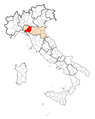
Province of Parma
- province of Italy
Hiking in Province of Parma
The Province of Parma, located in the Emilia-Romagna region of Italy, offers a variety of beautiful hiking opportunities that showcase its natural landscapes, historical sites, and cultural heritage. Here are some highlights to consider when hiking in this area:...
- Country:
- Capital: Parma
- Postal Code: 43010–43059; 43121–43126
- Local Dialing Code: 0524; 0521; 0525
- Licence Plate Code: PR
- Coordinates: 44° 47' 42" N, 10° 19' 52" E
- GPS tracks (wikiloc): [Link]
- Area: 3449.32 sq km
- Web site: [Link]


Province of Piacenza
- province of Italy
Hiking in Province of Piacenza
The Province of Piacenza, located in the Emilia-Romagna region of Italy, offers a variety of hiking opportunities that cater to different skill levels and preferences. Known for its diverse landscapes, which include rolling hills, lush valleys, and the Apennine Mountains, Piacenza is a fantastic destination for nature lovers and outdoor enthusiasts....
- Country:
- Capital: Piacenza
- Postal Code: 29010–29029; 29121–29122
- Local Dialing Code: 0523
- Licence Plate Code: PC
- Coordinates: 45° 3' 0" N, 9° 42' 0" E
- GPS tracks (wikiloc): [Link]
- Area: 2589.47 sq km
- Web site: [Link]