Rochefort (Rochefort)

- commune in Charente-Maritime, France
- Country:

- Postal Code: 17300
- Coordinates: 45° 56' 31" N, 0° 58' 1" E


- GPS tracks (wikiloc): [Link]
- Area: 21.95 sq km
- Population: 24045
- Web site: http://www.ville-rochefort.fr
- Wikipedia en: wiki(en)
- Wikipedia: wiki(fr)
- Wikidata storage: Wikidata: Q207587
- Wikipedia Commons Gallery: [Link]
- Wikipedia Commons Category: [Link]
- Freebase ID: [/m/0qb4s]
- Freebase ID: [/m/0qb4s]
- Freebase ID: [/m/0qb4s]
- GeoNames ID: Alt: [2983276]
- GeoNames ID: Alt: [2983276]
- GeoNames ID: Alt: [2983276]
- SIREN number: [211702998]
- SIREN number: [211702998]
- SIREN number: [211702998]
- BnF ID: [15249160b]
- BnF ID: [15249160b]
- BnF ID: [15249160b]
- VIAF ID: Alt: [129904479]
- VIAF ID: Alt: [129904479]
- VIAF ID: Alt: [129904479]
- GND ID: Alt: [4235624-6]
- GND ID: Alt: [4235624-6]
- GND ID: Alt: [4235624-6]
- archINFORM location ID: [696]
- archINFORM location ID: [696]
- archINFORM location ID: [696]
- MusicBrainz area ID: [8f54ca40-cd48-42f5-8bf2-c2a444c33f9e]
- MusicBrainz area ID: [8f54ca40-cd48-42f5-8bf2-c2a444c33f9e]
- MusicBrainz area ID: [8f54ca40-cd48-42f5-8bf2-c2a444c33f9e]
- Quora topic ID: [Rochefort-Charente-Maritime]
- Quora topic ID: [Rochefort-Charente-Maritime]
- Quora topic ID: [Rochefort-Charente-Maritime]
- SUDOC authorities ID: [061283894]
- SUDOC authorities ID: [061283894]
- SUDOC authorities ID: [061283894]
- Encyclopædia Britannica Online ID: [place/Rochefort]
- Encyclopædia Britannica Online ID: [place/Rochefort]
- Encyclopædia Britannica Online ID: [place/Rochefort]
- Gran Enciclopèdia Catalana ID: [0056228]
- Gran Enciclopèdia Catalana ID: [0056228]
- Gran Enciclopèdia Catalana ID: [0056228]
- ISNI: Alt: [0000 0001 2156 7223]
- ISNI: Alt: [0000 0001 2156 7223]
- ISNI: Alt: [0000 0001 2156 7223]
- YouTube channel ID: [UC3_snm57IlOjIbvyZA4__Cg]
- YouTube channel ID: [UC3_snm57IlOjIbvyZA4__Cg]
- YouTube channel ID: [UC3_snm57IlOjIbvyZA4__Cg]
- INSEE municipality code: 17299
- INSEE municipality code: 17299
- INSEE municipality code: 17299
Shares border with regions:

Breuil-Magné
- commune in Charente-Maritime, France
- Country:
- Postal Code: 17870
- Coordinates: 45° 59' 5" N, 0° 57' 36" E
- GPS tracks (wikiloc): [Link]
- Area: 22.25 sq km
- Population: 1638
- Web site: [Link]


Vergeroux
- commune in Charente-Maritime, France
- Country:
- Postal Code: 17300
- Coordinates: 45° 57' 39" N, 0° 59' 10" E
- GPS tracks (wikiloc): [Link]
- Area: 5.53 sq km
- Population: 1182


Saint-Nazaire-sur-Charente
- commune in Charente-Maritime, France
- Country:
- Postal Code: 17780
- Coordinates: 45° 56' 8" N, 1° 3' 10" E
- GPS tracks (wikiloc): [Link]
- Area: 20.31 sq km
- Population: 1183
- Web site: [Link]


Saint-Hippolyte
- commune in Charente-Maritime, France
- Country:
- Postal Code: 17430
- Coordinates: 45° 55' 18" N, 0° 53' 50" E
- GPS tracks (wikiloc): [Link]
- Area: 23.28 sq km
- Population: 1412
- Web site: [Link]


Loire-les-Marais
- commune in Charente-Maritime, France
- Country:
- Postal Code: 17870
- Coordinates: 45° 59' 36" N, 0° 55' 51" E
- GPS tracks (wikiloc): [Link]
- Area: 12.46 sq km
- Population: 374

Échillais
- commune in Charente-Maritime, France
- Country:
- Postal Code: 17620
- Coordinates: 45° 53' 54" N, 0° 57' 6" E
- GPS tracks (wikiloc): [Link]
- Area: 14.72 sq km
- Population: 3502
- Web site: [Link]


Tonnay-Charente
- commune in Charente-Maritime, France
- Country:
- Postal Code: 17430
- Coordinates: 45° 56' 37" N, 0° 53' 29" E
- GPS tracks (wikiloc): [Link]
- Area: 34.39 sq km
- Population: 7958
- Web site: [Link]
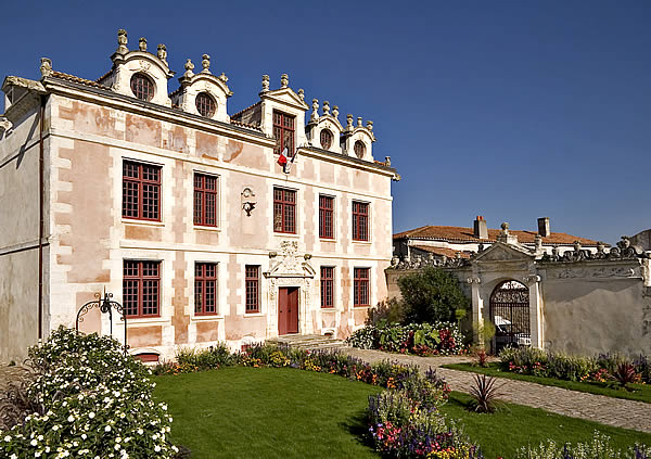
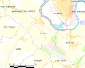
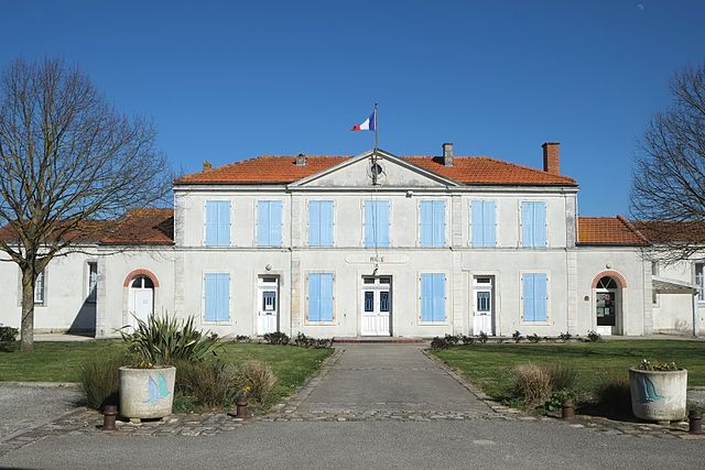
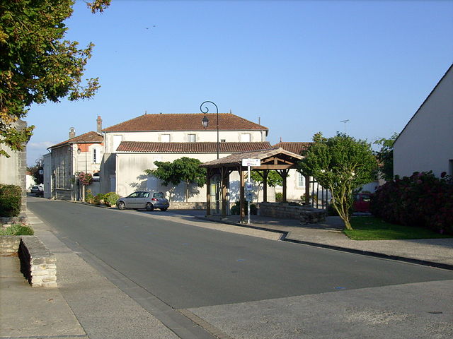
Soubise
- commune in Charente-Maritime, France
- Country:
- Postal Code: 17780
- Coordinates: 45° 55' 31" N, 1° 0' 32" E
- GPS tracks (wikiloc): [Link]
- Area: 10.93 sq km
- Population: 2970
- Web site: [Link]