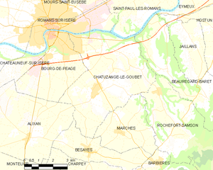
Rochefort-Samson (Rochefort-Samson)

- commune in Drôme, France
 Hiking in Rochefort-Samson
Rochefort-Samson, located in the Drôme department of the Auvergne-Rhône-Alpes region in southeastern France, is known for its beautiful landscapes, diverse flora and fauna, and welcoming hiking trails. Here are some key highlights for hiking in this area:
Trails and Routes
-
Tranquil Trails: Rochefort-Samson offers various hiking trails that range from easy walks suitable for families to more challenging hikes for seasoned adventurers. The trails weave through forests, hills, and offer panoramic views of the surrounding landscapes.
-
Circuit de la Roche des Aures: This is a popular loop trail that showcases stunning views of the Vercors mountains and the surrounding countryside. It features diverse terrain, including woodlands and open fields.
-
Lac de Rochefort: A picturesque spot for a more leisurely hike or even a picnic. The lake is surrounded by scenic trails and is a great area for birdwatching and enjoying nature.
Natural Attractions
-
Diverse Ecosystems: The region boasts a variety of ecosystems, from dense forests to open grasslands, home to numerous wildlife species and plant life. Keep an eye out for local flora and fauna as you hike.
-
Panoramic Views: Many trails offer stunning views over the Rhône Valley, Vercors Massif, and, on clear days, even the Alps in the distance.
Practical Tips
-
Best Time to Hike: Spring and autumn are fantastic seasons for hiking in Rochefort-Samson, with mild weather and vibrant colors. Summer can get warm, while winter may bring snow in higher elevations, so plan accordingly.
-
Safety: Always check trail conditions before heading out and ensure you have adequate supplies, including water, food, and a first-aid kit. Also, wearing sturdy hiking boots is recommended.
-
Trail Maps: Local tourist offices or websites can provide detailed maps and information on trail conditions, distances, and durations.
Local Amenities
Rochefort-Samson has a few local amenities where you may find dining options, accommodations, and visitor information. It's beneficial to plan your trips with these resources in mind.
Whether you are a casual hiker or a seasoned trekker, Rochefort-Samson offers beautiful and tranquil trails that allow you to experience the natural beauty of southeastern France. Be sure to respect the natural environment and follow local guidelines for an enjoyable experience!
- Country:

- Postal Code: 26300
- Coordinates: 44° 58' 23" N, 5° 9' 6" E


- GPS tracks (wikiloc): [Link]
- Area: 24.59 sq km
- Population: 994
- Wikipedia en: wiki(en)
- Wikipedia: wiki(fr)
- Wikidata storage: Wikidata: Q632455
- Wikipedia Commons Category: [Link]
- Freebase ID: [/m/03mhjkm]
- GeoNames ID: Alt: [6430193]
- SIREN number: [212602734]
- BnF ID: [152531336]
- INSEE municipality code: 26273
Shares border with regions:


Barbières
- commune in Drôme, France
Hiking in Barbières
Barbières is a charming village located in the Drôme department of the Auvergne-Rhône-Alpes region in France. It offers beautiful landscapes and a variety of hiking trails suitable for different levels of hikers. Here are some key points to consider for hiking in Barbières:...
- Country:
- Postal Code: 26300
- Coordinates: 44° 57' 23" N, 5° 8' 27" E
- GPS tracks (wikiloc): [Link]
- Area: 14.4 sq km
- Population: 1013
Chatuzange-le-Goubet
- commune in Drôme, France
Hiking in Chatuzange-le-Goubet
Chatuzange-le-Goubet is a charming commune located in the Drôme department of southeastern France, nestled near the picturesque foothills of the Alps. While the area is not as widely recognized for hiking as some of its neighboring regions, it still offers beautiful landscapes and serene trails that can appeal to outdoor enthusiasts....
- Country:
- Postal Code: 26300
- Coordinates: 45° 0' 24" N, 5° 5' 27" E
- GPS tracks (wikiloc): [Link]
- AboveSeaLevel: 238 м m
- Area: 28.24 sq km
- Population: 5311
- Web site: [Link]


Beauregard-Baret
- commune in Drôme, France
Hiking in Beauregard-Baret
Beauregard-Baret is a picturesque region located in the Drôme department of southeastern France. Known for its beautiful landscapes, it's a fantastic destination for hiking enthusiasts of all levels....
- Country:
- Postal Code: 26300
- Coordinates: 45° 0' 57" N, 5° 9' 5" E
- GPS tracks (wikiloc): [Link]
- Area: 23.44 sq km
- Population: 808
- Web site: [Link]

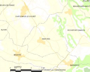
Marches
- commune in Drôme, France
Hiking in Marches
Hiking in the Drôme region, particularly in the Marches area, offers a wonderful blend of stunning landscapes, diverse terrain, and rich cultural heritage. Here's what you can expect when hiking in this beautiful French region:...
- Country:
- Postal Code: 26300
- Coordinates: 44° 58' 34" N, 5° 6' 29" E
- GPS tracks (wikiloc): [Link]
- Area: 11.09 sq km
- Population: 788
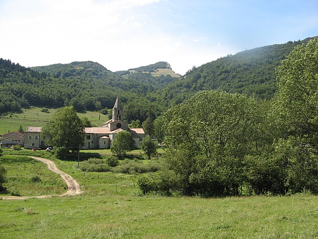

Léoncel
- commune in Drôme, France
Hiking in Léoncel
Léoncel is a beautiful village located in the Drôme department of the Auvergne-Rhône-Alpes region in southeastern France. It is situated in the Vercors Massif, which offers diverse landscapes and rich natural beauty, making it an excellent destination for hiking enthusiasts....
- Country:
- Postal Code: 26190
- Coordinates: 44° 54' 39" N, 5° 11' 34" E
- GPS tracks (wikiloc): [Link]
- Area: 43.01 sq km
- Population: 58