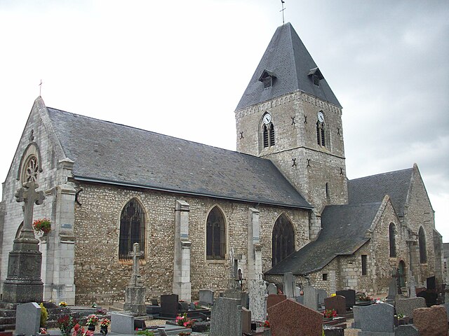
Romilly-sur-Andelle (Romilly-sur-Andelle)

- commune in Eure, France
- Country:

- Postal Code: 27610
- Coordinates: 49° 19' 52" N, 1° 15' 32" E


- GPS tracks (wikiloc): [Link]
- Area: 8.53 sq km
- Population: 3229
- Web site: http://www.romilly-sur-andelle.fr/
- Wikipedia en: wiki(en)
- Wikipedia: wiki(fr)
- Wikidata storage: Wikidata: Q525926
- Wikipedia Commons Category: [Link]
- Freebase ID: [/m/03nqlbl]
- Freebase ID: [/m/03nqlbl]
- GeoNames ID: Alt: [2982973]
- GeoNames ID: Alt: [2982973]
- SIREN number: [212704936]
- SIREN number: [212704936]
- BnF ID: [152537288]
- BnF ID: [152537288]
- VIAF ID: Alt: [236555847]
- VIAF ID: Alt: [236555847]
- PACTOLS thesaurus ID: [pcrtE53tVvTmcB]
- PACTOLS thesaurus ID: [pcrtE53tVvTmcB]
- INSEE municipality code: 27493
- INSEE municipality code: 27493
Shares border with regions:


Amfreville-sous-les-Monts
- commune in Eure, France
- Country:
- Postal Code: 27380
- Coordinates: 49° 18' 16" N, 1° 16' 12" E
- GPS tracks (wikiloc): [Link]
- Area: 7.52 sq km
- Population: 509

Pîtres
- commune in Eure, France
- Country:
- Postal Code: 27590
- Coordinates: 49° 19' 10" N, 1° 13' 33" E
- GPS tracks (wikiloc): [Link]
- Area: 10.97 sq km
- Population: 2452
- Web site: [Link]


Flipou
- commune in Eure, France
- Country:
- Postal Code: 27380
- Coordinates: 49° 18' 53" N, 1° 16' 45" E
- GPS tracks (wikiloc): [Link]
- Area: 6.97 sq km
- Population: 335

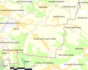
La Neuville-Chant-d'Oisel
- commune in Seine-Maritime, France
- Country:
- Postal Code: 76520
- Coordinates: 49° 22' 4" N, 1° 14' 35" E
- GPS tracks (wikiloc): [Link]
- AboveSeaLevel: 168 м m
- Area: 21.83 sq km
- Population: 2242
- Web site: [Link]


Pont-Saint-Pierre
- commune in Eure, France
- Country:
- Postal Code: 27360
- Coordinates: 49° 20' 7" N, 1° 16' 30" E
- GPS tracks (wikiloc): [Link]
- Area: 6.9 sq km
- Population: 1168