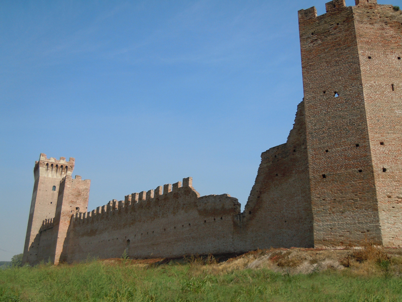
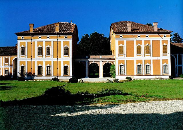
Roncoferraro (Roncoferraro)
.svg)
- Italian comune
 Hiking in Roncoferraro
Roncoferraro is a small town located in the Lombardy region of northern Italy, near the city of Mantua. The area is known for its scenic landscapes, which can provide a lovely backdrop for hiking enthusiasts. While the town itself may not have extensive hiking trails, you can explore the surrounding countryside and waterways, offering a blend of natural beauty and cultural heritage.
Hiking Opportunities:
-
Natural Reserves and Parks:
- The nearby Parco del Mincio is a great spot for outdoor activities. This park features picturesque trails alongside the Mincio River, where you can enjoy walking or hiking while observing a variety of flora and fauna.
-
Countryside Trails:
- The flat terrain around Roncoferraro lends itself to easy hikes. You can create your route through the agricultural fields, orchards, and small woodlands, taking in the local flora and fauna.
-
Cultural Treks:
- Combining hiking with local culture, you can explore nearby historical sites. For instance, the area’s vineyards and old farms can create a convoy of culture-rich hikes.
Tips for Hiking in the Area:
-
Check the Weather: The weather can change rapidly, so dress in layers and be prepared for changes. Always check local forecasts before heading out.
-
Stay Hydrated: Bring plenty of water, especially during the warmer months, as the trails might not have facilities.
-
Navigation: Carry a map or a GPS device, as some trails might not be well-marked. Consider downloading offline maps for better access.
-
Wildlife Awareness: Be aware of the local wildlife. While significant large animals are rare, it's always good to respect nature and know what to expect.
-
Local Regulations: Always follow local regulations and guidelines regarding trail use, especially in nature reserves or parks.
-
Connecting with Local Guides: If you're unfamiliar with the area, consider hiring a local guide or joining a hiking group to enhance your experience.
Overall, while Roncoferraro may be small, its location in Lombardy gives you access to beautiful regional trails and a rich cultural landscape, making it a pleasant destination for hiking enthusiasts.
- Country:

- Postal Code: 46037
- Local Dialing Code: 0376
- Licence Plate Code: MN
- Coordinates: 45° 8' 3" N, 10° 57' 9" E


- GPS tracks (wikiloc): [Link]
- AboveSeaLevel: 25 м m
- Area: 63.43 sq km
- Population: 6982
- Web site: http://www.comune.roncoferraro.mn.it/
- Wikipedia en: wiki(en)
- Wikipedia: wiki(it)
- Wikidata storage: Wikidata: Q42334
- Wikipedia Commons Category: [Link]
- Freebase ID: [/m/0gk0ns]
- GeoNames ID: Alt: [6540647]
- VIAF ID: Alt: [158428408]
- OSM relation ID: [44234]
- TGN ID: [7042086]
- UN/LOCODE: [ITROF]
- ISTAT ID: 020052
- Italian cadastre code: H541
Shares border with regions:
Villimpenta
- Italian comune
Hiking in Villimpenta
Villimpenta is a small municipality located in the province of Mantua, in the Lombardy region of northern Italy. While it may not be a widely known hiking destination, the surrounding area offers scenic landscapes and a chance to experience nature in a more tranquil setting....
- Country:
- Postal Code: 46039
- Local Dialing Code: 0376
- Licence Plate Code: MN
- Coordinates: 45° 9' 0" N, 11° 2' 0" E
- GPS tracks (wikiloc): [Link]
- AboveSeaLevel: 18 м m
- Area: 14.85 sq km
- Population: 2167
- Web site: [Link]


Castel d'Ario
- Italian comune
Hiking in Castel d'Ario
Castel d'Ario is a small town located in the province of Mantua, Italy. While it may not be widely known as a hiking destination, the surrounding areas offer beautiful landscapes and the opportunity for outdoor activities, including hiking....
- Country:
- Postal Code: 46033
- Local Dialing Code: 0376
- Licence Plate Code: MN
- Coordinates: 45° 11' 20" N, 10° 58' 32" E
- GPS tracks (wikiloc): [Link]
- AboveSeaLevel: 24 м m
- Area: 22.58 sq km
- Population: 4659
- Web site: [Link]
Bagnolo San Vito
- Italian comune
Hiking in Bagnolo San Vito
Bagnolo San Vito is a charming town located in the Lombardy region of Italy, surrounded by beautiful landscapes that offer a variety of hiking opportunities. Here’s what you need to know about hiking in and around Bagnolo San Vito:...
- Country:
- Postal Code: 46031
- Local Dialing Code: 0376
- Licence Plate Code: MN
- Coordinates: 45° 5' 0" N, 10° 53' 0" E
- GPS tracks (wikiloc): [Link]
- AboveSeaLevel: 19 м m
- Area: 49.2 sq km
- Population: 5938
- Web site: [Link]


San Giorgio Bigarello
- Italian comune
Hiking in San Giorgio Bigarello
San Giorgio Bigarello is a small municipality located in the Lombardy region of Italy, near the city of Mantova (Mantua). While it may not be as famous for hiking as some other areas in Italy, it offers several opportunities for nature walks and exploring the surrounding countryside....
- Country:
- Postal Code: 46030
- Local Dialing Code: 0376
- Licence Plate Code: MN
- Coordinates: 45° 9' 0" N, 10° 50' 0" E
- GPS tracks (wikiloc): [Link]
- AboveSeaLevel: 21 м m
- Area: 24.53 sq km
- Population: 9678
- Web site: [Link]

Sustinente
- Italian comune
Hiking in Sustinente
Sustinente, a small commune in the Lombardy region of Italy, offers a unique backdrop for hiking enthusiasts. Nestled in the verdant landscapes of the Po Valley and close to the varied terrain of the surrounding areas, Sustinente provides a mix of scenic rural trails and easy access to more rugged hikes nearby....
- Country:
- Postal Code: 46030
- Local Dialing Code: 0386
- Licence Plate Code: MN
- Coordinates: 45° 4' 7" N, 11° 1' 18" E
- GPS tracks (wikiloc): [Link]
- AboveSeaLevel: 17 м m
- Area: 26.27 sq km
- Population: 2023
- Web site: [Link]


Mantua
- Italian comune
Hiking in Mantua
Hiking in Mantua, located in northern Italy, offers a unique blend of natural beauty, historical sites, and cultural experiences. While Mantua itself is a small city surrounded by three lakes—Lago di Mezzo, Lago di Inferiore, and Lago di Superiore—it serves as a great base for exploring the surrounding landscapes and trails. Here are some highlights of hiking in and around Mantua:...
- Country:
- Postal Code: 46100
- Local Dialing Code: 0376
- Licence Plate Code: MN
- Coordinates: 45° 9' 23" N, 10° 47' 28" E
- GPS tracks (wikiloc): [Link]
- AboveSeaLevel: 19 м m
- Area: 63 sq km
- Population: 49308
- Web site: [Link]