Rose, Calabria (Rose)
.svg)
- Italian comune
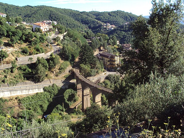
 Hiking in Rose, Calabria
Hiking in Rose, Calabria, offers a unique and beautiful experience in a less-commercialized part of Italy. Nestled in the Aspromonte National Park, Rose boasts stunning landscapes, diverse flora and fauna, and a variety of trails suited for different levels of hikers.
Key Highlights of Hiking in Rose:
-
Scenic Trails: The area features numerous trails that cater to different levels of hiking experience, from easy walks suitable for families to more challenging hikes for seasoned adventurers.
-
Natural Beauty: Hikers can enjoy breathtaking views of the Aspromonte mountains, deep gorges, and panoramic vistas that overlook the surrounding countryside and coastlines. The diverse ecosystems offer opportunities to see unique plant species and wildlife.
-
Historical Sites: Along some trails, you may come across old shepherd's paths, ruins, and ancient stone houses that tell the story of the region's past. The combination of nature and history makes for a rich hiking experience.
-
Cultural Experiences: The small towns around Rose, including the main village, offer a chance to experience local culture, cuisine, and traditions. Stopping by local eateries to taste traditional Calabrian dishes can enhance your hiking experience.
-
Weather Considerations: The best times to hike in Rose are spring (April to June) and early autumn (September to October), when temperatures are mild, and nature is in full bloom. Summers can be quite hot, so early morning or later afternoon hikes are advisable during that time.
-
Safety and Preparation: As in any hiking adventure, it’s important to wear appropriate footwear, carry enough water, and have a basic first-aid kit. Although the trails are generally well-marked, having a map or GPS can be helpful.
-
Guided Tours: For those who prefer a guided experience, there are local hiking guides who can provide insights into the geography, flora, and fauna of the region, as well as ensure your safety on the trails.
When planning your hike in Rose, it's advisable to check local resources for any trail updates and regulations, especially if you venture into more remote areas. Enjoy your hiking adventure in this beautiful part of Calabria!
- Country:

- Postal Code: 87040
- Local Dialing Code: 0984
- Licence Plate Code: CS
- Coordinates: 39° 24' 0" N, 16° 17' 0" E


- GPS tracks (wikiloc): [Link]
- AboveSeaLevel: 399 м m
- Area: 47.49 sq km
- Population: 4395
- Web site: http://www.comune.rose.cs.it
- Wikipedia en: wiki(en)
- Wikipedia: wiki(it)
- Wikidata storage: Wikidata: Q53950
- Wikipedia Commons Category: [Link]
- Freebase ID: [/m/0f_ql6]
- GeoNames ID: Alt: [6540038]
- OSM relation ID: [39918]
- ISTAT ID: 078106
- Italian cadastre code: H565
Shares border with regions:


Acri
- Italian comune
Hiking in Acri
Acri, located in the Calabria region of southern Italy, offers some wonderful opportunities for hiking enthusiasts. This area is characterized by a stunning mix of Mediterranean landscapes, historical sites, and charming rural towns. Here are a few highlights to consider when planning a hiking trip in Acri:...
- Country:
- Postal Code: 87041
- Local Dialing Code: 0984
- Licence Plate Code: CS
- Coordinates: 39° 30' 0" N, 16° 23' 0" E
- GPS tracks (wikiloc): [Link]
- AboveSeaLevel: 720 м m
- Area: 200.63 sq km
- Population: 20442
- Web site: [Link]
Castiglione Cosentino
- Italian comune
Hiking in Castiglione Cosentino
Castiglione Cosentino is a charming town located in the Calabria region of southern Italy, offering beautiful hiking opportunities with stunning views and rich natural landscapes. Here are some key points about hiking in and around Castiglione Cosentino:...
- Country:
- Postal Code: 87040
- Local Dialing Code: 0984
- Licence Plate Code: CS
- Coordinates: 39° 21' 0" N, 16° 17' 0" E
- GPS tracks (wikiloc): [Link]
- AboveSeaLevel: 350 м m
- Area: 14.09 sq km
- Population: 2961
- Web site: [Link]


Celico
- Italian comune
Hiking in Celico
Celico is a charming town located in the Lombardy region of Italy, nestled in the foothills of the Alps near the larger city of Como. It offers a variety of hiking opportunities with stunning landscapes, picturesque views, and trails suited for different skill levels. Here are some highlights about hiking in and around Celico:...
- Country:
- Postal Code: 87053
- Local Dialing Code: 0984
- Licence Plate Code: CS
- Coordinates: 39° 19' 0" N, 16° 20' 0" E
- GPS tracks (wikiloc): [Link]
- AboveSeaLevel: 750 м m
- Area: 99.75 sq km
- Population: 2824
- Web site: [Link]
Luzzi
- Italian comune
Hiking in Luzzi
Luzzi, a charming town located in the Calabria region of southern Italy, offers a variety of hiking opportunities that showcase its stunning natural landscapes and rich cultural heritage. Here are some key points to consider if you're planning to hike in and around Luzzi:...
- Country:
- Postal Code: 87040
- Local Dialing Code: 0984
- Licence Plate Code: CS
- Coordinates: 39° 27' 0" N, 16° 17' 0" E
- GPS tracks (wikiloc): [Link]
- AboveSeaLevel: 375 м m
- Area: 77.6 sq km
- Population: 9206
- Web site: [Link]


Montalto Uffugo
- Italian comune
Hiking in Montalto Uffugo
Montalto Uffugo, located in the Calabria region of southern Italy, offers a variety of hiking opportunities that showcase its beautiful landscapes, rich biodiversity, and historical sites. Here are some key highlights for hiking in this area:...
- Country:
- Postal Code: 87046
- Local Dialing Code: 0984
- Licence Plate Code: CS
- Coordinates: 39° 24' 0" N, 16° 9' 0" E
- GPS tracks (wikiloc): [Link]
- AboveSeaLevel: 500 м m
- Area: 76.67 sq km
- Population: 20213
- Web site: [Link]


Rende
- Italian comune
Hiking in Rende
Rende, located in the Calabria region of Italy, offers various hiking opportunities that showcase its natural beauty, rich history, and stunning landscapes. Here are some highlights about hiking in and around Rende:...
- Country:
- Postal Code: 87036
- Local Dialing Code: 0984
- Licence Plate Code: CS
- Coordinates: 39° 20' 0" N, 16° 11' 0" E
- GPS tracks (wikiloc): [Link]
- AboveSeaLevel: 480 м m
- Area: 55.28 sq km
- Population: 35727
- Web site: [Link]

San Pietro in Guarano
- Italian comune
Hiking in San Pietro in Guarano
San Pietro in Guarano, located in Calabria, Italy, offers a unique hiking experience characterized by its beautiful landscapes, mountainous terrain, and lush greenery. Here are some highlights and tips for hiking in this area:...
- Country:
- Postal Code: 87047
- Local Dialing Code: 0984
- Licence Plate Code: CS
- Coordinates: 39° 20' 0" N, 16° 19' 0" E
- GPS tracks (wikiloc): [Link]
- AboveSeaLevel: 625 м m
- Area: 48.35 sq km
- Population: 3646
- Web site: [Link]