Rougnac (Rougnac)

- commune in Charente, France
- Country:

- Postal Code: 16320
- Coordinates: 45° 32' 10" N, 0° 21' 30" E


- GPS tracks (wikiloc): [Link]
- Area: 29.88 sq km
- Population: 410
- Web site: http://www.rougnac16.fr
- Wikipedia en: wiki(en)
- Wikipedia: wiki(fr)
- Wikidata storage: Wikidata: Q1624397
- Wikipedia Commons Category: [Link]
- Freebase ID: [/m/03mccyj]
- GeoNames ID: Alt: [2982571]
- SIREN number: [211602859]
- BnF ID: [15248724w]
- INSEE municipality code: 16285
Shares border with regions:


Charras
- commune in Charente, France
- Country:
- Postal Code: 16380
- Coordinates: 45° 32' 33" N, 0° 24' 58" E
- GPS tracks (wikiloc): [Link]
- Area: 15.12 sq km
- Population: 356


Gardes-le-Pontaroux
- commune in Charente, France
- Country:
- Postal Code: 16320
- Coordinates: 45° 31' 10" N, 0° 18' 17" E
- GPS tracks (wikiloc): [Link]
- Area: 13.3 sq km
- Population: 268

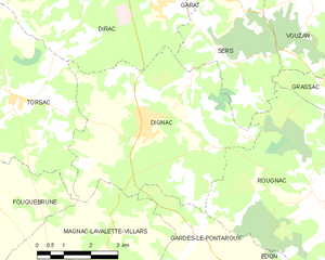
Dignac
- commune in Charente, France
- Country:
- Postal Code: 16410
- Coordinates: 45° 33' 23" N, 0° 16' 49" E
- GPS tracks (wikiloc): [Link]
- Area: 27.66 sq km
- Population: 1315


Édon
- commune in Charente, France
- Country:
- Postal Code: 16320
- Coordinates: 45° 29' 19" N, 0° 21' 15" E
- GPS tracks (wikiloc): [Link]
- Area: 16.49 sq km
- Population: 256


Sers
- commune in Charente, France
- Country:
- Postal Code: 16410
- Coordinates: 45° 35' 50" N, 0° 19' 22" E
- GPS tracks (wikiloc): [Link]
- Area: 14.17 sq km
- Population: 857


Combiers
- commune in Charente, France
- Country:
- Postal Code: 16320
- Coordinates: 45° 29' 32" N, 0° 24' 53" E
- GPS tracks (wikiloc): [Link]
- Area: 23.96 sq km
- Population: 125
- Web site: [Link]
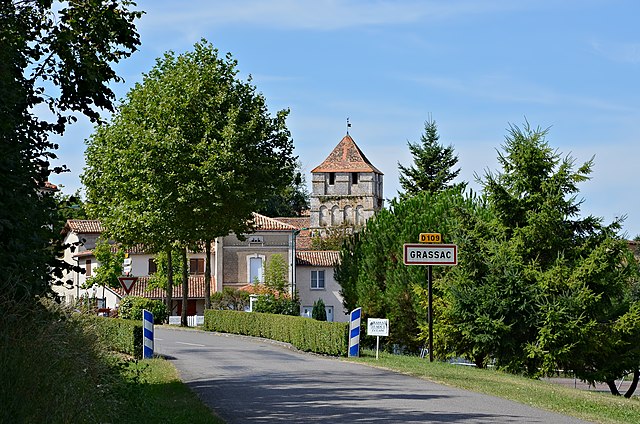

Grassac
- commune in Charente, France
- Country:
- Postal Code: 16380
- Coordinates: 45° 35' 9" N, 0° 24' 10" E
- GPS tracks (wikiloc): [Link]
- Area: 28.23 sq km
- Population: 325