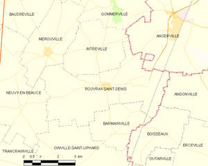
Rouvray-Saint-Denis (Rouvray-Saint-Denis)
- commune in Eure-et-Loir, France
- Country:

- Postal Code: 28310
- Coordinates: 48° 16' 42" N, 1° 56' 41" E


- GPS tracks (wikiloc): [Link]
- Area: 19.35 sq km
- Population: 441
- Wikipedia en: wiki(en)
- Wikipedia: wiki(fr)
- Wikidata storage: Wikidata: Q662702
- Wikipedia Commons Category: [Link]
- Freebase ID: [/m/03nrm8p]
- GeoNames ID: Alt: [2982407]
- SIREN number: [212803191]
- BnF ID: [152542493]
- INSEE municipality code: 28319
Shares border with regions:


Andonville
- commune in Loiret, France
- Country:

- Postal Code: 45480
- Coordinates: 48° 16' 13" N, 2° 1' 52" E


- GPS tracks (wikiloc): [Link]
- Area: 11.94 sq km
- Population: 223


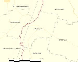
Boisseaux
- commune in Loiret, France
- Country:

- Postal Code: 45480
- Coordinates: 48° 15' 24" N, 1° 59' 16" E


- GPS tracks (wikiloc): [Link]
- Area: 7.19 sq km
- Population: 492
- Web site: [Link]


Angerville
- commune in Essonne, France
- Country:

- Postal Code: 91670
- Coordinates: 48° 18' 37" N, 1° 59' 54" E


- GPS tracks (wikiloc): [Link]
- Area: 25.83 sq km
- Population: 4193
- Web site: [Link]
