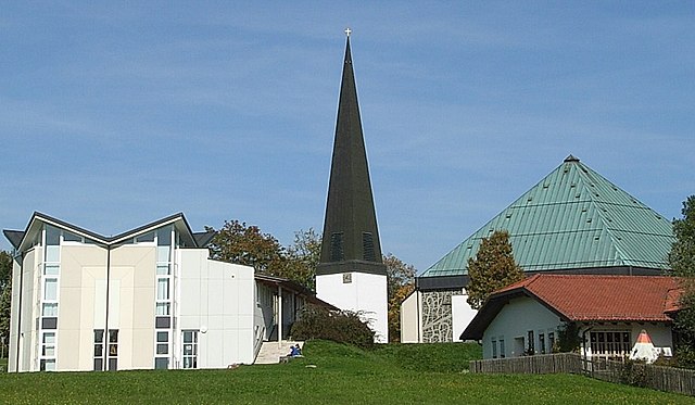
Ruderting (Ruderting)
- municipality of Germany
Ruderting, a small municipality in Bavaria, Germany, offers a variety of outdoor activities, including hiking. The area is characterized by its beautiful landscapes, including rolling hills, forests, and agricultural fields, making it an appealing destination for nature lovers.
Hiking Trails
Though Ruderting may not be as well-known for hiking as some larger regions in Bavaria, you can find several local trails that provide pleasant walking experiences. Here are some general tips about hiking in the area:
-
Local Trails: Look for local hiking trails that meander through scenic landscapes. Many rural areas in Bavaria have marked paths, often linked to regional trail networks.
-
Nature Reserves: Explore nearby nature reserves or parks where you can enjoy well-maintained trails, wildlife, and diverse flora.
-
Difficulty Levels: Trails in this region can vary in difficulty, from easy walks suitable for families to more challenging routes for experienced hikers. Always check the trail markers for difficulty ratings.
-
Scenic Views: Take advantage of vantage points along the trails that offer picturesque views of the surrounding countryside, especially during sunset or sunrise.
Essential Tips
- Mapping and Navigation: Use local hiking maps or mobile apps to navigate the trails. GPS can help you stay on the right path.
- Seasonal Considerations: Consider the season when planning your hikes. Spring and fall are often ideal for hiking, with milder temperatures and beautiful scenery.
- Safety: Always inform someone about your hiking plans, especially if you're venturing alone. Bring adequate supplies, such as water, snacks, and a first-aid kit.
Nearby Hiking Options
If you're open to exploring beyond Ruderting, consider some well-known hiking areas in the larger region of Bavaria, such as the Bavarian Forest National Park or the Alps, which offer a wider variety of trails and stunning landscapes.
Always remember to check local hiking associations or community boards in Ruderting for upcoming guided hikes or events that can enhance your experience in the area. Enjoy your hiking adventure!
- Country:

- Postal Code: 94161
- Local Dialing Code: 08509
- Licence Plate Code: PA
- Coordinates: 48° 39' 12" N, 13° 24' 31" E


- GPS tracks (wikiloc): [Link]
- AboveSeaLevel: 450 м m
- Area: 12.96 sq km
- Population: 2487
- Web site: http://www.ruderting.de
- Wikipedia en: wiki(en)
- Wikipedia: wiki(de)
- Wikidata storage: Wikidata: Q517953
- Wikipedia Commons Category: [Link]
- Freebase ID: [/m/02q6tv3]
- GeoNames ID: Alt: [2843399]
- VIAF ID: Alt: [246271210]
- OSM relation ID: [958108]
- GND ID: Alt: [4454539-3]
- Historical Gazetteer (GOV) ID: [RUDIN1JN68RP]
- Bavarikon ID: [ODB_A00001571]
- German municipality key: 09275144
Shares border with regions:


Neukirchen vorm Wald
- municipality in Bavaria, Germany
 Hiking in Neukirchen vorm Wald
Neukirchen vorm Wald, located in Bavaria, Germany, is a charming village that offers appealing hiking opportunities in a picturesque natural setting. The region is characterized by rolling hills, lush forests, and beautiful meadows, making it an ideal destination for hikers of all levels....
- Country:

- Postal Code: 94154
- Local Dialing Code: 08504
- Licence Plate Code: PA
- Coordinates: 48° 41' 0" N, 13° 23' 0" E


- GPS tracks (wikiloc): [Link]
- AboveSeaLevel: 466 м m
- Area: 24.3 sq km
- Population: 2071
- Web site: [Link]


Hutthurm
- municipality of Germany
Hutthurm, located in Bavaria, Germany, is a small town that serves as an excellent starting point for a variety of outdoor activities, including hiking. The surrounding region is characterized by its beautiful landscapes, rolling hills, forests, and scenic views, making it a delightful place for hikers of all levels....
- Country:

- Postal Code: 94116
- Local Dialing Code: 08505
- Licence Plate Code: PA
- Coordinates: 48° 40' 17" N, 13° 28' 16" E


- GPS tracks (wikiloc): [Link]
- AboveSeaLevel: 465 м m
- Area: 37.2 sq km
- Population: 4935
- Web site: [Link]


Salzweg
- municipality of Germany
Salzweg is a municipality located in Bavaria, Germany, near Passau, which is known for its beautiful landscapes and outdoor opportunities. Hiking enthusiasts will find plenty to explore in this region, characterized by rolling hills, scenic valleys, and lush forests....
- Country:

- Postal Code: 94121
- Local Dialing Code: 0851
- Licence Plate Code: PA
- Coordinates: 48° 36' 57" N, 13° 28' 57" E


- GPS tracks (wikiloc): [Link]
- AboveSeaLevel: 452 м m
- Area: 31.94 sq km
- Population: 5018
- Web site: [Link]

Tiefenbach
- human settlement in Germany
Tiefenbach, near Passau in Germany, is a wonderful area for hiking, boasting beautiful landscapes, scenic views, and a variety of trails suitable for different skill levels. Here are some key points about hiking in this area:...
- Country:

- Postal Code: 94113
- Local Dialing Code: 08509
- Licence Plate Code: PA
- Coordinates: 48° 37' 28" N, 13° 23' 56" E


- GPS tracks (wikiloc): [Link]
- AboveSeaLevel: 373 м m
- Area: 49.71 sq km
- Population: 5524
- Web site: [Link]
