Saint-Étienne-Roilaye (Saint-Étienne-Roilaye)

- commune in Oise, France
- Country:

- Postal Code: 60350
- Coordinates: 49° 22' 4" N, 3° 1' 11" E


- GPS tracks (wikiloc): [Link]
- Area: 7.96 sq km
- Population: 326
- Wikipedia en: wiki(en)
- Wikipedia: wiki(fr)
- Wikidata storage: Wikidata: Q1156023
- Wikipedia Commons Category: [Link]
- Freebase ID: [/m/03qg519]
- GeoNames ID: Alt: [6613552]
- SIREN number: [216005660]
- BnF ID: [15267807r]
- PACTOLS thesaurus ID: [pcrtweLXRfi3wS]
- INSEE municipality code: 60572
Shares border with regions:


Chelles
- commune in Oise, France
- Country:
- Postal Code: 60350
- Coordinates: 49° 21' 10" N, 3° 2' 4" E
- GPS tracks (wikiloc): [Link]
- Area: 9.08 sq km
- Population: 521

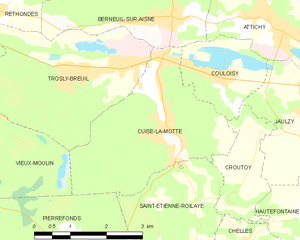
Cuise-la-Motte
- commune in Oise, France
- Country:
- Postal Code: 60350
- Coordinates: 49° 23' 13" N, 3° 0' 23" E
- GPS tracks (wikiloc): [Link]
- Area: 10.05 sq km
- Population: 2147
- Web site: [Link]

Retheuil
- commune in Aisne, France
- Country:
- Postal Code: 02600
- Coordinates: 49° 19' 19" N, 3° 0' 37" E
- GPS tracks (wikiloc): [Link]
- Area: 14.87 sq km
- Population: 379
- Web site: [Link]


Croutoy
- commune in Oise, France
- Country:
- Postal Code: 60350
- Coordinates: 49° 23' 11" N, 3° 2' 31" E
- GPS tracks (wikiloc): [Link]
- Area: 3.27 sq km
- Population: 212


Pierrefonds
- commune in Oise, France
- Country:
- Postal Code: 60350
- Coordinates: 49° 21' 4" N, 2° 58' 49" E
- GPS tracks (wikiloc): [Link]
- Area: 22.32 sq km
- Population: 1840
- Web site: [Link]