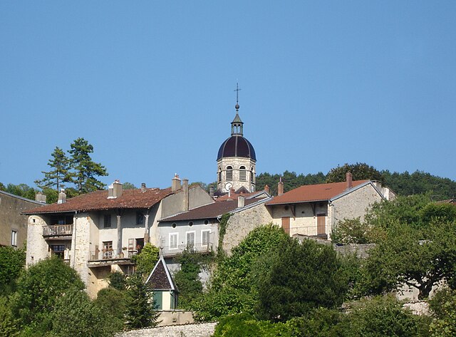
Saint-Étienne-du-Bois (Saint-Étienne-du-Bois)
- commune in Ain, France
 Hiking in Saint-Étienne-du-Bois
Saint-Étienne-du-Bois, located in the Ain department of the Auvergne-Rhône-Alpes region of France, offers a range of hiking opportunities for outdoor enthusiasts. The region is characterized by its picturesque landscapes, lush forests, and rolling hills, making it an inviting destination for both casual walkers and seasoned hikers.
Hiking Trails:
-
Local Trails: There are several marked hiking trails in and around Saint-Étienne-du-Bois that cater to different skill levels. These trails typically range from easy nature walks to more challenging hikes that explore the nearby hills and woodlands.
-
Monts Jura: Just a short drive from the village, the Monts Jura range offers more extensive hiking opportunities. Here, you'll find trails that showcase stunning views, diverse flora and fauna, and even some historical landmarks.
-
Lake and Countryside Walks: Trails are often available around local lakes and through the countryside. These routes provide a mix of scenic views and serene natural environments.
What to Expect:
- Scenery: Expect to encounter beautiful rural landscapes, wildflower meadows, woodlands, and panoramic views of the Jura Mountains and the Bresse plains.
- Wildlife: The area is home to various species of birds, deer, and other wildlife, giving you the chance to enjoy nature’s biodiversity.
- Cultural Sites: Along the trails, you may come across historical sites, quaint villages, and local farms, providing cultural enrichment as you hike.
Hiking Tips:
- Preparation: Check the weather forecast before your hike and dress in layers, as conditions can change. Sturdy hiking boots are advisable, particularly if you plan to tackle steeper or uneven trails.
- Navigation: Bring a map or a GPS device, especially on less-marked routes, to ensure you stay on track.
- Hydration and Snacks: Carry enough water and some snacks to keep your energy up during longer hikes.
Accessibility:
Saint-Étienne-du-Bois is relatively accessible, and depending on your starting point, you can find various trailheads just a short drive away. It's best to check local resources or visitor centers for updated trail information and maps.
Overall, hiking in Saint-Étienne-du-Bois can provide a fulfilling experience for nature lovers, families, and those wanting to explore the beautiful landscapes of this part of France.
- Country:

- Postal Code: 01370
- Coordinates: 46° 17' 17" N, 5° 17' 36" E


- GPS tracks (wikiloc): [Link]
- Area: 28.38 sq km
- Population: 2532
- Web site: http://www.st-etienne-du-bois.fr
- Wikipedia en: wiki(en)
- Wikipedia: wiki(fr)
- Wikidata storage: Wikidata: Q846508
- Wikipedia Commons Category: [Link]
- Wikipedia Commons Maps Category: [Link]
- Freebase ID: [/m/03h5v16]
- Freebase ID: [/m/03h5v16]
- GeoNames ID: Alt: [6424661]
- GeoNames ID: Alt: [6424661]
- SIREN number: [210103503]
- SIREN number: [210103503]
- INSEE municipality code: 01350
- INSEE municipality code: 01350
Shares border with regions:

Bény
- commune in Ain, France
Hiking in Bény
Bény is a picturesque region that offers a variety of hiking opportunities, typically characterized by its natural beauty, lush landscapes, and diverse trails. While specific trails and hiking conditions can vary, here are some general points to consider when hiking in Bény:...
- Country:
- Postal Code: 01370
- Coordinates: 46° 19' 10" N, 5° 17' 0" E
- GPS tracks (wikiloc): [Link]
- Area: 18.25 sq km
- Population: 747
- Web site: [Link]
Val-Revermont
- commune in Ain, France
Hiking in Val-Revermont
Val-Revermont is a picturesque region located in the foothills of the Jura Mountains in eastern France, offering an array of hiking opportunities for all skill levels. Known for its stunning landscapes, lush forests, rolling hills, and charming villages, Val-Revermont provides a beautiful setting for outdoor enthusiasts....
- Country:
- Postal Code: 01370
- Coordinates: 46° 16' 20" N, 5° 22' 12" E
- GPS tracks (wikiloc): [Link]
- Area: 45.42 sq km
- Web site: [Link]

Jasseron
- commune in Ain, France
Hiking in Jasseron
Jasseron, located in the Ain department of the Auvergne-Rhône-Alpes region in eastern France, offers beautiful landscapes for hiking enthusiasts. The area is characterized by rolling hills, lush greenery, and scenic views, making it an excellent destination for hikers of all levels....
- Country:
- Postal Code: 01250
- Coordinates: 46° 12' 45" N, 5° 19' 28" E
- GPS tracks (wikiloc): [Link]
- Area: 18.93 sq km
- Population: 1735
- Web site: [Link]

Marboz
- commune in Ain, France
- Country:
- Postal Code: 01851
- Coordinates: 46° 20' 33" N, 5° 15' 30" E
- GPS tracks (wikiloc): [Link]
- Area: 40.14 sq km
- Population: 2215
- Web site: [Link]
Treffort-Cuisiat
- former commune in Ain, France
Hiking in Treffort-Cuisiat
Treffort-Cuisiat, located in the Ain department of the Auvergne-Rhône-Alpes region in southeastern France, is an area that offers diverse and beautiful hiking opportunities. The landscape here is characterized by rolling hills, forests, and picturesque views, making it a great spot for both leisurely walks and more challenging hikes....
- Country:
- Postal Code: 02220
- Coordinates: 46° 16' 17" N, 5° 22' 6" E
- GPS tracks (wikiloc): [Link]
- Area: 39.41 sq km
- Population: 1728
- Web site: [Link]

Meillonnas
- commune in Ain, France
Hiking in Meillonnas
Meillonnas is a picturesque village in the Ain department of the Auvergne-Rhône-Alpes region in France. The area is known for its natural beauty, charming countryside, and opportunities for outdoor activities, particularly hiking....
- Country:
- Postal Code: 01370
- Coordinates: 46° 14' 42" N, 5° 21' 7" E
- GPS tracks (wikiloc): [Link]
- Area: 17.74 sq km
- Population: 1316
- Web site: [Link]

Viriat
- commune in Ain, France
- Country:
- Postal Code: 01440
- Coordinates: 46° 15' 13" N, 5° 13' 0" E
- GPS tracks (wikiloc): [Link]
- Area: 45.03 sq km
- Population: 6281
- Web site: [Link]
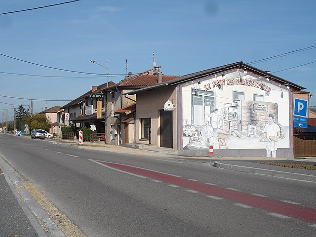
Villemotier
- commune in Ain, France
Hiking in Villemotier
Villemotier is a charming little village located in the Ain department in the Auvergne-Rhône-Alpes region of France. While it’s not widely known as a major hiking destination, the surrounding countryside offers some lovely opportunities for outdoor exploration and hiking....
- Country:
- Postal Code: 01270
- Coordinates: 46° 20' 46" N, 5° 19' 16" E
- GPS tracks (wikiloc): [Link]
- Area: 13.86 sq km
- Population: 669
- Web site: [Link]
Courmangoux
- commune in Ain, France
Hiking in Courmangoux
Courmangoux, a charming village located in the Ain department of the Auvergne-Rhône-Alpes region in France, is surrounded by natural beauty and offers a variety of hiking opportunities. Here are some aspects to consider when hiking in and around Courmangoux:...
- Country:
- Postal Code: 01370
- Coordinates: 46° 19' 52" N, 5° 22' 8" E
- GPS tracks (wikiloc): [Link]
- Area: 14.82 sq km
- Population: 504
- Web site: [Link]