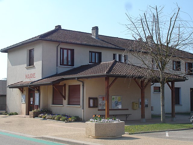
Marboz (Marboz)
- commune in Ain, France
- Country:

- Postal Code: 01851
- Coordinates: 46° 20' 33" N, 5° 15' 30" E


- GPS tracks (wikiloc): [Link]
- Area: 40.14 sq km
- Population: 2215
- Web site: http://www.marboz.fr
- Wikipedia en: wiki(en)
- Wikipedia: wiki(fr)
- Wikidata storage: Wikidata: Q274695
- Wikipedia Commons Category: [Link]
- Wikipedia Commons Maps Category: [Link]
- Freebase ID: [/m/0816c9]
- Freebase ID: [/m/0816c9]
- GeoNames ID: Alt: [6424581]
- GeoNames ID: Alt: [6424581]
- SIREN number: [210102323]
- SIREN number: [210102323]
- INSEE municipality code: 01232
- INSEE municipality code: 01232
Shares border with regions:


Attignat
- commune in Ain, France
- Country:
- Postal Code: 01340
- Coordinates: 46° 17' 14" N, 5° 9' 35" E
- GPS tracks (wikiloc): [Link]
- Area: 18.69 sq km
- Population: 3328
- Web site: [Link]

Bény
- commune in Ain, France
 Hiking in Bény
Bény is a picturesque region that offers a variety of hiking opportunities, typically characterized by its natural beauty, lush landscapes, and diverse trails. While specific trails and hiking conditions can vary, here are some general points to consider when hiking in Bény:...
- Country:
- Postal Code: 01370
- Coordinates: 46° 19' 10" N, 5° 17' 0" E
- GPS tracks (wikiloc): [Link]
- Area: 18.25 sq km
- Population: 747
- Web site: [Link]

Viriat
- commune in Ain, France
- Country:
- Postal Code: 01440
- Coordinates: 46° 15' 13" N, 5° 13' 0" E
- GPS tracks (wikiloc): [Link]
- Area: 45.03 sq km
- Population: 6281
- Web site: [Link]
Étrez
- commune in Ain, France
- Country:
- Postal Code: 01340
- Coordinates: 46° 20' 3" N, 5° 11' 5" E
- GPS tracks (wikiloc): [Link]
- Area: 12.15 sq km
- Population: 820
- Web site: [Link]
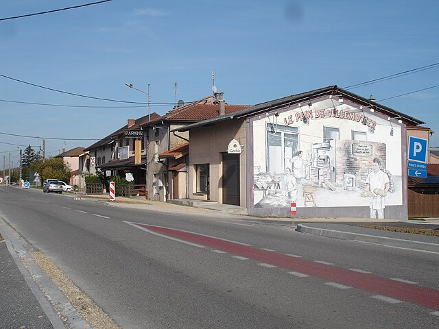
Villemotier
- commune in Ain, France
Hiking in Villemotier
Villemotier is a charming little village located in the Ain department in the Auvergne-Rhône-Alpes region of France. While it’s not widely known as a major hiking destination, the surrounding countryside offers some lovely opportunities for outdoor exploration and hiking....
- Country:
- Postal Code: 01270
- Coordinates: 46° 20' 46" N, 5° 19' 16" E
- GPS tracks (wikiloc): [Link]
- Area: 13.86 sq km
- Population: 669
- Web site: [Link]

Pirajoux
- commune in Ain, France
Hiking in Pirajoux
Pirajoux, a lesser-known destination, is often celebrated for its natural beauty and diverse hiking opportunities. While detailed information might be limited, the general characteristics of hiking in this area can be outlined as follows:...
- Country:
- Postal Code: 01270
- Coordinates: 46° 22' 17" N, 5° 17' 57" E
- GPS tracks (wikiloc): [Link]
- Area: 12.99 sq km
- Population: 393
- Web site: [Link]
Foissiat
- commune in Ain, France
- Country:
- Postal Code: 01340
- Coordinates: 46° 22' 13" N, 5° 10' 29" E
- GPS tracks (wikiloc): [Link]
- Area: 40.36 sq km
- Population: 2052
- Web site: [Link]

Cras-sur-Reyssouze
- commune in Ain, France
- Country:
- Postal Code: 01340
- Coordinates: 46° 18' 30" N, 5° 9' 56" E
- GPS tracks (wikiloc): [Link]
- Area: 13.83 sq km
- Population: 1431
- Web site: [Link]

Saint-Étienne-du-Bois
- commune in Ain, France
Hiking in Saint-Étienne-du-Bois
Saint-Étienne-du-Bois, located in the Ain department of the Auvergne-Rhône-Alpes region of France, offers a range of hiking opportunities for outdoor enthusiasts. The region is characterized by its picturesque landscapes, lush forests, and rolling hills, making it an inviting destination for both casual walkers and seasoned hikers....
- Country:
- Postal Code: 01370
- Coordinates: 46° 17' 17" N, 5° 17' 36" E
- GPS tracks (wikiloc): [Link]
- Area: 28.38 sq km
- Population: 2532
- Web site: [Link]