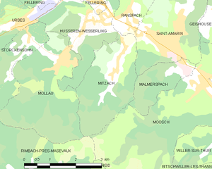
Saint-Amarin (Saint-Amarin)
- commune in Haut-Rhin, France
- Country:

- Postal Code: 68550
- Coordinates: 47° 52' 20" N, 7° 1' 51" E


- GPS tracks (wikiloc): [Link]
- Area: 11.61 sq km
- Population: 2294
- Web site: http://www.ville-saint-amarin.fr/
- Wikipedia en: wiki(en)
- Wikipedia: wiki(fr)
- Wikidata storage: Wikidata: Q149080
- Wikipedia Commons Category: [Link]
- Freebase ID: [/m/03nphfl]
- Freebase ID: [/m/03nphfl]
- GeoNames ID: Alt: [2981815]
- GeoNames ID: Alt: [2981815]
- SIREN number: [216802926]
- SIREN number: [216802926]
- BnF ID: [15271994j]
- BnF ID: [15271994j]
- VIAF ID: Alt: [239354556]
- VIAF ID: Alt: [239354556]
- GND ID: Alt: [4354143-4]
- GND ID: Alt: [4354143-4]
- INSEE municipality code: 68292
- INSEE municipality code: 68292
Shares border with regions:


Malmerspach
- commune in Haut-Rhin, France
- Country:

- Postal Code: 68550
- Coordinates: 47° 51' 50" N, 7° 2' 4" E


- GPS tracks (wikiloc): [Link]
- Area: 2.66 sq km
- Population: 515


Lautenbachzell
- commune in Haut-Rhin, France
- Country:

- Postal Code: 68610
- Coordinates: 47° 56' 25" N, 7° 8' 57" E


- GPS tracks (wikiloc): [Link]
- Area: 23.14 sq km
- Population: 968


Moosch
- commune in Haut-Rhin, France
- Country:

- Postal Code: 68690
- Coordinates: 47° 51' 36" N, 7° 3' 0" E


- GPS tracks (wikiloc): [Link]
- Area: 15.25 sq km
- Population: 1689
- Web site: [Link]


Mitzach
- commune in Haut-Rhin, France
- Country:

- Postal Code: 68470
- Coordinates: 47° 52' 13" N, 7° 0' 16" E


- GPS tracks (wikiloc): [Link]
- Area: 6.41 sq km
- Population: 409


Ranspach
- commune in Haut-Rhin, France
- Country:

- Postal Code: 68470
- Coordinates: 47° 53' 8" N, 7° 0' 32" E


- GPS tracks (wikiloc): [Link]
- Area: 11.4 sq km
- Population: 841


Geishouse
- commune in Haut-Rhin, France
- Country:

- Postal Code: 68690
- Coordinates: 47° 53' 1" N, 7° 3' 36" E


- GPS tracks (wikiloc): [Link]
- Area: 7.28 sq km
- Population: 454
- Web site: [Link]
