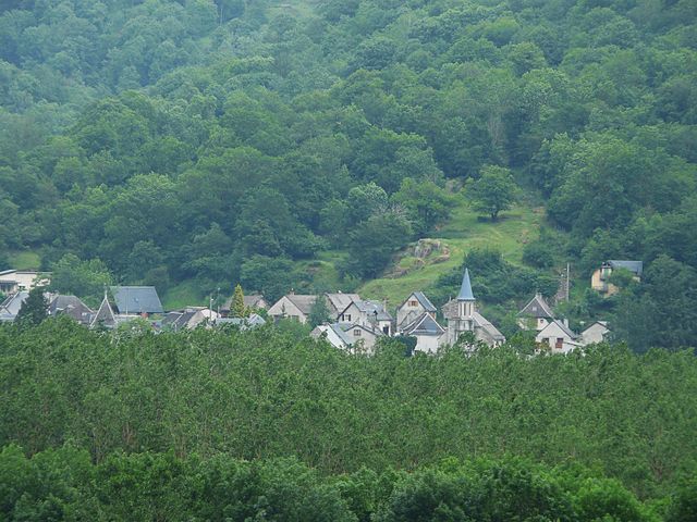
Saint-Béat (Saint-Béat)
- commune in Haute-Garonne, France
- Country:

- Postal Code: 31440
- Coordinates: 42° 54' 52" N, 0° 41' 33" E


- GPS tracks (wikiloc): [Link]
- Area: 7.37 sq km
- Population: 367
- Web site: http://www.st-beat.fr
- Wikipedia en: wiki(en)
- Wikipedia: wiki(fr)
- Wikidata storage: Wikidata: Q671104
- Wikipedia Commons Category: [Link]
- Freebase ID: [/m/03mgqhp]
- Freebase ID: [/m/03mgqhp]
- GeoNames ID: Alt: [2981428]
- GeoNames ID: Alt: [2981428]
- SIREN number: [213104714]
- SIREN number: [213104714]
- BnF ID: [15255466g]
- BnF ID: [15255466g]
- VIAF ID: Alt: [241877701]
- VIAF ID: Alt: [241877701]
- PACTOLS thesaurus ID: [pcrtP3E1us6ze4]
- PACTOLS thesaurus ID: [pcrtP3E1us6ze4]
- INSEE municipality code: 31471
- INSEE municipality code: 31471
Shares border with regions:


Arlos
- commune in Haute-Garonne, France
- Country:
- Postal Code: 31440
- Coordinates: 42° 53' 29" N, 0° 42' 13" E
- GPS tracks (wikiloc): [Link]
- Area: 9.41 sq km
- Population: 99

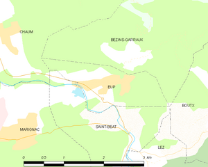
Eup
- commune in Haute-Garonne, France
- Country:
- Postal Code: 31440
- Coordinates: 42° 55' 38" N, 0° 41' 24" E
- GPS tracks (wikiloc): [Link]
- Area: 2.22 sq km
- Population: 127
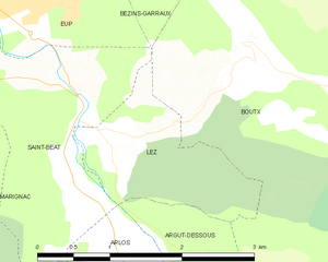
Lez
- commune in Haute-Garonne, France
- Country:
- Postal Code: 31440
- Coordinates: 42° 54' 33" N, 0° 42' 3" E
- GPS tracks (wikiloc): [Link]
- Area: 2.6 sq km
- Population: 59

Boutx
- commune in Haute-Garonne, France
- Country:
- Postal Code: 31440
- Coordinates: 42° 55' 4" N, 0° 42' 56" E
- GPS tracks (wikiloc): [Link]
- Area: 47.28 sq km
- Population: 240
Chaum
- commune in Haute-Garonne, France
- Country:
- Postal Code: 31440
- Coordinates: 42° 56' 3" N, 0° 39' 19" E
- GPS tracks (wikiloc): [Link]
- Area: 5.7 sq km
- Population: 186

Marignac
- commune in Haute-Garonne, France
- Country:
- Postal Code: 31440
- Coordinates: 42° 54' 51" N, 0° 39' 30" E
- GPS tracks (wikiloc): [Link]
- AboveSeaLevel: 510 м m
- Area: 12.95 sq km
- Population: 477