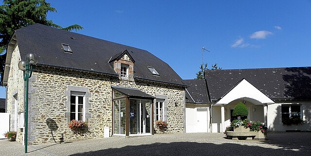
Saint-Baudelle (Saint-Baudelle)

- commune in Mayenne, France
- Country:

- Postal Code: 53100
- Coordinates: 48° 16' 52" N, 0° 38' 10" E


- GPS tracks (wikiloc): [Link]
- AboveSeaLevel: 250 м m
- Area: 7.17 sq km
- Population: 1140
- Web site: http://saint-baudelle.mairie.pagespro-orange.fr
- Wikipedia en: wiki(en)
- Wikipedia: wiki(fr)
- Wikidata storage: Wikidata: Q1100122
- Wikipedia Commons Category: [Link]
- Freebase ID: [/m/03np_tj]
- GeoNames ID: Alt: [6436461]
- SIREN number: [215302001]
- BnF ID: [15263993g]
- INSEE municipality code: 53200
Shares border with regions:

Parigné-sur-Braye
- commune in Mayenne, France
- Country:
- Postal Code: 53100
- Coordinates: 48° 18' 57" N, 0° 39' 11" E
- GPS tracks (wikiloc): [Link]
- AboveSeaLevel: 56 м m
- Area: 9.88 sq km
- Population: 842

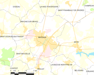
Mayenne
- commune in Mayenne, France
- Country:
- Postal Code: 53100
- Coordinates: 48° 18' 11" N, 0° 36' 49" E
- GPS tracks (wikiloc): [Link]
- AboveSeaLevel: 120 м m
- Area: 19.88 sq km
- Population: 13016
- Web site: [Link]


Saint-Georges-Buttavent
- commune in Mayenne, France
- Country:
- Postal Code: 53100
- Coordinates: 48° 18' 36" N, 0° 41' 40" E
- GPS tracks (wikiloc): [Link]
- AboveSeaLevel: 124 м m
- Area: 36.87 sq km
- Population: 1418
- Web site: [Link]


Contest
- commune in Mayenne, France
- Country:
- Postal Code: 53100
- Coordinates: 48° 15' 44" N, 0° 39' 22" E
- GPS tracks (wikiloc): [Link]
- AboveSeaLevel: 109 м m
- Area: 22.96 sq km
- Population: 858
- Web site: [Link]

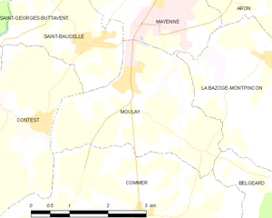
Moulay
- commune in Mayenne, France
- Country:
- Postal Code: 53100
- Coordinates: 48° 16' 22" N, 0° 37' 42" E
- GPS tracks (wikiloc): [Link]
- Area: 8.66 sq km
- Population: 963