Saint-Benoît-de-Carmaux (Saint-Benoît-de-Carmaux)

- commune in Tarn, France
- Country:

- Postal Code: 81400
- Coordinates: 44° 3' 8" N, 2° 7' 47" E


- GPS tracks (wikiloc): [Link]
- Area: 4.49 sq km
- Population: 2157
- Web site: http://www.saint-benoit-de-carmaux.fr
- Wikipedia en: wiki(en)
- Wikipedia: wiki(fr)
- Wikidata storage: Wikidata: Q922712
- Wikipedia Commons Category: [Link]
- Freebase ID: [/m/03npmdl]
- SIREN number: [218102440]
- BnF ID: [152775508]
- VIAF ID: Alt: [315942763]
- Library of Congress authority ID: Alt: [no2001067814]
- INSEE municipality code: 81244
Shares border with regions:

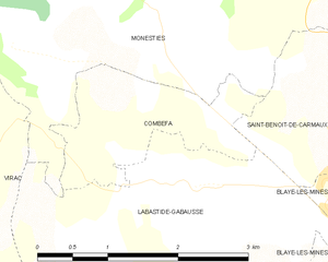
Combefa
- commune in Tarn, France
- Country:
- Postal Code: 81640
- Coordinates: 44° 3' 18" N, 2° 5' 46" E
- GPS tracks (wikiloc): [Link]
- Area: 2.93 sq km
- Population: 158
Labastide-Gabausse
- commune in Tarn, France
- Country:
- Postal Code: 81400
- Coordinates: 44° 2' 18" N, 2° 5' 48" E
- GPS tracks (wikiloc): [Link]
- Area: 12.18 sq km
- Population: 491


Blaye-les-Mines
- commune in Tarn, France
- Country:
- Postal Code: 81400
- Coordinates: 44° 2' 1" N, 2° 9' 31" E
- GPS tracks (wikiloc): [Link]
- Area: 8.88 sq km
- Population: 3066
- Web site: [Link]


Carmaux
- commune in Tarn, France
- Country:
- Postal Code: 81400
- Coordinates: 44° 2' 57" N, 2° 9' 29" E
- GPS tracks (wikiloc): [Link]
- AboveSeaLevel: 235 м m
- Area: 14.16 sq km
- Population: 9460
- Web site: [Link]

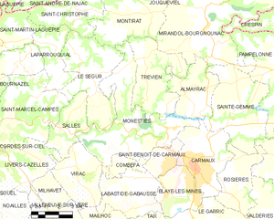
Monestiés
- commune in Tarn, France
- Country:
- Postal Code: 81640
- Coordinates: 44° 4' 16" N, 2° 5' 50" E
- GPS tracks (wikiloc): [Link]
- Area: 26.83 sq km
- Population: 1388