Saint-Benoît-la-Chipotte (Saint-Benoît-la-Chipotte)

- commune in Vosges, France
- Country:

- Postal Code: 88700
- Coordinates: 48° 21' 27" N, 6° 44' 5" E


- GPS tracks (wikiloc): [Link]
- Area: 20.77 sq km
- Population: 424
- Wikipedia en: wiki(en)
- Wikipedia: wiki(fr)
- Wikidata storage: Wikidata: Q837655
- Wikipedia Commons Category: [Link]
- Freebase ID: [/m/03qgy6n]
- Freebase ID: [/m/03qgy6n]
- SIREN number: [218804128]
- SIREN number: [218804128]
- BnF ID: [15279333m]
- BnF ID: [15279333m]
- INSEE municipality code: 88412
- INSEE municipality code: 88412
Shares border with regions:


Sainte-Barbe
- commune in Vosges, France
- Country:
- Postal Code: 88700
- Coordinates: 48° 23' 47" N, 6° 43' 21" E
- GPS tracks (wikiloc): [Link]
- AboveSeaLevel: 360 м m
- Area: 30.38 sq km
- Population: 282


Brû
- commune in Vosges, France
- Country:
- Postal Code: 88700
- Coordinates: 48° 20' 53" N, 6° 40' 59" E
- GPS tracks (wikiloc): [Link]
- Area: 8.95 sq km
- Population: 579


Ménil-sur-Belvitte
- commune in Vosges, France
- Country:
- Postal Code: 88700
- Coordinates: 48° 23' 24" N, 6° 41' 29" E
- GPS tracks (wikiloc): [Link]
- Area: 8.6 sq km
- Population: 308

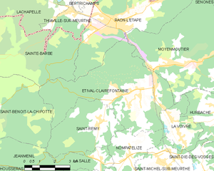
Étival-Clairefontaine
- commune in Vosges, France
- Country:
- Postal Code: 88480
- Coordinates: 48° 21' 50" N, 6° 51' 29" E
- GPS tracks (wikiloc): [Link]
- Area: 27.12 sq km
- Population: 2603
- Web site: [Link]

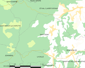
Saint-Remy
- commune in Vosges, France
- Country:
- Postal Code: 88480
- Coordinates: 48° 20' 49" N, 6° 49' 40" E
- GPS tracks (wikiloc): [Link]
- AboveSeaLevel: 350 м m
- Area: 12.25 sq km
- Population: 518


Jeanménil
- commune in Vosges, France
- Country:
- Postal Code: 88700
- Coordinates: 48° 20' 7" N, 6° 41' 16" E
- GPS tracks (wikiloc): [Link]
- Area: 18.24 sq km
- Population: 1108
- Web site: [Link]