Saint-Caprais-de-Lerm (Saint-Caprais-de-Lerm)

- commune in Lot-et-Garonne, France
- Country:

- Postal Code: 47270
- Coordinates: 44° 12' 47" N, 0° 44' 37" E


- GPS tracks (wikiloc): [Link]
- Area: 13.6 sq km
- Population: 644
- Web site: https://www.saintcapraisdelerm.fr
- Wikipedia en: wiki(en)
- Wikipedia: wiki(fr)
- Wikidata storage: Wikidata: Q208601
- Wikipedia Commons Category: [Link]
- Freebase ID: [/m/03qm2m5]
- GeoNames ID: Alt: [6435050]
- SIREN number: [214702342]
- BnF ID: [15261315j]
- INSEE municipality code: 47234
Shares border with regions:


Castelculier
- commune in Lot-et-Garonne, France
- Country:
- Postal Code: 47240
- Coordinates: 44° 10' 28" N, 0° 41' 34" E
- GPS tracks (wikiloc): [Link]
- Area: 14.95 sq km
- Population: 2342
- Web site: [Link]
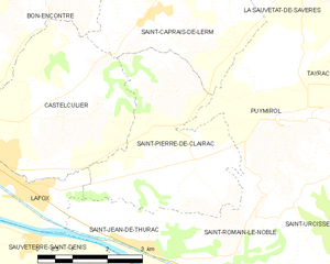
Saint-Pierre-de-Clairac
- commune in Lot-et-Garonne, France
- Country:
- Postal Code: 47270
- Coordinates: 44° 10' 46" N, 0° 45' 39" E
- GPS tracks (wikiloc): [Link]
- Area: 13.15 sq km
- Population: 889
- Web site: [Link]


Saint-Robert
- commune in Lot-et-Garonne, France
- Country:
- Postal Code: 47340
- Coordinates: 44° 14' 48" N, 0° 47' 42" E
- GPS tracks (wikiloc): [Link]
- Area: 6.74 sq km
- Population: 183

La Sauvetat-de-Savères
- commune in Lot-et-Garonne, France
- Country:
- Postal Code: 47270
- Coordinates: 44° 13' 33" N, 0° 47' 53" E
- GPS tracks (wikiloc): [Link]
- Area: 6.86 sq km
- Population: 549


Bon-Encontre
- commune in Lot-et-Garonne, France
- Country:
- Postal Code: 47240
- Coordinates: 44° 11' 11" N, 0° 40' 19" E
- GPS tracks (wikiloc): [Link]
- Area: 20.56 sq km
- Population: 6255
- Web site: [Link]


Puymirol
- commune in Lot-et-Garonne, France
- Country:
- Postal Code: 47270
- Coordinates: 44° 11' 13" N, 0° 47' 51" E
- GPS tracks (wikiloc): [Link]
- Area: 19.54 sq km
- Population: 938
- Web site: [Link]
Sauvagnas
- commune in Lot-et-Garonne, France
- Country:
- Postal Code: 47340
- Coordinates: 44° 14' 59" N, 0° 44' 19" E
- GPS tracks (wikiloc): [Link]
- Area: 13.57 sq km
- Population: 524
- Web site: [Link]