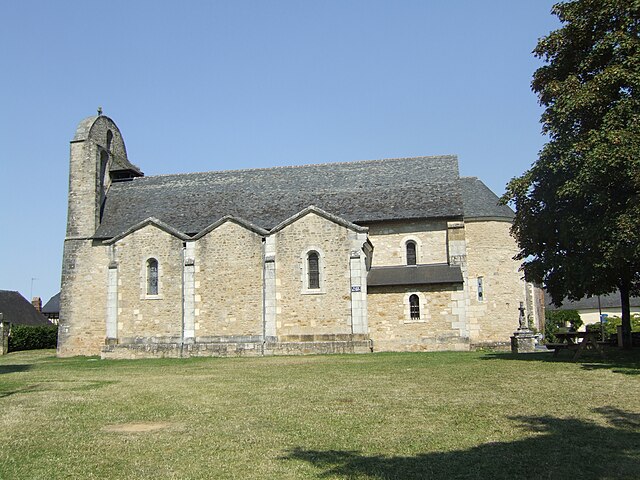
Saint-Cernin-de-Larche (Saint-Cernin-de-Larche)
- commune in Corrèze, France
- Country:

- Postal Code: 19600
- Coordinates: 45° 6' 11" N, 1° 24' 54" E


- GPS tracks (wikiloc): [Link]
- Area: 9.15 sq km
- Population: 663
- Wikipedia en: wiki(en)
- Wikipedia: wiki(fr)
- Wikidata storage: Wikidata: Q1079161
- Wikipedia Commons Category: [Link]
- Freebase ID: [/m/03mf_fr]
- GeoNames ID: Alt: [6428416]
- SIREN number: [211919105]
- BnF ID: [15249827f]
- PACTOLS thesaurus ID: [pcrtQv4Pho6hZB]
- INSEE municipality code: 19191
Shares border with regions:


Chavagnac
- former commune in Dordogne, France
- Country:

- Postal Code: 24120
- Coordinates: 45° 5' 21" N, 1° 22' 19" E


- GPS tracks (wikiloc): [Link]
- Area: 13.59 sq km
- Population: 383


Lissac-sur-Couze
- commune in Corrèze, France
- Country:

- Postal Code: 19600
- Coordinates: 45° 6' 14" N, 1° 27' 41" E


- GPS tracks (wikiloc): [Link]
- Area: 12.62 sq km
- Population: 767
- Web site: [Link]
Chartrier-Ferrière
- commune in Corrèze, France
- Country:

- Postal Code: 19600
- Coordinates: 45° 4' 15" N, 1° 27' 7" E


- GPS tracks (wikiloc): [Link]
- Area: 15.16 sq km
- Population: 366
- Web site: [Link]


Chasteaux
- commune in Corrèze, France
- Country:

- Postal Code: 19600
- Coordinates: 45° 5' 34" N, 1° 28' 4" E


- GPS tracks (wikiloc): [Link]
- Area: 18.75 sq km
- Population: 748


Larche
- commune in Corrèze, France
- Country:

- Postal Code: 19600
- Coordinates: 45° 7' 14" N, 1° 24' 56" E


- GPS tracks (wikiloc): [Link]
- Area: 5.74 sq km
- Population: 1599
