Saint-Chamarand (Saint-Chamarand)

- commune in Lot, France
- Country:

- Postal Code: 46310
- Coordinates: 44° 40' 42" N, 1° 27' 39" E


- GPS tracks (wikiloc): [Link]
- Area: 13.09 sq km
- Population: 219
- Wikipedia en: wiki(en)
- Wikipedia: wiki(fr)
- Wikidata storage: Wikidata: Q59801
- Wikipedia Commons Category: [Link]
- Freebase ID: [/m/03nwkhc]
- GeoNames ID: Alt: [6434881]
- SIREN number: [214602534]
- BnF ID: [152609943]
- INSEE municipality code: 46253
Shares border with regions:

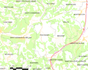
Frayssinet
- commune in Lot, France
- Country:
- Postal Code: 46310
- Coordinates: 44° 39' 44" N, 1° 28' 57" E
- GPS tracks (wikiloc): [Link]
- Area: 16.83 sq km
- Population: 304
Soucirac
- commune in Lot, France
- Country:
- Postal Code: 46300
- Coordinates: 44° 42' 9" N, 1° 30' 14" E
- GPS tracks (wikiloc): [Link]
- Area: 11.31 sq km
- Population: 100


Concorès
- commune in Lot, France
- Country:
- Postal Code: 46310
- Coordinates: 44° 39' 32" N, 1° 23' 42" E
- GPS tracks (wikiloc): [Link]
- Area: 19 sq km
- Population: 321

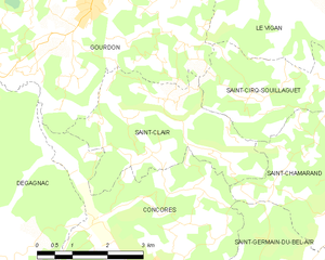
Saint-Clair
- commune in Lot, France
- Country:
- Postal Code: 46300
- Coordinates: 44° 41' 59" N, 1° 24' 40" E
- GPS tracks (wikiloc): [Link]
- Area: 11 sq km
- Population: 150
Saint-Cirq-Souillaguet
- commune in Lot, France
- Country:
- Postal Code: 46300
- Coordinates: 44° 42' 28" N, 1° 27' 31" E
- GPS tracks (wikiloc): [Link]
- Area: 8.54 sq km
- Population: 159


Saint-Germain-du-Bel-Air
- commune in Lot, France
- Country:
- Postal Code: 46310
- Coordinates: 44° 38' 49" N, 1° 26' 23" E
- GPS tracks (wikiloc): [Link]
- Area: 21.47 sq km
- Population: 574


Vaillac
- former commune in Lot, France
- Country:
- Postal Code: 46240
- Coordinates: 44° 40' 28" N, 1° 31' 47" E
- GPS tracks (wikiloc): [Link]
- Area: 13.68 sq km
- Population: 101