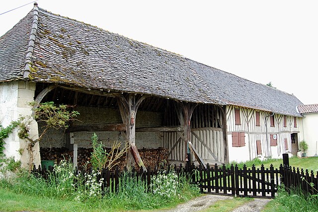
Saint-Christophe-de-Double (Saint-Christophe-de-Double)
- commune in Gironde, France
- Country:

- Postal Code: 33230
- Coordinates: 45° 4' 50" N, 0° 0' 57" E


- GPS tracks (wikiloc): [Link]
- AboveSeaLevel: 89 м m
- Area: 36.13 sq km
- Population: 719
- Web site: http://www.saintchristophededouble.fr
- Wikipedia en: wiki(en)
- Wikipedia: wiki(fr)
- Wikidata storage: Wikidata: Q577322
- Wikipedia Commons Category: [Link]
- Freebase ID: [/m/03ns0z5]
- GeoNames ID: Alt: [6616564]
- SIREN number: [213303852]
- BnF ID: [152564343]
- INSEE municipality code: 33385
Shares border with regions:


La Roche-Chalais
- commune in Dordogne, France
- Country:

- Postal Code: 24490
- Coordinates: 45° 9' 6" N, 0° 0' 32" E


- GPS tracks (wikiloc): [Link]
- Area: 89.4 sq km
- Population: 2970


Les Églisottes-et-Chalaures
- commune in Gironde, France
- Country:

- Postal Code: 33230
- Coordinates: 45° 5' 59" N, 0° 2' 15" E


- GPS tracks (wikiloc): [Link]
- AboveSeaLevel: 24 м m
- Area: 17.16 sq km
- Population: 2178


Porchères
- commune in Gironde, France
- Country:

- Postal Code: 33660
- Coordinates: 45° 1' 46" N, 0° 0' 37" E


- GPS tracks (wikiloc): [Link]
- Area: 13.19 sq km
- Population: 911
- Web site: [Link]


Saint-Antoine-sur-l'Isle
- commune in Gironde, France
- Country:

- Postal Code: 33660
- Coordinates: 45° 1' 37" N, 0° 2' 17" E


- GPS tracks (wikiloc): [Link]
- Area: 10.4 sq km
- Population: 578
- Web site: [Link]


Le Fieu
- commune in Gironde, France
- Country:

- Postal Code: 33230
- Coordinates: 45° 3' 34" N, 0° 2' 1" E


- GPS tracks (wikiloc): [Link]
- AboveSeaLevel: 87 м m
- Area: 14.67 sq km
- Population: 540
