Saint-Clément (Saint-Clément)
- commune in Ardèche, France
- Country:

- Postal Code: 07310
- Coordinates: 44° 57' 10" N, 4° 15' 54" E


- GPS tracks (wikiloc): [Link]
- Area: 19.55 sq km
- Population: 87
- Wikipedia en: wiki(en)
- Wikipedia: wiki(fr)
- Wikidata storage: Wikidata: Q691967
- Wikipedia Commons Category: [Link]
- Freebase ID: [/m/03m89h9]
- GeoNames ID: Alt: [6453579]
- SIREN number: [210702262]
- INSEE municipality code: 07226
Shares border with regions:

La Rochette
- commune in Ardèche, France
- Country:
- Postal Code: 07310
- Coordinates: 44° 54' 58" N, 4° 14' 27" E
- GPS tracks (wikiloc): [Link]
- AboveSeaLevel: 930 м m
- Area: 13.86 sq km
- Population: 57


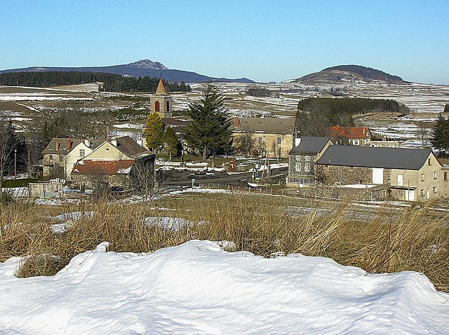
Chaudeyrolles
- commune in Haute-Loire, France
- Country:
- Postal Code: 43430
- Coordinates: 44° 57' 1" N, 4° 12' 11" E
- GPS tracks (wikiloc): [Link]
- Area: 18.9 sq km
- Population: 100

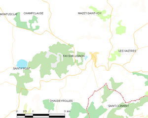
Fay-sur-Lignon
- commune in Haute-Loire, France
- Country:
- Postal Code: 43430
- Coordinates: 44° 59' 11" N, 4° 13' 35" E
- GPS tracks (wikiloc): [Link]
- Area: 13.24 sq km
- Population: 374

Chanéac
- commune in Ardèche, France
- Country:
- Postal Code: 07310
- Coordinates: 44° 55' 59" N, 4° 19' 10" E
- GPS tracks (wikiloc): [Link]
- Area: 15.73 sq km
- Population: 259

Les Vastres
- commune in Haute-Loire, France
- Country:
- Postal Code: 43430
- Coordinates: 44° 59' 21" N, 4° 15' 40" E
- GPS tracks (wikiloc): [Link]
- AboveSeaLevel: 1100 м m
- Area: 30.34 sq km
- Population: 199

Lachapelle-sous-Chanéac
- commune in Ardèche, France
- Country:
- Postal Code: 07310
- Coordinates: 44° 56' 51" N, 4° 19' 51" E
- GPS tracks (wikiloc): [Link]
- Area: 8.94 sq km
- Population: 176
- Web site: [Link]

Saint-Julien-Boutières
- former commune in Ardèche, France
- Country:
- Postal Code: 07310
- Coordinates: 44° 58' 27" N, 4° 21' 7" E
- GPS tracks (wikiloc): [Link]
- Area: 11.12 sq km
- Population: 199