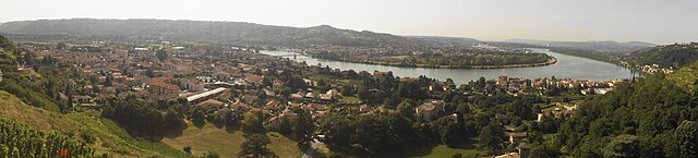
Saint-Clair-du-Rhône (Saint-Clair-du-Rhône)

- commune in Isère, France
- Country:

- Postal Code: 38370
- Coordinates: 45° 26' 24" N, 4° 46' 23" E


- GPS tracks (wikiloc): [Link]
- Area: 7.16 sq km
- Population: 3889
- Web site: http://www.st-clair-du-rhone.fr
- Wikipedia en: wiki(en)
- Wikipedia: wiki(fr)
- Wikidata storage: Wikidata: Q1068169
- Wikipedia Commons Category: [Link]
- Freebase ID: [/m/03nvj0b]
- SIREN number: [213803786]
- BnF ID: [15258188p]
- PACTOLS thesaurus ID: [pcrtaVYMQYOklR]
- INSEE municipality code: 38378
Shares border with regions:
Chavanay
- commune in Loire, France
- Country:
- Postal Code: 42410
- Coordinates: 45° 24' 53" N, 4° 43' 52" E
- GPS tracks (wikiloc): [Link]
- Area: 15.06 sq km
- Population: 2889
- Web site: [Link]
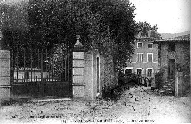
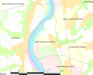
Saint-Alban-du-Rhône
- commune in Isère, France
- Country:
- Postal Code: 38370
- Coordinates: 45° 25' 36" N, 4° 45' 19" E
- GPS tracks (wikiloc): [Link]
- Area: 3.56 sq km
- Population: 849


Saint-Prim
- commune in Isère, France
- Country:
- Postal Code: 38370
- Coordinates: 45° 26' 37" N, 4° 47' 36" E
- GPS tracks (wikiloc): [Link]
- Area: 7.3 sq km
- Population: 1335
- Web site: [Link]

Les Roches-de-Condrieu
- commune in Isère, France
- Country:
- Postal Code: 38370
- Coordinates: 45° 27' 11" N, 4° 46' 4" E
- GPS tracks (wikiloc): [Link]
- Area: 1.03 sq km
- Population: 2030
- Web site: [Link]
Vérin
- commune in Loire, France
- Country:
- Postal Code: 42410
- Coordinates: 45° 27' 15" N, 4° 45' 9" E
- GPS tracks (wikiloc): [Link]
- Area: 3.05 sq km
- Population: 676
Saint-Michel-sur-Rhône
- commune in Loire, France
- Country:
- Postal Code: 42410
- Coordinates: 45° 26' 46" N, 4° 44' 41" E
- GPS tracks (wikiloc): [Link]
- Area: 5.87 sq km
- Population: 805
- Web site: [Link]


Clonas-sur-Varèze
- commune in Isère, France
- Country:
- Postal Code: 38550
- Coordinates: 45° 24' 51" N, 4° 47' 27" E
- GPS tracks (wikiloc): [Link]
- Area: 6.83 sq km
- Population: 1482

Condrieu
- commune in Rhône, France
- Country:
- Postal Code: 69420
- Coordinates: 45° 27' 47" N, 4° 46' 4" E
- GPS tracks (wikiloc): [Link]
- Area: 9.21 sq km
- Population: 3883
- Web site: [Link]