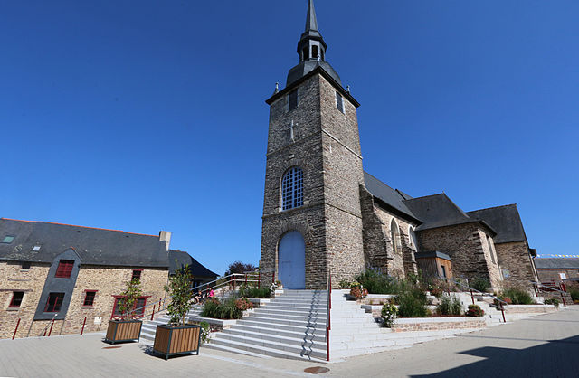
Saint-Erblon (Saint-Erblon)

- commune in Ille-et-Vilaine, France
- Country:

- Postal Code: 35230
- Coordinates: 48° 1' 8" N, 1° 39' 6" E


- GPS tracks (wikiloc): [Link]
- Area: 10.93 sq km
- Population: 2879
- Web site: http://www.saint-erblon.fr
- Wikipedia en: wiki(en)
- Wikipedia: wiki(fr)
- Wikidata storage: Wikidata: Q643467
- Wikipedia Commons Category: [Link]
- Freebase ID: [/m/03mf4sb]
- GeoNames ID: Alt: [6432825]
- SIREN number: [213502669]
- BnF ID: [152572087]
- VIAF ID: Alt: [124347662]
- OSM relation ID: [145265]
- PACTOLS thesaurus ID: [pcrtagdfmSUJz6]
- SUDOC authorities ID: [035240318]
- INSEE municipality code: 35266
Shares border with regions:


Bourgbarré
- commune in Ille-et-Vilaine, France
- Country:
- Postal Code: 35230
- Coordinates: 47° 59' 40" N, 1° 36' 53" E
- GPS tracks (wikiloc): [Link]
- Area: 14.2 sq km
- Population: 3841
- Web site: [Link]


Noyal-Châtillon-sur-Seiche
- commune in Ille-et-Vilaine, France
- Country:
- Postal Code: 35230
- Coordinates: 48° 2' 36" N, 1° 39' 27" E
- GPS tracks (wikiloc): [Link]
- AboveSeaLevel: 44 м m
- Area: 26.51 sq km
- Population: 6911
- Web site: [Link]


Pont-Péan
- commune in Ille-et-Vilaine, France
- Country:
- Postal Code: 35131
- Coordinates: 48° 0' 46" N, 1° 42' 17" E
- GPS tracks (wikiloc): [Link]
- Area: 8.76 sq km
- Population: 4128
- Web site: [Link]


Vern-sur-Seiche
- commune in Ille-et-Vilaine, France
- Country:
- Postal Code: 35770
- Coordinates: 48° 2' 41" N, 1° 36' 1" E
- GPS tracks (wikiloc): [Link]
- AboveSeaLevel: 56 м m
- Area: 19.7 sq km
- Population: 7871
- Web site: [Link]

Orgères
- commune in Ille-et-Vilaine, France
- Country:
- Postal Code: 35230
- Coordinates: 47° 59' 56" N, 1° 40' 6" E
- GPS tracks (wikiloc): [Link]
- Area: 16.33 sq km
- Population: 4258
- Web site: [Link]