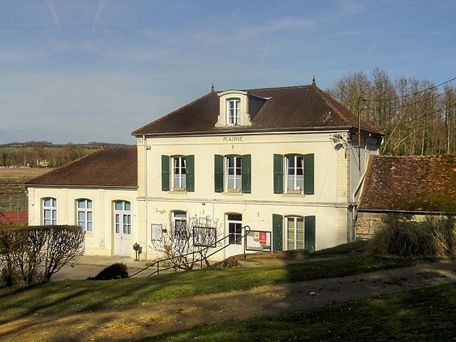
Saint-Félix (Saint-Félix)

- commune in Oise, France
- Country:

- Postal Code: 60370
- Coordinates: 49° 20' 52" N, 2° 17' 8" E


- GPS tracks (wikiloc): [Link]
- Area: 5.13 sq km
- Population: 634
- Web site: http://www.saint-felix-notre-village.fr
- Wikipedia en: wiki(en)
- Wikipedia: wiki(fr)
- Wikidata storage: Wikidata: Q749051
- Wikipedia Commons Category: [Link]
- Freebase ID: [/m/03qgnwm]
- GeoNames ID: Alt: [6438950]
- SIREN number: [216005686]
- BnF ID: [15267809f]
- INSEE municipality code: 60574
Shares border with regions:


La Neuville-en-Hez
- commune in Oise, France
- Country:
- Postal Code: 60510
- Coordinates: 49° 24' 14" N, 2° 19' 26" E
- GPS tracks (wikiloc): [Link]
- Area: 28.42 sq km
- Population: 995
- Web site: [Link]


Hondainville
- commune in Oise, France
- Country:
- Postal Code: 60250
- Coordinates: 49° 20' 24" N, 2° 18' 2" E
- GPS tracks (wikiloc): [Link]
- Area: 6 sq km
- Population: 689
- Web site: [Link]

Heilles
- commune in Oise, France
- Country:
- Postal Code: 60250
- Coordinates: 49° 20' 3" N, 2° 15' 43" E
- GPS tracks (wikiloc): [Link]
- Area: 6.01 sq km
- Population: 622
- Web site: [Link]

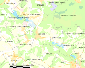
Hermes
- commune in Oise, France
- Country:
- Postal Code: 60370
- Coordinates: 49° 21' 27" N, 2° 14' 46" E
- GPS tracks (wikiloc): [Link]
- Area: 11.72 sq km
- Population: 2458