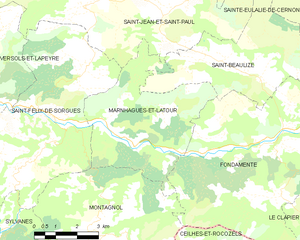
Saint-Félix-de-Sorgues (Saint-Félix-de-Sorgues)
- commune in Aveyron, France
- Country:

- Postal Code: 12400
- Coordinates: 43° 53' 3" N, 2° 59' 3" E


- GPS tracks (wikiloc): [Link]
- Area: 31 sq km
- Population: 237
- Wikipedia en: wiki(en)
- Wikipedia: wiki(fr)
- Wikidata storage: Wikidata: Q1364864
- Wikipedia Commons Category: [Link]
- Freebase ID: [/m/03m95dz]
- GeoNames ID: Alt: [6427019]
- SIREN number: [211202221]
- BnF ID: [15247198j]
- Library of Congress authority ID: Alt: [n89606963]
- INSEE municipality code: 12222
Shares border with regions:


Gissac
- commune in Aveyron, France
- Country:

- Postal Code: 12360
- Coordinates: 43° 50' 47" N, 2° 55' 55" E


- GPS tracks (wikiloc): [Link]
- Area: 31.02 sq km
- Population: 106


Montagnol
- commune in Aveyron, France
- Country:

- Postal Code: 12360
- Coordinates: 43° 50' 18" N, 3° 0' 48" E


- GPS tracks (wikiloc): [Link]
- Area: 34.47 sq km
- Population: 125


Versols-et-Lapeyre
- commune in Aveyron, France
- Country:

- Postal Code: 12400
- Coordinates: 43° 53' 38" N, 2° 56' 43" E


- GPS tracks (wikiloc): [Link]
- Area: 27.95 sq km
- Population: 440
- Web site: [Link]


Marnhagues-et-Latour
- commune in Aveyron, France
- Country:

- Postal Code: 12540
- Coordinates: 43° 52' 21" N, 3° 1' 48" E


- GPS tracks (wikiloc): [Link]
- Area: 21.92 sq km
- Population: 127


Saint-Jean-et-Saint-Paul
- commune in Aveyron, France
- Country:

- Postal Code: 12250
- Coordinates: 43° 55' 41" N, 3° 0' 19" E


- GPS tracks (wikiloc): [Link]
- Area: 37.91 sq km
- Population: 274


Sylvanès
- commune in Aveyron, France
- Country:

- Postal Code: 12360
- Coordinates: 43° 50' 3" N, 2° 57' 33" E


- GPS tracks (wikiloc): [Link]
- Area: 16.96 sq km
- Population: 107
