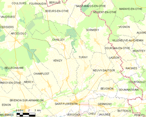
Saint-Florentin (Saint-Florentin)
- commune in Yonne, France
- Country:

- Postal Code: 89600
- Coordinates: 48° 0' 7" N, 3° 43' 30" E


- GPS tracks (wikiloc): [Link]
- Area: 28.6 sq km
- Population: 4505
- Web site: http://www.saint-florentin.fr/
- Wikipedia en: wiki(en)
- Wikipedia: wiki(fr)
- Wikidata storage: Wikidata: Q840511
- Wikipedia Commons Category: [Link]
- Freebase ID: [/m/02wxpxd]
- Freebase ID: [/m/02wxpxd]
- GeoNames ID: Alt: [2980111]
- GeoNames ID: Alt: [2980111]
- SIREN number: [218903458]
- SIREN number: [218903458]
- BnF ID: [15279801c]
- BnF ID: [15279801c]
- VIAF ID: Alt: [300376662]
- VIAF ID: Alt: [300376662]
- Library of Congress authority ID: Alt: [no2013061236]
- Library of Congress authority ID: Alt: [no2013061236]
- INSEE municipality code: 89345
- INSEE municipality code: 89345
Shares border with regions:


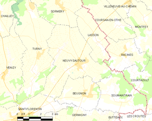
Neuvy-Sautour
- commune in Yonne, France
- Country:

- Postal Code: 89570
- Coordinates: 48° 2' 31" N, 3° 47' 38" E


- GPS tracks (wikiloc): [Link]
- Area: 19.06 sq km
- Population: 918


Venizy
- commune in Yonne, France
- Country:

- Postal Code: 89210
- Coordinates: 48° 2' 8" N, 3° 42' 32" E


- GPS tracks (wikiloc): [Link]
- Area: 43.68 sq km
- Population: 948


Germigny
- commune in Yonne, France
- Country:

- Postal Code: 89600
- Coordinates: 47° 59' 42" N, 3° 46' 51" E


- GPS tracks (wikiloc): [Link]
- Area: 11.87 sq km
- Population: 550


Mont-Saint-Sulpice
- commune in Yonne, France
- Country:

- Postal Code: 89250
- Coordinates: 47° 57' 7" N, 3° 37' 34" E


- GPS tracks (wikiloc): [Link]
- Area: 19.62 sq km
- Population: 809
- Web site: [Link]
Chéu
- commune in Yonne, France
- Country:

- Postal Code: 89600
- Coordinates: 47° 57' 56" N, 3° 45' 56" E


- GPS tracks (wikiloc): [Link]
- AboveSeaLevel: 107 м m
- Area: 7.61 sq km
- Population: 546


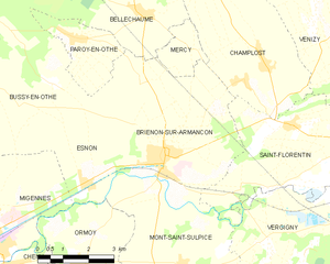
Brienon-sur-Armançon
- commune in Yonne, France
- Country:

- Postal Code: 89210
- Coordinates: 47° 59' 34" N, 3° 36' 59" E


- GPS tracks (wikiloc): [Link]
- Area: 25.87 sq km
- Population: 3152
Beugnon
- commune in Yonne, France
- Country:

- Postal Code: 89570
- Coordinates: 48° 1' 14" N, 3° 48' 19" E


- GPS tracks (wikiloc): [Link]
- AboveSeaLevel: 121 м m
- Area: 7.7 sq km
- Population: 322
- Web site: [Link]


Vergigny
- commune in Yonne, France
- Country:

- Postal Code: 89600
- Coordinates: 47° 58' 13" N, 3° 43' 9" E


- GPS tracks (wikiloc): [Link]
- Area: 38.01 sq km
- Population: 1560


Turny
- commune in Yonne, France
- Country:

- Postal Code: 89570
- Coordinates: 48° 2' 6" N, 3° 44' 47" E


- GPS tracks (wikiloc): [Link]
- Area: 24.87 sq km
- Population: 710
Champlost
- commune in Yonne, France
- Country:

- Postal Code: 89210
- Coordinates: 48° 1' 37" N, 3° 40' 4" E


- GPS tracks (wikiloc): [Link]
- Area: 22.94 sq km
- Population: 801
