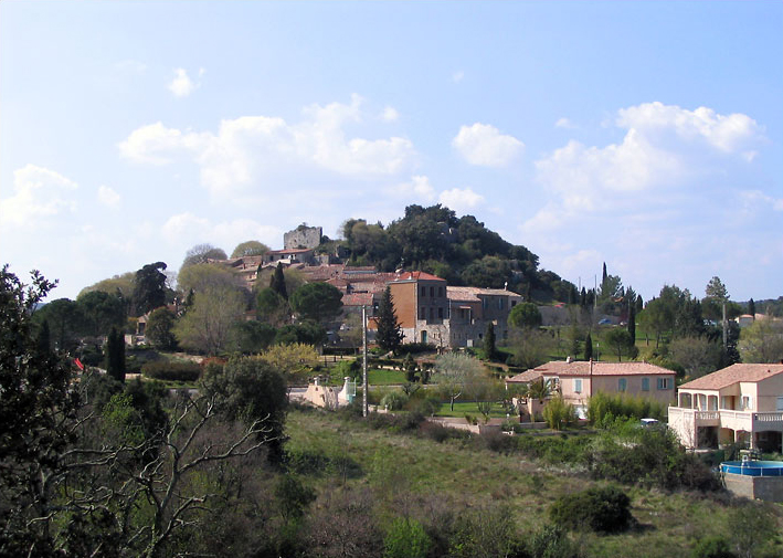
Saint-Gély-du-Fesc (Saint-Gély-du-Fesc)

- commune in Hérault, France
- Country:

- Postal Code: 34980
- Coordinates: 43° 41' 32" N, 3° 48' 22" E


- GPS tracks (wikiloc): [Link]
- AboveSeaLevel: 116 м m
- Area: 16.51 sq km
- Population: 9826
- Web site: http://www.ville-saintgelydufesc.fr/
- Wikipedia en: wiki(en)
- Wikipedia: wiki(fr)
- Wikidata storage: Wikidata: Q178466
- Wikipedia Commons Gallery: [Link]
- Wikipedia Commons Category: [Link]
- Freebase ID: [/m/03mgp7f]
- Freebase ID: [/m/03mgp7f]
- GeoNames ID: Alt: [6432627]
- GeoNames ID: Alt: [6432627]
- SIREN number: [213402555]
- SIREN number: [213402555]
- BnF ID: [15256856h]
- BnF ID: [15256856h]
- VIAF ID: Alt: [247418973]
- VIAF ID: Alt: [247418973]
- PACTOLS thesaurus ID: [pcrtbubBZyLjHs]
- PACTOLS thesaurus ID: [pcrtbubBZyLjHs]
- MusicBrainz area ID: [76f376e7-3f9b-432d-bf92-d33b660779a4]
- MusicBrainz area ID: [76f376e7-3f9b-432d-bf92-d33b660779a4]
- INSEE municipality code: 34255
- INSEE municipality code: 34255
Shares border with regions:


Les Matelles
- commune in Hérault, France
- Country:
- Postal Code: 34270
- Coordinates: 43° 43' 50" N, 3° 48' 32" E
- GPS tracks (wikiloc): [Link]
- Area: 16.81 sq km
- Population: 1991
- Web site: [Link]


Grabels
- commune in Hérault, France
- Country:
- Postal Code: 34790
- Coordinates: 43° 38' 53" N, 3° 48' 6" E
- GPS tracks (wikiloc): [Link]
- Area: 16.24 sq km
- Population: 7939
- Web site: [Link]


Combaillaux
- commune in Hérault, France
- Country:
- Postal Code: 34980
- Coordinates: 43° 40' 38" N, 3° 45' 59" E
- GPS tracks (wikiloc): [Link]
- Area: 9.06 sq km
- Population: 1453
- Web site: [Link]
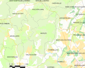
Murles
- commune in Hérault, France
- Country:
- Postal Code: 34980
- Coordinates: 43° 41' 21" N, 3° 44' 45" E
- GPS tracks (wikiloc): [Link]
- Area: 24.06 sq km
- Population: 295

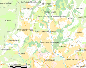
Saint-Clément-de-Rivière
- commune in Hérault, France
- Country:
- Postal Code: 34980
- Coordinates: 43° 41' 1" N, 3° 50' 47" E
- GPS tracks (wikiloc): [Link]
- AboveSeaLevel: 64 м m
- Area: 12.73 sq km
- Population: 4803
- Web site: [Link]