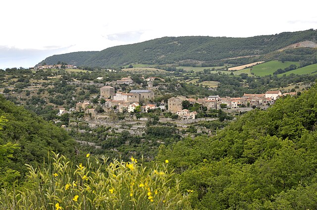
Saint-Georges-de-Luzençon (Saint-Georges-de-Luzençon)
- commune in Aveyron, France
- Country:

- Postal Code: 12100
- Coordinates: 44° 3' 52" N, 2° 59' 8" E


- GPS tracks (wikiloc): [Link]
- Area: 47.73 sq km
- Population: 1584
- Wikipedia en: wiki(en)
- Wikipedia: wiki(fr)
- Wikidata storage: Wikidata: Q630849
- Wikipedia Commons Category: [Link]
- Freebase ID: [/m/03c7f2b]
- SIREN number: [211202254]
- BnF ID: [15247201m]
- VIAF ID: Alt: [170506761]
- INSEE municipality code: 12225
Shares border with regions:


La Bastide-Pradines
- commune in Aveyron, France
- Country:

- Postal Code: 12490
- Coordinates: 44° 0' 5" N, 3° 2' 47" E


- GPS tracks (wikiloc): [Link]
- Area: 20.56 sq km
- Population: 106
- Web site: [Link]


Saint-Rome-de-Tarn
- commune in Aveyron, France
- Country:

- Postal Code: 12490
- Coordinates: 44° 2' 55" N, 2° 53' 47" E


- GPS tracks (wikiloc): [Link]
- Area: 52.06 sq km
- Population: 872
- Web site: [Link]


Creissels
- commune in Aveyron, France
- Country:

- Postal Code: 12100
- Coordinates: 44° 5' 14" N, 3° 3' 55" E


- GPS tracks (wikiloc): [Link]
- Area: 28.19 sq km
- Population: 1603


Montjaux
- commune in Aveyron, France
- Country:

- Postal Code: 12490
- Coordinates: 44° 6' 9" N, 2° 54' 20" E


- GPS tracks (wikiloc): [Link]
- Area: 31.48 sq km
- Population: 381

Comprégnac
- commune in Aveyron, France
- Country:

- Postal Code: 12100
- Coordinates: 44° 4' 59" N, 2° 57' 41" E


- GPS tracks (wikiloc): [Link]
- Area: 11.09 sq km
- Population: 251


Saint-Rome-de-Cernon
- commune in Aveyron, France
- Country:

- Postal Code: 12490
- Coordinates: 44° 0' 44" N, 2° 57' 57" E


- GPS tracks (wikiloc): [Link]
- AboveSeaLevel: 374 м m
- Area: 37.88 sq km
- Population: 866
- Web site: [Link]
