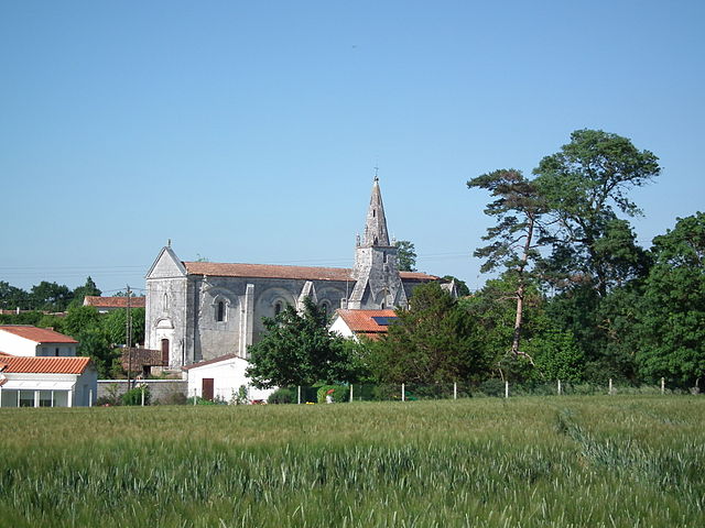
Saint-Georges-des-Coteaux (Saint-Georges-des-Coteaux)

- commune in Charente-Maritime, France
- Country:

- Postal Code: 17810
- Coordinates: 45° 45' 47" N, 0° 42' 39" E


- GPS tracks (wikiloc): [Link]
- Area: 19.23 sq km
- Population: 2663
- Web site: http://www.saintgeorgesdescoteaux.fr
- Wikipedia en: wiki(en)
- Wikipedia: wiki(fr)
- Wikidata storage: Wikidata: Q611954
- Wikipedia Commons Category: [Link]
- Freebase ID: [/m/03mcj_s]
- GeoNames ID: Alt: [2979921]
- SIREN number: [211703368]
- BnF ID: [15249197p]
- INSEE municipality code: 17336
Shares border with regions:


Les Essards
- commune in Charente-Maritime, France
- Country:
- Postal Code: 17250
- Coordinates: 45° 47' 31" N, 0° 45' 31" E
- GPS tracks (wikiloc): [Link]
- Area: 9.66 sq km
- Population: 710
- Web site: [Link]
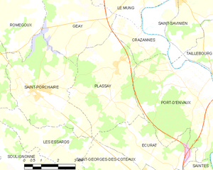
Plassay
- commune in Charente-Maritime, France
- Country:
- Postal Code: 17250
- Coordinates: 45° 49' 7" N, 0° 43' 31" E
- GPS tracks (wikiloc): [Link]
- Area: 16.87 sq km
- Population: 715
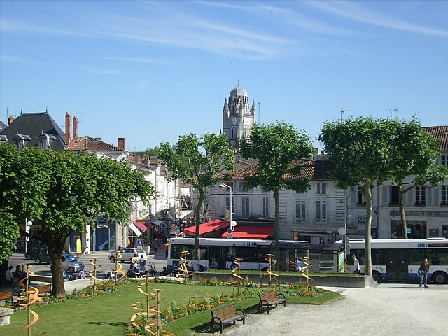

Saintes
- commune in Charente-Maritime, France
- Country:
- Postal Code: 17100
- Coordinates: 45° 44' 43" N, 0° 38' 4" E
- GPS tracks (wikiloc): [Link]
- Area: 45.55 sq km
- Population: 25288
- Web site: [Link]


Écurat
- commune in Charente-Maritime, France
- Country:
- Postal Code: 17810
- Coordinates: 45° 47' 1" N, 0° 40' 30" E
- GPS tracks (wikiloc): [Link]
- Area: 10.55 sq km
- Population: 471

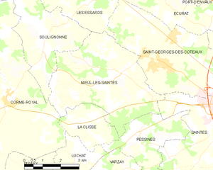
Nieul-lès-Saintes
- commune in Charente-Maritime, France
- Country:
- Postal Code: 17810
- Coordinates: 45° 45' 35" N, 0° 43' 56" E
- GPS tracks (wikiloc): [Link]
- Area: 20.41 sq km
- Population: 1190