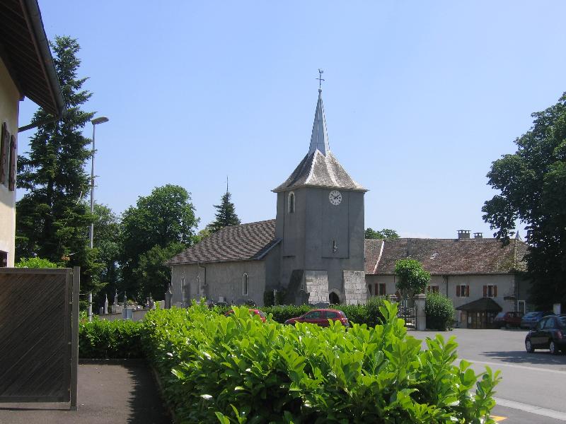
Saint-Germain-sur-Rhône (Saint-Germain-sur-Rhône)

- commune in Haute-Savoie, France
 Hiking in Saint-Germain-sur-Rhône
Saint-Germain-sur-Rhône is a picturesque commune located in the Auvergne-Rhône-Alpes region of France. It offers a variety of hiking opportunities, allowing visitors to explore the natural beauty of the surrounding countryside and enjoy scenic views of the Rhône River and the nearby landscapes.
Hiking Trails
-
Vineyard Trails: The region is known for its vineyards, and there are trails that take you through lush vineyards, offering the chance to learn about local wine production while enjoying the scenery.
-
River Trails: The proximity to the Rhône River means there are trails along its banks. These paths often provide beautiful river views and opportunities for wildlife spotting.
-
Forest Hikes: Nearby forests offer trails that vary in difficulty, allowing hikers to immerse themselves in nature, observe flora and fauna, and enjoy some peaceful time away from urban areas.
-
Hilltop Walks: Some trails lead to elevated areas that provide stunning panoramic views of the region, perfect for photography or simply soaking in the beauty of the landscape.
Best Practices for Hiking in Saint-Germain-sur-Rhône
- Stay Informed: Check local maps and trail markers for the best routes and any information on trail conditions.
- Dress Appropriately: Wear suitable footwear and clothing depending on the season; layers are key in case of changing weather.
- Hydration and Snacks: Bring plenty of water and snacks, particularly if you plan on hiking for several hours.
- Respect Nature: Stay on marked trails and follow local guidelines to protect the environment.
Local Attractions
After a day of hiking, consider exploring some local attractions in and around Saint-Germain-sur-Rhône, including charming villages, local markets, or tasting the region's renowned wines.
Overall, hiking in Saint-Germain-sur-Rhône offers a blend of natural beauty, cultural richness, and a peaceful escape into nature, making it a lovely destination for outdoor enthusiasts.
- Country:

- Postal Code: 74910
- Coordinates: 46° 4' 0" N, 5° 48' 52" E


- GPS tracks (wikiloc): [Link]
- Area: 7.85 sq km
- Population: 507
- Web site: http://www.saint-germain-sur-rhone.com
- Wikipedia en: wiki(en)
- Wikipedia: wiki(fr)
- Wikidata storage: Wikidata: Q840830
- Wikipedia Commons Category: [Link]
- Freebase ID: [/m/03ntxkj]
- SIREN number: [217402353]
- BnF ID: [15274490h]
- INSEE municipality code: 74235
Shares border with regions:

Bellegarde-sur-Valserine
- commune in Ain, France
Hiking in Bellegarde-sur-Valserine
Bellegarde-sur-Valserine, located in the Auvergne-Rhône-Alpes region of France, is a beautiful area for hiking, set against the backdrop of the Jura Mountains. The region offers a variety of trails suitable for different skill levels, from beginner walks to more challenging hikes that reward adventurers with stunning views....
- Country:
- Postal Code: 01200
- Coordinates: 46° 6' 27" N, 5° 49' 33" E
- GPS tracks (wikiloc): [Link]
- Area: 15.25 sq km
- Population: 11809
- Web site: [Link]

Billiat
- commune in Ain, France
Hiking in Billiat
Billiat, which is located in Zimbabwe, is not only known for its beautiful landscapes and wildlife but also offers some fantastic hiking opportunities for outdoor enthusiasts. Although it may not be as popular as other hiking destinations, it features some stunning trails and natural beauty. Here are some points to consider if you're thinking about hiking in the Billiat area:...
- Country:
- Postal Code: 01200
- Coordinates: 46° 4' 37" N, 5° 47' 7" E
- GPS tracks (wikiloc): [Link]
- Area: 13.7 sq km
- Population: 601

Injoux-Génissiat
- commune in Ain, France
Hiking in Injoux-Génissiat
Injoux-Génissiat is a charming commune located in the Ain department of the Auvergne-Rhône-Alpes region in southeastern France. The area is known for its natural beauty, making it a great destination for hiking enthusiasts. Here are some key points about hiking in Injoux-Génissiat:...
- Country:
- Postal Code: 01200
- Coordinates: 46° 3' 5" N, 5° 48' 9" E
- GPS tracks (wikiloc): [Link]
- Area: 29.61 sq km
- Population: 1144
- Web site: [Link]


Éloise
- commune in Haute-Savoie, France
Hiking in Éloise
Éloise is a charming municipality located in the "Auvergne-Rhône-Alpes" region of France, nestled in the foothills of the Alps. While not as widely known for hiking as some other areas in the French Alps, it offers access to some beautiful natural landscapes and trails for those interested in hiking....
- Country:
- Postal Code: 01200
- Coordinates: 46° 4' 48" N, 5° 51' 30" E
- GPS tracks (wikiloc): [Link]
- Area: 8.95 sq km
- Population: 833

Chêne-en-Semine
- commune in Haute-Savoie, France
Hiking in Chêne-en-Semine
Chêne-en-Semine is a charming destination for hiking enthusiasts, located in the Auvergne-Rhône-Alpes region of France. Known for its picturesque natural surroundings, this area offers a variety of trails suitable for different skill levels. Here are some highlights of hiking in Chêne-en-Semine:...
- Country:
- Postal Code: 74270
- Coordinates: 46° 2' 49" N, 5° 51' 31" E
- GPS tracks (wikiloc): [Link]
- Area: 9.46 sq km
- Population: 463
- Web site: [Link]


Franclens
- commune in Haute-Savoie, France
Hiking in Franclens
Franclens is a charming area located in the Haute-Savoie region of the French Alps. It offers beautiful landscapes and a range of hiking opportunities, suitable for various skill levels. Here are some highlights and tips for hiking in Franclens:...
- Country:
- Postal Code: 74910
- Coordinates: 46° 2' 33" N, 5° 49' 47" E
- GPS tracks (wikiloc): [Link]
- Area: 5.37 sq km
- Population: 529