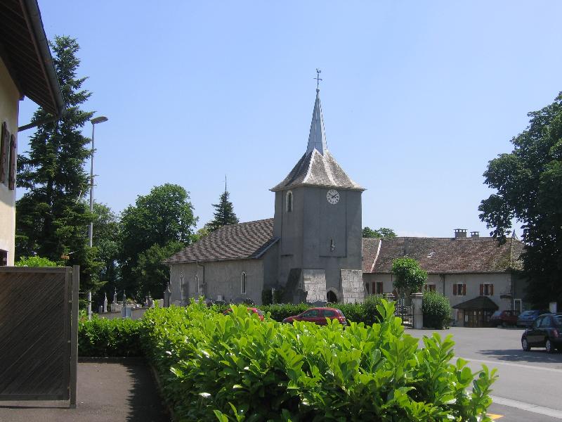
Éloise (Éloise)

- commune in Haute-Savoie, France
 Hiking in Éloise
Éloise is a charming municipality located in the "Auvergne-Rhône-Alpes" region of France, nestled in the foothills of the Alps. While not as widely known for hiking as some other areas in the French Alps, it offers access to some beautiful natural landscapes and trails for those interested in hiking.
Here are some points to consider about hiking in and around Éloise:
-
Local Trails: The area may have local trails suitable for various skill levels. It’s advisable to consult local maps or guides for current trails and their conditions. Check with local hiking clubs or tourist information centers for recommendations.
-
Scenic Views: Hiking in Éloise allows you to enjoy picturesque views of the nearby mountains and valleys. The changing seasons also offer a different beauty: lush greens in the summer, vibrant autumn colors, and white-capped peaks in winter.
-
Nearer Attractions: If you’re willing to venture a little further, the nearby areas of the Jura Mountains or the Alps provide a greater variety of hiking terrains, from gentle walks to challenging mountain hikes.
-
Wildlife and Nature: The region may be home to diverse flora and fauna. As you hike, take the time to appreciate the natural surroundings and watch for local wildlife.
-
Safety and Preparedness: Always check the weather before heading out, bring appropriate gear, and inform someone of your hiking plans. It's also a good practice to carry a map or GPS device, particularly in less marked areas.
-
Cultural Experience: Hiking can also be enriched by the local culture. Take the time to enjoy local cuisine, visit historical sites, or meet local residents.
-
Guided Hikes: If you're unfamiliar with the area or hiking in general, consider joining a guided hike. There may be local guides or organized groups that offer hikes with varying levels of complexity.
In summary, while Éloise may not be a top hiking destination, it can still provide enjoyable outdoor experiences for those willing to explore. Always plan ahead and respect the local environment during your hikes!
- Country:

- Postal Code: 01200
- Coordinates: 46° 4' 48" N, 5° 51' 30" E


- GPS tracks (wikiloc): [Link]
- Area: 8.95 sq km
- Population: 833
- Wikipedia en: wiki(en)
- Wikipedia: wiki(fr)
- Wikidata storage: Wikidata: Q274793
- Wikipedia Commons Category: [Link]
- Freebase ID: [/m/03ntz9x]
- GeoNames ID: Alt: [6442945]
- SIREN number: [217401090]
- INSEE municipality code: 74109
Shares border with regions:

Léaz
- commune in Ain, France
Hiking in Léaz
Léaz is a charming commune located in the Ain department of the Auvergne-Rhône-Alpes region in southeastern France. While it may not be as widely known as some larger hiking destinations, it offers some beautiful opportunities for outdoor enthusiasts....
- Country:
- Postal Code: 01200
- Coordinates: 46° 5' 53" N, 5° 53' 12" E
- GPS tracks (wikiloc): [Link]
- Area: 11.4 sq km
- Population: 700
- Web site: [Link]

Bellegarde-sur-Valserine
- commune in Ain, France
Hiking in Bellegarde-sur-Valserine
Bellegarde-sur-Valserine, located in the Auvergne-Rhône-Alpes region of France, is a beautiful area for hiking, set against the backdrop of the Jura Mountains. The region offers a variety of trails suitable for different skill levels, from beginner walks to more challenging hikes that reward adventurers with stunning views....
- Country:
- Postal Code: 01200
- Coordinates: 46° 6' 27" N, 5° 49' 33" E
- GPS tracks (wikiloc): [Link]
- Area: 15.25 sq km
- Population: 11809
- Web site: [Link]


Clarafond-Arcine
- commune in Haute-Savoie, France
Hiking in Clarafond-Arcine
Clarafond-Arcine, a picturesque commune located in the Auvergne-Rhône-Alpes region of France, near Annecy, offers some beautiful hiking opportunities. The area is known for its stunning alpine scenery, encompassing rolling hills, lush forests, and panoramic views of the surrounding mountains....
- Country:
- Postal Code: 74270
- Coordinates: 46° 3' 51" N, 5° 53' 38" E
- GPS tracks (wikiloc): [Link]
- Area: 16.88 sq km
- Population: 978

Chêne-en-Semine
- commune in Haute-Savoie, France
Hiking in Chêne-en-Semine
Chêne-en-Semine is a charming destination for hiking enthusiasts, located in the Auvergne-Rhône-Alpes region of France. Known for its picturesque natural surroundings, this area offers a variety of trails suitable for different skill levels. Here are some highlights of hiking in Chêne-en-Semine:...
- Country:
- Postal Code: 74270
- Coordinates: 46° 2' 49" N, 5° 51' 31" E
- GPS tracks (wikiloc): [Link]
- Area: 9.46 sq km
- Population: 463
- Web site: [Link]


Saint-Germain-sur-Rhône
- commune in Haute-Savoie, France
Hiking in Saint-Germain-sur-Rhône
Saint-Germain-sur-Rhône is a picturesque commune located in the Auvergne-Rhône-Alpes region of France. It offers a variety of hiking opportunities, allowing visitors to explore the natural beauty of the surrounding countryside and enjoy scenic views of the Rhône River and the nearby landscapes....
- Country:
- Postal Code: 74910
- Coordinates: 46° 4' 0" N, 5° 48' 52" E
- GPS tracks (wikiloc): [Link]
- Area: 7.85 sq km
- Population: 507
- Web site: [Link]