Saint-Goussaud (Saint-Goussaud)

- commune in Creuse, France
- Country:

- Postal Code: 23430
- Coordinates: 46° 2' 26" N, 1° 34' 41" E


- GPS tracks (wikiloc): [Link]
- Area: 24.3 sq km
- Population: 163
- Wikipedia en: wiki(en)
- Wikipedia: wiki(fr)
- Wikidata storage: Wikidata: Q1011207
- Wikipedia Commons Category: [Link]
- Freebase ID: [/m/03mfkk1]
- Freebase ID: [/m/03mfkk1]
- GeoNames ID: Alt: [2979630]
- GeoNames ID: Alt: [2979630]
- SIREN number: [212320006]
- SIREN number: [212320006]
- BnF ID: [15251587r]
- BnF ID: [15251587r]
- Digital Atlas of the Roman Empire ID: [37144]
- Digital Atlas of the Roman Empire ID: [37144]
- INSEE municipality code: 23200
- INSEE municipality code: 23200
Shares border with regions:

Laurière
- commune in Haute-Vienne, France
- Country:
- Postal Code: 87370
- Coordinates: 46° 4' 35" N, 1° 28' 31" E
- GPS tracks (wikiloc): [Link]
- Area: 20.77 sq km
- Population: 577


Jabreilles-les-Bordes
- commune in Haute-Vienne, France
- Country:
- Postal Code: 87370
- Coordinates: 46° 1' 3" N, 1° 30' 55" E
- GPS tracks (wikiloc): [Link]
- AboveSeaLevel: 550 м m
- Area: 19.05 sq km
- Population: 253

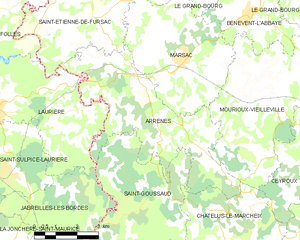
Arrènes
- commune in Creuse, France
- Country:
- Postal Code: 23210
- Coordinates: 46° 4' 17" N, 1° 34' 12" E
- GPS tracks (wikiloc): [Link]
- Area: 22.56 sq km
- Population: 225


Châtelus-le-Marcheix
- commune in Creuse, France
- Country:
- Postal Code: 23430
- Coordinates: 45° 59' 58" N, 1° 36' 28" E
- GPS tracks (wikiloc): [Link]
- Area: 43.2 sq km
- Population: 342


Les Billanges
- commune in Haute-Vienne, France
- Country:
- Postal Code: 87340
- Coordinates: 45° 57' 50" N, 1° 32' 0" E
- GPS tracks (wikiloc): [Link]
- Area: 22.61 sq km
- Population: 298